Rainbow, California facts for kids
Quick facts for kids
Rainbow, California
|
|
|---|---|

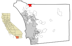
Location in San Diego County and the state of California
|
|
| Country | |
| State | |
| County | San Diego |
| Area | |
| • Total | 11.042 sq mi (28.599 km2) |
| • Land | 11.042 sq mi (28.599 km2) |
| • Water | 0 sq mi (0 km2) 0% |
| Elevation | 1,043 ft (318 m) |
| Population | |
| • Total | 1,832 |
| • Density | 165.91/sq mi (64.058/km2) |
| Time zone | UTC-8 (Pacific) |
| • Summer (DST) | UTC-7 (PDT) |
| ZIP code |
92028
|
| Area codes | 442/760 |
| FIPS code | 06-59248 |
| GNIS feature IDs | 1652780, 2409123 |
Rainbow is a small community located in northern San Diego County, in the state of California. It's known as a census designated place (CDP). This means it's a place that looks like a town but isn't officially a city with its own local government.
In 2010, about 1,832 people lived in Rainbow. This number was a bit lower than in 2000, when 2,026 people lived there.
Contents
Exploring Rainbow's Location
Rainbow is found at these coordinates: 33.411213 degrees North and -117.149209 degrees West. It's in a part of California that has warm weather.
The United States Census Bureau says that Rainbow covers about 11 square miles (28.5 square kilometers) of land. There is no water area within its borders.
Rainbow's Climate and Weather
Rainbow has a warm-summer Mediterranean climate. This type of climate is often called "Csa" on climate maps. It means Rainbow has hot, dry summers and mild, wet winters, much like places around the Mediterranean Sea.
People and Population in Rainbow
This section shares details about the people who live in Rainbow. It uses information from the official census, which is a count of everyone living in an area.
Population in 2010
In 2010, the population of Rainbow was 1,832 people. This means there were about 166 people living in each square mile.
Most people in Rainbow were White (72.3%). Other groups included African American (1.0%), Native American (0.7%), Asian (2.3%), and Pacific Islander (0.7%). About 20.3% of the people were from other races, and 2.8% were from two or more races. A significant number, 36.3%, were of Hispanic or Latino background.
Most people (95.3%) lived in regular homes. Only a small number (4.7%) lived in places like care facilities.
The average age in Rainbow in 2010 was about 45.3 years old.
- 18.7% of the people were under 18 years old.
- 8.4% were between 18 and 24 years old.
- 22.5% were between 25 and 44 years old.
- 30.3% were between 45 and 64 years old.
- 20.1% were 65 years or older.
There were slightly more males than females in Rainbow. For every 100 females, there were about 97 males.
Population in 2000
In 2000, Rainbow had a population of 2,026 people. The population density was about 126 people per square mile.
The racial makeup was similar to 2010, with 81.4% White. About 21.8% of the population was Hispanic or Latino.
The average age in 2000 was 42 years.
- 23.7% were under 18 years old.
- 6.0% were between 18 and 24 years old.
- 25.8% were between 25 and 44 years old.
- 26.8% were between 45 and 64 years old.
- 17.8% were 65 years or older.
Rainbow's History
The area where Rainbow is now was once called "Vallecitos," which means "little valley" in Spanish.
In the late 1880s, the name was changed to "Rainbow Valley." This new name came from Mr. James Peebles Marshall Rainbow, who bought land there.
In October 2007, a large wildfire happened in the area. Strong Santa Ana winds made the fire spread quickly.
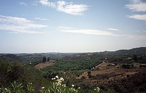
Today, Rainbow is known for its many palm tree farms. It also serves as a way to get to the nearby city of Temecula.
See also
 In Spanish: Rainbow (California) para niños
 | Tommie Smith |
 | Simone Manuel |
 | Shani Davis |
 | Simone Biles |
 | Alice Coachman |


