
Ramsgate Beach, New South Wales facts for kids
Quick facts for kids Ramsgate BeachSydney, New South Wales |
|||||||||||||||
|---|---|---|---|---|---|---|---|---|---|---|---|---|---|---|---|

Cook Park, Ramsgate Beach
|
|||||||||||||||
| Population | 1,660 (2016 census) | ||||||||||||||
| Postcode(s) | 2217 | ||||||||||||||
| Elevation | 6 m (20 ft) | ||||||||||||||
| Location | 16 km (10 mi) south of Sydney CBD | ||||||||||||||
| LGA(s) | Bayside Council | ||||||||||||||
| State electorate(s) | Rockdale | ||||||||||||||
| Federal Division(s) | Cook | ||||||||||||||
|
|||||||||||||||
Ramsgate Beach is a cool suburb located in southern Sydney, Australia. It's about 16 kilometres south of Sydney's city centre. This area is part of the Bayside Council and the wider St George region. Its postcode is 2217. Don't mix it up with Ramsgate, which is a different suburb just to the west!
Contents
History of Ramsgate Beach
Long ago, the beach area between the Cooks River and Georges River was called Seven Mile Beach. In 1874, its name changed to Lady Robinson's Beach. This was to honor the wife of Governor Sir Hercules Robinson.
The beautiful Cook Park is named after Samuel Cook. He worked hard to make sure this area became a public park for everyone to enjoy. The suburb of Ramsgate Beach gets its name from a popular seaside town in England. There were plans to build a special model village here, but that idea was later stopped.
Geography and Location
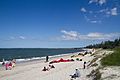
Ramsgate Beach is surrounded by other suburbs like Monterey, Ramsgate, and Sans Souci. The lovely Lady Robinson Beach and Cook Park stretch along its eastern side, right on Botany Bay.
This suburb is mostly a place where people live. You'll find a shopping area on Ramsgate Road, close to The Grand Parade. It has a supermarket and other shops. Another shopping area, which includes the post office, is located in the nearby suburb of Ramsgate on Rocky Point Road.
People and Population
Let's look at who lives in Ramsgate Beach! According to the 2016 census, there were 1,660 people living here. About 58.4% of these people were born in Australia.
When it comes to languages, 52.0% of people spoke only English at home. Other languages were also spoken, with Greek being the most common at 12.6%. For religious beliefs, the most common choices were Catholic (23.6%), Eastern Orthodox (18.5%), and Anglican (12.8%).
Cool Places to See
Ramsgate Beach has some great spots to visit!
- Lady Robinsons Beach - Perfect for a swim or a walk.
- Cook Park - A lovely park right by the beach.
- Ramsgate Beach Baths - A safe place to swim in the ocean.
- Ramsgate Baptist Church - A local church in the area.
Images for kids
-
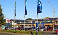
Ramsgate Beach Plaza, Ramsgate Road
-
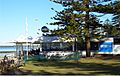
Restaurant, Cook Park
-
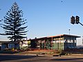
Life Saving Club, Cook Park
-
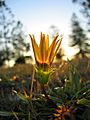
Ramsgate Beach Flower
-
Lady Robinsons Beach


.jpg)
