Raritan Landing, New Jersey facts for kids
Quick facts for kids
Raritan Landing, New Jersey
|
|
|---|---|

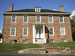
Cornelius Low House in 2008
|
|
| Country | |
| State | |
| County | Middlesex |
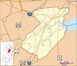
| Township | Piscataway |
Raritan Landing was a very old community in Piscataway Township, Middlesex County, New Jersey. It was once a busy inland port on the Raritan River. This was the farthest point that large ocean-going ships could reach. It was located right across the river from New Brunswick.
The port started in the early 1700s and was very important until the mid-1800s. After that, most of the port was no longer used. Today, the remains of the community are buried under Johnson Park. You can still see some old buildings like the Cornelius Low House and the Metlar-Bodine House. The Road Up Raritan Historic District and an archeological site also remain. The nearby East Jersey Olde Towne Village has a special exhibit about Raritan Landing.
Contents
History of Raritan Landing
A Busy Trading Port
Raritan Landing became an important port community in the 1720s. It was built at the furthest point on the Raritan River where merchant ships could sail. In its busiest time, the Landing was a center for local trade. It worked with New Brunswick to handle goods coming in and going out of the Raritan Valley.
Farmers from central New Jersey brought their crops and lumber here. These goods were stored in warehouses. From Raritan Landing, they were shipped to New York or sometimes even to the Caribbean islands. Goods brought in from other places were unloaded here. Traders then took these imported items to stores all over the area. Most of the community was located between today's River Road and the Raritan River. It was near where Landing Lane and River Road meet now. By the 1740s, there were about 70 buildings and over 100 people living there.
During the American Revolution
When the American Revolution began, British troops took over the community. The high bluffs (cliffs) along the river were a safe place for the soldiers. They could also see clearly towards New Brunswick. This helped them spot American Patriot forces coming their way.
Important Dates for Raritan Landing
- c. 1700: People first started living in the Raritan Landing area.
- c. 1739: The Edward Antill House was built.
- 1740: The Raritan Landing community had 70 buildings and over 100 people.
- 1741: The Cornelius Low House was built.
- 1825: Landing Lane was a busy street. It had many blacksmith shops, barrel-making shops, stores, and warehouses.
- 1830: Work began on building the Delaware and Raritan Canal.
- 1834: The Delaware and Raritan Canal was finished. This new canal made it easier to move goods, which changed how important Raritan Landing was.
- 1870: Most of the old community was taken apart. The land was turned into fields for animals to graze.
- 1936: Cornelius Clarkson Vermeule I, who lived in Piscataway, made a map of Raritan Landing. He based it on his research. The numbers on his map showed where houses were. He also listed the owners in an article. His work encouraged others to research the area's history.
- 1970s: The Cornelius Low House, Metlar-Bodine House, and Road Up Raritan Historic District were added to important lists. These lists are the New Jersey Register of Historic Places and the National Register of Historic Places. This helps protect these historic sites.
Raritan Landing Archeological Site
|
Raritan Landing Archeological District
(Boundary Increase) |
|

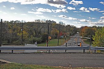
View from the Cornelius Low House
|
|
| Location | Piscataway Highland Park |
|---|---|
| NRHP reference No. | 79001506 (1979) 84002738 (1984) |
| Added to NRHP | October 11, 1984 |
An archeological site is a place where scientists dig to find old objects. These objects help us learn about how people lived long ago. The Raritan Landing Archeological Site includes several areas. These are the Upper Van Rants House Site, the Bluff Prehistoric Site, and areas in today's Highland Park. It also includes parts of Johnson Park.
The site was first listed as important in 1979 and then made larger in 1984. Rutgers University started archeological work there in 1979. The New Jersey Department of Transportation continued the work. This was part of a plan to extend Route 18.
 | Misty Copeland |
 | Raven Wilkinson |
 | Debra Austin |
 | Aesha Ash |


