
Ratchaburi Province facts for kids
Quick facts for kids
Ratchaburi
ราชบุรี
|
|||
|---|---|---|---|
|
|||

Map of Thailand highlighting Ratchaburi Province
|
|||
| Country | |||
| Capital | Ratchaburi | ||
| Area | |||
| • Total | 5,196.5 km2 (2,006.4 sq mi) | ||
| Area rank | Ranked 43rd | ||
| Population | |||
| • Total | 871,714 | ||
| • Rank | Ranked 28th | ||
| • Density | 167.7502/km2 (434.471/sq mi) | ||
| • Density rank | Ranked 22nd | ||
| Time zone | UTC+7 (ICT) | ||
| ISO 3166 code | TH-70 | ||


Ratchaburi Province, also called Rat Buri, is a province in western Thailand. In Thai, it's called Thai: จังหวัดราชบุรี. It is known for its beautiful nature and interesting history.
Contents
Geography of Ratchaburi

Ratchaburi Province is a medium-sized area. It covers about 5,196 square kilometers.
The eastern part has flat plains. The Mae Klong River flows through it. Many small canals, called khlongs, crisscross the land. A famous place here is the Damnoen Saduak Floating Market.
The western part is more mountainous. It includes the Tenasserim Hills. These mountains are mostly limestone. So, you can find many caves. These caves often have amazing stalactites. Some caves are home to many bats. It's cool to see them fly out in the evening to find food! Other caves, like Khao Bin, are open for visitors to explore.
The main river in the west is the Phachi River. The Chaloem Phrakiat Thai Prachan National Park is located on its left bank.
Ratchaburi Province has three main areas. First, there's the western border with Myanmar, which is about 60 kilometers long. Second, there are the Tenasserim mountains and forests. These areas are about 200–300 meters high. Third, the central part of the province has many wetlands because of the rivers.
Ratchaburi has important natural resources. About 38 percent of the province is covered by forests. It also has minerals like tin, tantalum, and limestone.
History of Ratchaburi

The city of Ratchaburi has a very old history. It dates back to the Dvaravati period. During that time, it was an important city for the Mon Kingdom.
The nearby city of Khu Bua is now just ruins. But legend says it's even older than Dvaravati. It might have been part of the mythical Suvannabhumi Kingdom.
The name "Ratchaburi" means 'the land of the king'. The city of Ratchaburi is located on the banks of the Mae Klong River. It was once a town of the Suvarnabhumi Kingdom.
People of Ratchaburi
Hill tribes, mostly Karen, live near the Myanmar border. They make up about one percent of the population. There are also smaller groups of Mon, Lawa, Lao, Chinese, and Khmer people living in the province.
Most people in Ratchaburi are Buddhist, about 98.3 percent.
Fun Things to See and Do
Damnoen Saduak Floating Market

The Damnoen Saduak Floating Market is in Damnoen Saduak District. It's a great place to see how people live. You can also see how important the river was for trade in the past.
Wat Phra Si Ratana Mahathat
This is an ancient temple. Locals call it Wat Na Phra That. It's on the west bank of the Mae Klong River in town. Its beautiful prangs (pagodas) are still in good shape. They might have been inspired by Cambodia's Angkor Wat.
Murals of Wat Khongkharam
This is a Mon monastery that is over 200 years old. It was first called "Wat Klang" or "Phia To". King Mongkut later gave it the new name "Wat Khongkharam". It is in Photharam, about 22 kilometers from Ratchaburi.
Bo Khloung Hot Stream
This hot stream is five kilometers past Suan Phung. It's full of mineral water. The water flows all year from the Tanaosi Range. Its temperature is usually between 50-68 degrees Celsius.
Kaew Chan Waterfall
Also known as the Nine-Level waterfall, this beautiful spot is only one kilometer from Bo Khlung hot stream.

Pong Yub
Pong Yub is in Ban Tha Kheay. The ground here has sunk, creating a steep cliff. It looks a lot like Pae Muang Phi in Phrae Province.
Khao Bin Cave
About 22 kilometers from Ratchaburi city center is the "Khao Bin" mountain range. This mountain, whose name means "Flying Mount," is home to the famous Khao Bin Cave.
Khao Wang
This is a hill about 44 meters high. It was first called "Khao Sattanat". It is two kilometers west of the town.
Festivals and Events
- Ratchaburi Tourism Fair (งานเที่ยวราชบุรี) is held every year in February or March. It takes place at the city hall. You can see demonstrations of famous crafts, like jar making and "Sin Tin Chok" cloth weaving. You can also buy local products and food. There are also folk art and cultural shows by local groups.
- Sweet Grape and Damnoen Saduak Floating Market Week Fair (งานเทศกาลองุ่นหวานและตลาดน้ำดำเนินสะดวก) This festival celebrates sweet grapes. It includes a beauty contest called Thida A-ngun Wan. There are also competitions for the best farm products.
- Khao Ho or Ang Mi Thong Festival (ประเพณีกินข้าวห่อ หรือ อั๊งหมี่ทอง) This is a special blessing ceremony called Su Khwan. It is held to wish for happiness and a long life. It usually takes place around the ninth lunar month.
 |
Kanchanaburi Province | Nakhon Pathom Province | |
|
| Samut Sakhon Province | ||||
| Phetchaburi Province | Samut Songkhram Province |
Images for kids
-
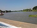
Bus terminal by Mae Klong, Ban Pong
-
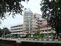
Muban Chombueng Rajabhat University, a branch of Rajabhat University in Chom Bueng
-
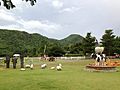
The Scenery Vintage Farm, resort of Suan Phueng
-
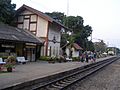
Chet Samian Railway Station, Photharam
-
Ratchaburi Shadow Puppet Museum in Wat Khanon, Photharam
-
Chaloem Phrakiat Rama 9 Road, Ban Pong
-
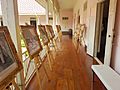
Corridor of Ratchaburi National Museum
.jpg)
.jpg)


_1.jpg)

.jpg)
See also
 In Spanish: Provincia de Ratchaburi para niños
