Rattlesnake Creek (Bronx) facts for kids
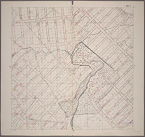
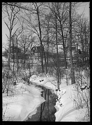
Rattlesnake Creek is a stream that mostly flows underground in the northeast part of The Bronx, New York City. It was once a visible stream with a waterfall and a pond. By the mid-1900s, most of it was covered up. Today, you can still see a small part of Rattlesnake Creek in Seton Falls Park.
Contents
Where Does Rattlesnake Creek Flow?
Old maps show that Rattlesnake Creek started near Nereid and Hill Avenues in the Edenwald area of the Bronx. It flowed southwest, then turned southeast near East 233rd Street.
Visible Section in Seton Falls Park
The creek flows above ground inside Seton Falls Park. Here, it creates a man-made waterfall. After leaving the park, the creek goes back underground.
Past Features and Its End Point
South of Boston Road, the creek used to flow into a large man-made pond called Holler's Pond. This pond was located where the Boston Secor Houses are now in the Baychester neighborhood. Rattlesnake Creek then passes through Co-op City. Finally, it empties into the Hutchinson River. Before reaching the Hutchinson River, it used to split into two smaller streams, one of which was called Mill Creek.
Co-op City and the Creek's Path
Most of Co-op City was built over the area where Rattlesnake Creek used to flow into the river. Some streets, like Alcott Place, Bellamy Loop, and Dreiser Loop, actually follow the old path of the creek. There's a small nature area called the Givans Creek Woods in Co-op City. Even though it's named after Robert Givan, this area is located above Rattlesnake Creek. The actual Givans Creek is a bit further south.
Why Is It Called Rattlesnake Creek?
The creek got its name because there used to be many rattlesnakes in the northeast Bronx. In the late 1700s, people in the town of Eastchester thought these snakes were a problem. They even had weekly meetings to talk about getting rid of them.
How They Dealt with Rattlesnakes
One local historian said that the first ten families of Eastchester spent one day each spring trying to destroy rattlesnakes. They used hogs to hunt the snakes because the hogs' fat protected them from the snake bites. By the early 1900s, the rattlesnake population was gone. Some stories say the very last rattlesnake, a 6-foot-long one, was killed in 1775.
History of Rattlesnake Creek
Before the American Revolutionary War, the land around Rattlesnake Creek was owned by Thomas Pell. In 1739, two men named Thomas Shute and Joseph Stanton built a mill. They dammed the creek south of Boston Road, which created Holler's Pond.
Ponds and Waterfalls
Further upstream, William Seton, who owned land around what is now Seton Falls Park in the mid-1800s, also dammed the creek. This created two more ponds and a waterfall. Seton's mill was destroyed in a storm in 1900, but the waterfall remained. This waterfall was described as a 30-foot drop with two separate falls.
Pollution and Changes
By 1926, Rattlesnake Creek was very polluted. Some cases of typhoid, a serious illness, were linked to the creek. After New York City Parks took over Seton Falls Park in 1930, they changed the creek's path inside the park. They put it into a stone channel and filled in the two ponds on the Seton estate.
Holler's Pond and Its End
Downstream, Holler's Pond was used to collect ice. There were several buildings called ice houses on the pond's shore, but they were all torn down by 1935. The pond was also a popular spot for ice-skating until it was filled in 1951. The Boston-Secor Houses were built over the filled-in pond in 1968. There was also a beer garden near the pond that was taken down in 1960.
Modern Developments Over the Creek
The end of the creek was covered in 1960 by Freedomland U.S.A., a theme park about American history. Before Freedomland was built, this land was a city landfill on the banks of the Hutchinson River. Building Freedomland greatly changed the landscape around the creek's mouth. Freedomland closed in 1964, and its site was then used to build Co-op City.
Today, Rattlesnake Creek mostly flows through underground pipes. The only part of the creek that is still visible above ground upstream is in Seton Falls Park. A small road called Reeds Mill Lane is a reminder of the old Holler's Pond mill. This road takes an unusual route through the Baychester area.
 | Aaron Henry |
 | T. R. M. Howard |
 | Jesse Jackson |


