Razorback, New South Wales facts for kids
Quick facts for kids RazorbackNew South Wales |
|||||||||||||||
|---|---|---|---|---|---|---|---|---|---|---|---|---|---|---|---|

|
|||||||||||||||
| Population | 1,174 (2021 census) | ||||||||||||||
| Postcode(s) | 2571 | ||||||||||||||
| Elevation | 303 m (994 ft) | ||||||||||||||
| Location | |||||||||||||||
| LGA(s) | Wollondilly | ||||||||||||||
| Region | Macarthur | ||||||||||||||
| State electorate(s) | Wollondilly | ||||||||||||||
| Federal Division(s) | Hume | ||||||||||||||
|
|||||||||||||||
Razorback is a small area and spread-out village in the Macarthur Region of New South Wales, Australia. It's part of the Wollondilly Shire. In 2021, about 1,174 people lived here. Razorback is located between the towns of Picton (to the south) and Camden (to the north).
What is Razorback?
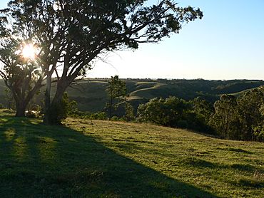
People often call this area Razorback Range. This is because it's a series of tall, steep hills. These hills are a big part of the Macarthur Region.
Hills and Highlands
Like most of the Wollondilly area, Razorback is made up of hills. These hills sit between two other famous regions. They are located between the Blue Mountains and the Southern Highlands.
Amazing Views!
At the very top of Razorback, there is a special lookout spot. From here, you can see amazing wide views. You can look out over the urban areas of Campbelltown and Camden. You can also see the big city of Sydney from this high point!
 | Victor J. Glover |
 | Yvonne Cagle |
 | Jeanette Epps |
 | Bernard A. Harris Jr. |


