Red Indian Lake facts for kids
Quick facts for kids Red Indian Lake |
|
|---|---|
| Location | Newfoundland, Canada |
| Coordinates | 48°44′21″N 56°50′47″W / 48.73917°N 56.84639°W |
| Primary outflows | Exploits River |
| Basin countries | Canada |
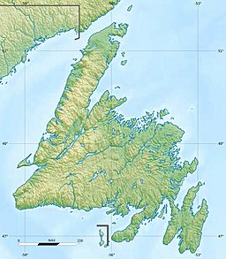
Red Indian Lake is a large lake located in the middle of Newfoundland, Canada. It is an important part of the island's water system. The lake drains into the Exploits River, which flows across Newfoundland and empties into the Atlantic Ocean through the Bay of Exploits. Other rivers like the Lloyds River, the Victoria River, and the Star River also flow into Red Indian Lake.
Contents
History of Red Indian Lake
Early Inhabitants: The Beothuk People
For a long time, the Beothuk people lived around Red Indian Lake. They were also known as the 'Red Indians'. They had many campsites along the lake's shores. In the late 1700s, explorers John Cartwright and his brother George Cartwright explored the area. They were looking for the Beothuk, but they only found empty campsites. When they discovered the lake, they called it Lieutenant's Lake. They thought it was connected to another lake called Lake Mickmack, which is now known as Grand Lake.
Attempts at Contact and Their Outcomes
In January 1811, an expedition led by David Buchan traveled up the Exploits River. Their goal was to make friends with the Beothuk people. Buchan did find them, but the meeting did not go well. Sadly, two marines died during this encounter.
Later, in 1819, another expedition went to the lake. This one was led by John Peyton Jr. This trip also ended in sadness. The Beothuk leader, Nonosbawsut, died, and a Beothuk woman named Demasduit was captured.
Considering a New Name for the Lake
In April 2021, there was an announcement about changing the lake's name. The new name was proposed to be "Wantaqo'ti Qospem." This name means "peaceful lake" in the Mi'kmaq language. However, many people felt they were not asked for their opinion about the name change. Because of this, the Newfoundland government decided to pause the renaming plans. They announced they would start a process to ask people for their thoughts on the name.
Economy and Resources Around the Lake
The Arrival of the Railway and Logging
The building of the Newfoundland Railway made it easier to reach the middle of Newfoundland. This opened up the forests around Red Indian Lake for business. In 1899, Alex McCombie surveyed the lake. By 1901, Lewis Miller had started a logging business on the shore. This was near where Demasduit was captured.
A special railway line was built to the town of Millertown. In 1905, a company called Anglo-Newfoundland Development (AND) Company got a long-term lease. This lease gave them rights to cut timber (trees) and mine minerals in the land around the lake for 99 years.
Mining Discoveries and New Towns
People working for the AND Company also found a large amount of valuable metals on the north side of the lake. These are called "base metals." Because of this discovery, the town of Buchans was started in 1926. Mining operations, which means digging for these metals, began the next year.
Hydroelectric Power from the Lake
Building a Pulp and Paper Mill
A large factory called a pulp and paper mill was built further down the Exploits River, in Grand Falls. This mill needed a lot of power to operate.
Creating a Power Source
To provide power for the mill, a dam was built at the mouth of Red Indian Lake. This dam created a huge storage area for water, like a giant bathtub. This water is used to power a hydroelectric generating plant at the mill in Grand Falls. Hydroelectric plants use the force of moving water to create electricity.
 | Aaron Henry |
 | T. R. M. Howard |
 | Jesse Jackson |


