Rice Valley facts for kids
Quick facts for kids Rice Valley |
|
|---|---|

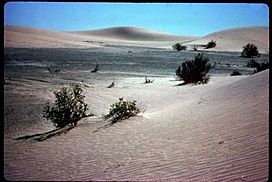
Sand dunes in the Rice Valley Wilderness
|
|
| Length | 22 miles (35 km) |
| Width | 15 miles (24 km) |
| Geography | |
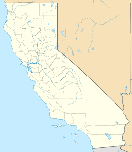
| Location | Riverside County, California, United States |
| Borders on | Little Maria Mountains-SW Arica Mountains(minor range)-W Danby Dry Lake & Ward Valley (California)-NNW Turtle Mountains CA-N West Riverside Mountains-NE & E "Big Wash"-E Big Maria Mountains-SE & S |
The Rice Valley is a large valley located in the southeastern part of the Mojave Desert. You can find it in Riverside County, California.
Contents
What is Rice Valley Like?
Rice Valley is mostly a "closed basin," which means it's an endorheic valley. Water flows into it but doesn't flow out to the ocean. Instead, it collects in a low spot called Rice Dry Lake. The valley is also filled with bajadas, which are gentle slopes made of rock and dirt that wash down from the nearby mountains. Strong winds from the northwest and west have also created many sand dune fields here.
In the southeastern part of Rice Valley, there's a small area that isn't a closed basin. A seasonal stream called Big Wash flows through here. It runs between the Big Maria Mountains and the West Riverside Mountains. This wash eventually reaches the Colorado River near the Parker Valley.
Nearby, to the northwest, is the Ward Valley, which also has a dry lake called Danby Dry Lake. Other dry lake valleys like Palen Valley and Chuckwalla Valley are also in the region. If you want to drive through the valley, California State Route 62 is a highway that goes from east to west right through it.
Rice Valley Wilderness Area
A special part of the valley is protected as the Rice Valley Wilderness Area. This area is managed by the Bureau of Land Management (BLM), a government agency that takes care of public lands. The goal is to keep this desert area wild and natural. The Big Maria Mountains Wilderness Area is right next to it on the southeast side.
History of Rice Valley
Rice Valley has some interesting history!
World War II Airfield
During World War II, there was an important training area called the Desert Training Center. The Rice Army Airfield was one of its airfields, located right here in the valley. It's now abandoned, but it played a role in training soldiers for desert warfare.
The Rice Shoe Tree
There used to be a famous landmark called the Rice Shoe Tree in the former town of Rice. This town was once a stop along the Santa Fe Railroad. People would nail their old shoes to the tree, creating a unique sight. Sadly, the original Shoe Tree burned down in 2003. But don't worry, people started a new tradition! Now, there's a "Rice Shoe Garden" where shoes are hung along a fence, keeping the quirky tradition alive.
 | Anna J. Cooper |
 | Mary McLeod Bethune |
 | Lillie Mae Bradford |


