Rich Mountain (Moses Cone Park, North Carolina) facts for kids
Quick facts for kids Rich Mountain |
|
|---|---|
| Highest point | |
| Elevation | 4,199 ft (1,280 m) |
| Geography | |
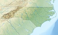
| Location | Watauga County, North Carolina, U.S. |
| Parent range | Blue Ridge Mountains |
| Topo map | USGS Boone |
Rich Mountain is a mountain located in North Carolina, United States. It sits just south of the town of Boone. This mountain is part of the beautiful Moses H. Cone Memorial Park.
About Rich Mountain
Rich Mountain stands tall at about 4,199 feet (which is about 1,280 meters) above sea level. It is a part of the Blue Ridge Mountains, which are famous for their misty, blue appearance. Because the mountain is inside the Blue Ridge Parkway, it is protected. This means it cannot be built on or developed.
History of the Mountain
For many years, Rich Mountain was home to a special place called Camp Yonahlossee. This camp was for girls and operated from 1922 to 1985. "Yonahlossee" is a Cherokee word that means "Trail of the Bear." It was one of the oldest camps for girls in North Carolina. Today, the area where the camp used to be is now a resort and club.
Water Sources
Rich Mountain is important for the local water supply. It helps create several small streams. These streams flow into larger rivers. Some of the water goes into the South Fork New River. Other streams flow into the Watauga River. These rivers are important for the environment and the people living nearby.
 | Bayard Rustin |
 | Jeannette Carter |
 | Jeremiah A. Brown |


