Watauga River facts for kids
Quick facts for kids Watauga River |
|
|---|---|
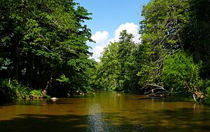
The Watauga River near Valle Crucis, North Carolina
|
|
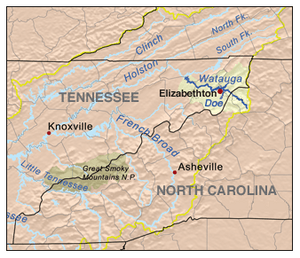
Locator – overview
|
|
|
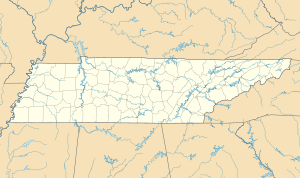
Location of the mouth of Watauga River in Tennessee
|
|
| Other name(s) | Watoga |
| Country | United States |
| States | North Carolina, Tennessee |
| Counties | Avery NC, Watauga NC, Johnson TN, Carter TN, Sullivan TN, Washington TN |
| Physical characteristics | |
| Main source | Linville Gap Sugar Mountain, North Carolina 4,051 ft (1,235 m) 36°07′25″N 81°50′07″W / 36.12361°N 81.83528°W |
| River mouth | Holston River, South Fork Gray, Tennessee 1,352 ft (412 m) 36°26′50″N 82°25′15″W / 36.44722°N 82.42083°W |
| Length | 78.5 mi (126.3 km) |
| Basin features | |
| Progression | Watauga → Holston → Tennessee → Ohio → Mississippi → Gulf of Mexico |
| Basin size | 867.849 sq mi (2,247.72 km2) |
The Watauga River is a big stream that flows through western North Carolina and East Tennessee. It is about 78.5 miles (126.3 km) long. Its journey starts in Linville Gap and ends when it joins the South Fork Holston River at Boone Lake.
Contents
The River's Journey
The Watauga River begins from a spring near Peak Mountain in Avery County, North Carolina. This spring is on the western side of the Tennessee Valley Divide. This divide is also the Eastern Continental Divide. Water on one side flows to the Atlantic Ocean, while water on the other side, like the Watauga River, flows to the Gulf of Mexico.
The river then flows through Watauga County, North Carolina. It crosses into Tennessee at Johnson County. From there, it goes into Carter County, Tennessee. Finally, it meets the Holston River's South Fork at the border of Washington and Sullivan Counties.
Dams and Lakes
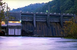
Once the Watauga River enters Johnson County, it is stopped by the Tennessee Valley Authority (TVA) Watauga Dam. This dam creates a large lake called Watauga Lake, which is about 6,430-acre (2,600 ha) big. Two other important rivers, the Elk River and Roan Creek, flow into Watauga Lake. The Appalachian Trail crosses the river right on top of Watauga Dam.
About 3 miles below Watauga Dam, you'll find another TVA dam called Wilbur Dam. This dam creates a smaller, very deep lake called Wilbur Lake. The TVA releases water from Wilbur Dam back into the Watauga River, especially during summer. Below Wilbur Dam, the river flows north and then west into Carter County. It forms the northern edge of Elizabethton, where the Watauga River is joined by the Doe River.
Further downstream, the Watauga River forms part of the border between Washington County and Sullivan County. The river then flows into Boone Lake, which is formed by Boone Dam.
River's Past
The exact meaning of the name "Watauga River" is a bit of a mystery. Most people agree it comes from a Native American language. However, no one is sure which tribe or what it means. Some old documents suggest "Watauga" might mean "River of Islands" or "Island River." The Cherokee people might have even called the Holston River by this name.
A page from North Carolina State University says "Watauga" is a Native American word meaning "the land beyond." Local stories say it means "beautiful river" or "beautiful water." There were once Native American villages named Watauga, including one where Elizabethton is today. This place was known as "Watauga Old Fields."
Daniel Boone and James Robertson first explored the Watauga River area in 1759. Later, during the American Revolution, the first settlers of Nashville, Tennessee, left from the Watauga River area. This area was known as the Watauga Association. These settlers knew that the British rule, which said colonists couldn't settle west of the Blue Ridge Mountains, was hard to enforce.
Wilbur Dam is special because it was the first hydroelectric dam built in Tennessee. It started making electricity in 1912. The Tennessee Electric Power Company built it, and later the TVA bought it. Because Elizabethton got electricity so early from Wilbur Dam, it was called the "City of Power."
The Watauga River is home to some special animals. The endangered green floater mussel (Lasmigona subviridis) lives here. It's also a place where eastern hellbenders (Cryptobranchus alleganiensis alleganiensis) breed. These are large salamanders.
Fun on the River
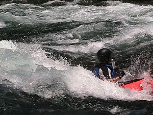
The Watauga River is a great place for outdoor activities! People love to go whitewater rafting, kayaking, and canoeing. It's also very popular for fly fishing and regular angling with fishing reels. You can catch Rainbow trout, brown trout, and striped bass in the river.
Whitewater Adventures
The part of the Watauga River below the TVA dams is a big draw for rafting companies. They bring people from northeast Tennessee and western North Carolina for exciting trips, especially in the summer. Fishing guides also use the river all year.
The beautiful Class II+ Bee Cliff Rapids are found between Wilbur Dam and the Siam Bridge. Some rafting companies call them the "Anaconda Rapids."
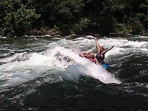
For rafting and kayaking, most people start right below the TVA Wilbur Dam. They usually finish their trip about 2 to 2½ hours downstream at the Blackbottom park in Elizabethton. The trip from Wilbur Dam to Blackbottom is about seven miles long.
Here's how long it takes to reach some spots:
- Wilbur Dam to Bee Cliff Rapids: ~15 minutes
- Wilbur Dam to Siam Bridge: ~30 minutes
- Wilbur Dam to Hunter Bridge (TWRA put-in/take out): ~60 minutes
- Wilbur Dam to Gilbert Peters Bridge at US 19-E in Elizabethton: ~90 minutes
- Wilbur Dam to Bristol Bridge in Elizabethton: ~120 minutes
The Watauga River also has a very challenging section of Class IV-V whitewater. This part is upstream of Watauga Lake in North Carolina. It's only for expert kayakers and needs a lot of rain to be runnable. It has many steep rapids and drops.
TVA Recreation Spots
The Tennessee Valley Authority (TVA) has a public campground below Watauga Dam. It has 29 campsites with electricity, restrooms, showers, and picnic areas. You can also find boat ramps, fishing spots, hiking trails, and places to watch wildlife and birds.
How Weather Affects the River
The TVA controls the water flow in the Watauga River by releasing water from Watauga Dam and Wilbur Dam. Because this water comes from deep in the lakes, it's very cold. In summer, the river temperature below the dams is about 52–53°F (11–12 °C).
The Watauga River is usually comfortable for kayaking, canoeing, and rafting in the summer. However, because the water is cold, it's important to be careful not to get too cold (hypothermia) if you are in the water for a long time.
The TVA also makes sure there's enough water released during summer for river activities. This means that even if other rivers are too low due to dry weather, rafting companies can still offer trips on the Watauga River.
See also
- Dragging Canoe
- Fort Watauga
- International Scale of River Difficulty
- List of rivers of Tennessee
- Overmountain Men
- Riverboarding
- River surfing
- Sycamore Shoals
- Watauga, Tennessee
 | Stephanie Wilson |
 | Charles Bolden |
 | Ronald McNair |
 | Frederick D. Gregory |


