
Sullivan County, Tennessee facts for kids
Quick facts for kids
Sullivan County
|
|
|---|---|

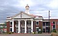
Sullivan County Courthouse in Blountville
|
|

Location within the U.S. state of Tennessee
|
|
 Tennessee's location within the U.S. |
|
| Country | |
| State | |
| Founded | 1779 |
| Named for | General John Sullivan |
| Seat | Blountville |
| Largest city | Kingsport |
| Area | |
| • Total | 430 sq mi (1,100 km2) |
| • Land | 413 sq mi (1,070 km2) |
| • Water | 16 sq mi (40 km2) 3.8%% |
| Population
(2020)
|
|
| • Total | 158,163 |
| • Estimate
(2023)
|
162,135 |
| • Density | 368/sq mi (142.0/km2) |
| Time zone | UTC−5 (Eastern) |
| • Summer (DST) | UTC−4 (EDT) |
| Congressional district | 1st |
Sullivan County is a county in the state of Tennessee. It's located in the northeastern part of Tennessee, right on the border. In 2020, about 158,163 people lived there. The main town, or county seat, is Blountville.
Sullivan County is part of a larger area called the "Tri-Cities" region. This area includes Kingsport, Johnson City, and Bristol. Sullivan County is very old; it was created in 1779. Back then, this land was still part of North Carolina. For a few years, from 1784 to 1788, it was even part of a special, unofficial state called the State of Franklin.
Contents
History of Sullivan County
Sullivan County was formed in 1779. It was created from a part of Washington County. The county was named after John Sullivan, who was a general during the American Revolutionary War.
A place called Long Island of the Holston in Kingsport was very important to the Cherokee people for a long time. They lived in this area. Later, in 1761, British colonists built Fort Robinson on Long Island. This fort was built after another fort, Fort Loudoun, fell to attacks. Building Fort Robinson helped bring more settlers to the area. This made Sullivan County one of the first places in Tennessee where European Americans settled.
Before the American Civil War, there were strong disagreements in the country. Sullivan County was one of the few counties in East Tennessee that supported leaving the United States. It was even known as the "Little Confederacy." In June 1861, the county voted to separate from the Union.
Geography of Sullivan County
Sullivan County covers about 430 square miles. Most of this area, about 413 square miles, is land. The rest, about 16 square miles, is water.
The western part of the county is in the Ridge-and-Valley Appalachians. This area has long, narrow mountains that run from northeast to southwest. For example, the northeastern end of Bays Mountain is found here. The eastern part of the county is in the Blue Ridge Mountains. Holston Mountain is the highest point in Sullivan County. It is 4,284 feet tall and sits on the border with Johnson County.
In Kingsport, two rivers, the South Fork Holston River and the North Fork Holston River, join together. They form the Holston River, which eventually flows into the Tennessee River. The Watauga River is another important river. It forms part of Sullivan County's border with Washington County to the south. The North Fork Holston River forms part of the border with Hawkins County to the west. There are also two large artificial lakes in the county. These lakes were created by the Fort Patrick Henry Dam and Boone Dam on the South Fork Holston River.
Blountville, the county seat, is special because it's Tennessee's only county seat that is an unincorporated area. This means it doesn't have its own city government.
Morrell Cave
Morrell Cave, also known as Worleys Cave, is a special natural area in Tennessee. It is about 4.4 miles long, making it the second-longest cave in East Tennessee. It's also one of the longest caves in the entire United States. Morrell Cave is located south of the Holston River, near Bluff City.
During the Civil War, this cave was very important. It was a major source of saltpeter. Saltpeter was a key ingredient needed to make gunpowder. You can still see signs of this mining activity in the cave today. There are places where a lot of dirt containing saltpeter was removed. You can also see pick marks in the dirt and a system of trails that the miners used.
Neighboring Areas
- Scott County, Virginia (north)
- Washington County, Virginia (northeast)
- Bristol, Virginia (northeast)
- Johnson County (east)
- Carter County (southeast)
- Washington County (south)
- Hawkins County (west)
Protected Natural Areas
- Appalachian Trail (part)
- Cherokee National Forest (part)
- Morrell's Cave State Natural Area
- Rocky Mount State Historic Site
- Warriors' Path State Park
- Bays Mountain Park (part)
Main Roads
Population of Sullivan County
| Historical population | |||
|---|---|---|---|
| Census | Pop. | %± | |
| 1800 | 10,218 | — | |
| 1810 | 6,847 | −33.0% | |
| 1820 | 7,015 | 2.5% | |
| 1830 | 10,073 | 43.6% | |
| 1840 | 10,736 | 6.6% | |
| 1850 | 11,742 | 9.4% | |
| 1860 | 13,552 | 15.4% | |
| 1870 | 13,136 | −3.1% | |
| 1880 | 18,321 | 39.5% | |
| 1890 | 20,879 | 14.0% | |
| 1900 | 24,935 | 19.4% | |
| 1910 | 28,120 | 12.8% | |
| 1920 | 36,259 | 28.9% | |
| 1930 | 51,087 | 40.9% | |
| 1940 | 69,085 | 35.2% | |
| 1950 | 95,063 | 37.6% | |
| 1960 | 114,139 | 20.1% | |
| 1970 | 127,329 | 11.6% | |
| 1980 | 143,968 | 13.1% | |
| 1990 | 143,596 | −0.3% | |
| 2000 | 153,048 | 6.6% | |
| 2010 | 156,823 | 2.5% | |
| 2020 | 158,163 | 0.9% | |
| 2023 (est.) | 162,135 | 3.4% | |
| U.S. Decennial Census 1790-1960 1900-1990 1990-2000 2010-2019 |
|||

In 2020, the census counted 158,163 people living in Sullivan County. There were 68,560 households and 44,284 families. Most people, about 90.64%, identified as White (non-Hispanic). About 2.02% were Black or African American, and 0.8% were Asian. People of Hispanic or Latino background made up about 2.24% of the population.
In 2010, the population was 156,823. At that time, about 95.1% of the people were White, 2.1% were Black or African American, and 0.6% were Asian. About 1.5% of the people were Hispanic or Latino.
Towns and Communities
Cities
- Bluff City
- Bristol
- Johnson City (mostly in Washington County and a small part in Carter County)
- Kingsport (partially in Sullivan County)
Census-Designated Places
These are areas that are like towns but are not officially incorporated as cities.
- Bloomingdale
- Blountville (county seat)
- Colonial Heights
- Orebank
- Spurgeon (partially in Sullivan County)
- Sullivan Gardens
- Walnut Hill
Other Communities
These are smaller, unincorporated communities.
Education
There are three main school districts in Sullivan County:
- Bristol Tennessee City Schools
- Kingsport City School District
- Sullivan County School District
Famous People from Sullivan County
- Besse Cooper (1896-2012): She was known as the world's oldest living person for a time.
- Austin Augustus King (1802–1870): A lawyer and politician who became the tenth governor of Missouri. He also served as a United States congressman.
- John Smith: An important early leader in a religious movement called the Restoration Movement.
Images for kids
-
Sullivan County Courthouse in Blountville
See also
 In Spanish: Condado de Sullivan (Tennessee) para niños
