Western North Carolina facts for kids
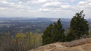
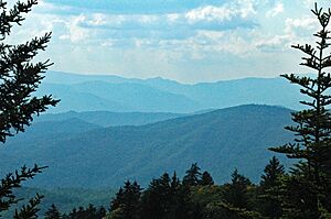
Western North Carolina (often called WNC) is a special part of North Carolina where you'll find the amazing Appalachian Mountains. People often call it the state's Mountain Region. It's home to the tallest mountains in the eastern United States! There are 125 peaks that rise over 5,000 feet (1,524 meters) high. Mount Mitchell is the highest of them all, standing at 6,684 feet (2,037 meters). It's the tallest peak in the entire Appalachian Mountains and even in mainland eastern North America!
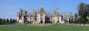
About 1.1 million people live in the 23 counties that are usually considered part of Western North Carolina. This is about 11% of North Carolina's total population. This region is located east of Tennessee and west of the Piedmont area. It doesn't have many huge cities. Asheville is the biggest city and main business center, right in the middle of the region.
The area along Western North Carolina's eastern edge is called the Foothills. This is where the land changes from the mountains to the flatter Piedmont Plateau in central North Carolina.
Some parts of northwest Western North Carolina, like Boone and Blowing Rock, are known as "The High Country." The area around Asheville has a cool nickname: Land of the Sky. This name comes from an old novel called Land of the Sky (1876) by Mrs. Frances Tiernan. She wrote about the beautiful Great Smoky Mountains and Blue Ridge Mountains, which are the two main mountain ranges here.
The Eastern Band of Cherokee Indians (EBCI) has a special area called Qualla Boundary in this region. It's right next to the Great Smoky Mountains National Park. Their main town is Cherokee, North Carolina. This whole region, including parts of Tennessee, North and South Carolina, and Georgia, was the original home of the Cherokee people. Many Cherokee were forced to leave in the late 1830s during the Trail of Tears. But some stayed, and their descendants are part of the EBCI today. Scientists have found many ancient earth mounds built by native peoples in this area, which were important to Cherokee towns and culture.
Contents
Exploring Western North Carolina's Areas
The Far West Region
The southwestern and far western parts of Western North Carolina are deep within the Appalachian Mountain chain. This is where you'll find the tallest Appalachian mountain ranges, like the Blacks, Great Smokies, and Great Balsams. Mt. Mitchell, the highest peak in eastern North America, is in the Black Mountains.
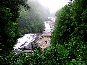
This region also has more waterfalls than anywhere else in North Carolina! Transylvania County is even called the "land of waterfalls." Asheville is the main city in this far western area. Other towns include Hendersonville, Waynesville, Brevard, Canton, and Sylva. Western Carolina University is located in Cullowhee, near Sylva.
Many people visit this area for outdoor fun like canoeing, whitewater rafting, camping, and fishing. A lot of the land is protected, including Pisgah National Forest, Nantahala National Forest, and Great Smoky Mountains National Park.
The High Country Area
The northern counties of Western North Carolina are known as the High Country. This area, centered around Boone, is famous for its popular ski resorts like Ski Beech, Appalachian Ski Mountain, and Sugar Mountain.
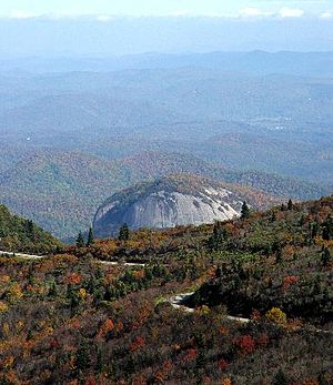
You can also visit cool places like Linville Caverns, Grandfather Mountain, and Blowing Rock. Important industries here include education, skiing, tourism, and even Christmas tree farming. Farming and raising animals are still important too. The counties in the High Country are Alleghany, Ashe, Avery, Mitchell, Watauga, Wilkes, and Yancey.
The Foothills Region
The Foothills is a transition area between the Piedmont Plateau and the Appalachian Mountains. The Blue Ridge Mountains drop sharply here, going from 3,500 to 4,000 feet (1,000–1,200 meters) down to 1,000–1,500 feet (300–450 meters). The Foothills have many smaller peaks and mountain ranges, like the South Mountains and Brushy Mountains.
This region has many small river valleys where most people live. While there aren't huge cities, there are many smaller towns. Historically, these towns often grew around one main industry, like furniture or textiles, which used local water power. Today, some of these older industries have moved away, but new businesses like manufacturing and health care have grown. Many farmers in the northern Foothills raise chickens. Vineyards and winemaking have also become popular.
Some towns in the North Carolina Foothills include Elkin, Forest City, Lake Lure, and Tryon. Cities like Hickory, Lenoir, and Morganton are also in this area.
Colleges and Universities
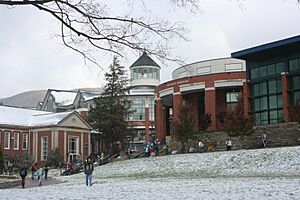
Western North Carolina has three main public universities. These are Appalachian State University in Boone, Western Carolina University in Cullowhee, and UNC Asheville in Asheville. All three are part of the larger University of North Carolina system.
There are also several smaller private colleges. Mars Hill University, founded in 1856, is the oldest college in Western North Carolina. Montreat College and Lees-McRae College are connected to the Presbyterian Church. Warren Wilson College is known for its focus on the environment and for being a "work college," where students also work on campus. Brevard College is connected to the United Methodist Church, and Lenoir-Rhyne University in Hickory is connected to the Evangelical Lutheran Church.
The region also has many community colleges that help people learn new skills and get ready for jobs or further education.
Getting Around Western North Carolina
Major Roads
Interstates
Three major interstate highways cross Western North Carolina. Interstate 40 goes east to west. Interstate 77 runs north to south through the northeastern part. Interstate 26 also goes north to south. Interstate 240 is a smaller interstate that helps people get around downtown Asheville.
U.S. Highways
US 421 is a big highway in the northwestern part of the state. Other important U.S. highways in the far western region include US 19, US 23, US 64, US 74, and US 441. US 70 connects Hickory and Asheville. US 221 and US 321 also run through the area.
Blue Ridge Parkway
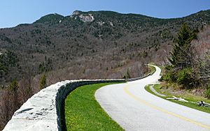
The Blue Ridge Parkway is a famous, scenic road that is 469 miles (755 km) long. It winds through western North Carolina, starting in Virginia and ending near the Great Smoky Mountains National Park. It's a beautiful drive!
Trains
Two large railroad companies, CSX and Norfolk Southern, serve the region. There are also two fun tourist railroads: the Tweetsie Railroad theme park and the Great Smoky Mountains Railroad.
Airports
Asheville Regional Airport (AVL) is located southeast of Asheville. It offers direct flights to many cities, including Charlotte, New York City, Atlanta, and Chicago.
Economy and Jobs
Tourism is a huge part of the economy here. Many visitors come to enjoy the Great Smoky Mountains National Park and the Nantahala and Pisgah national forests. There are also several lakes and dams, like Lake Lure and Fontana Dam. Lots of people visit in summer and autumn to escape hot weather and see the beautiful fall leaves. The timber industry (cutting down trees for wood) is also important.
Appalachian Regional Commission
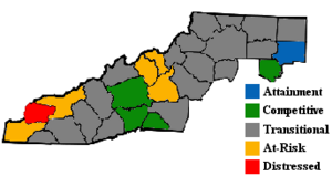
The Appalachian Regional Commission (ARC) was created in 1965 to help the Appalachian region grow economically. This region, which includes 29 counties in North Carolina, used to be behind the rest of the country in many ways. The ARC classifies counties based on their economy.
In 2003, most counties in Western North Carolina were classified as "transitional." This means they were improving but still had some catching up to do compared to the national average. Graham County was considered "distressed," meaning it faced more economic challenges. Buncombe, Davie, Henderson, and Polk counties were "competitive," doing better economically. Watauga County had one of the lowest unemployment rates in the entire Appalachian region!
More tourism and people moving to the area have brought both good and bad changes. Local businesses benefit from more money, but the cost of living can go up, and natural areas can be lost to new buildings.
Mountains and Rivers
Western North Carolina is full of mountains! There are 82 mountain peaks between 5,000 and 6,000 feet (1,524 and 1,829 meters) high, and 43 peaks rise over 6,000 feet (1,829 meters). These mountains are part of the Blue Ridge Mountains, which are part of the larger Appalachian Mountains. The Blue Ridge Mountains have several smaller ranges within them, like the Great Smoky Mountains, South Mountains, and Black Mountains. Mount Mitchell, the highest point in eastern North America, is in the Black Mountains. Valleys and foothills are usually between 1,000 and 2,000 feet (305 and 610 meters) above sea level.
Major rivers in the region include the French Broad River, Nolichucky River, and Little Tennessee River, which flow towards the Tennessee River. The New River flows towards the Ohio River. Other rivers like the Catawba River and Yadkin River flow through the foothills towards the Atlantic Ocean. The Eastern Continental Divide runs through the region. This invisible line separates rivers that flow west towards the Tennessee River from those that flow east towards the Atlantic Ocean.
Counties, Cities, and Towns
Western North Carolina is generally thought to include 23 counties.
The counties usually included are:
- Alleghany County
- Ashe County
- Avery County
- Buncombe County
- Burke County
- Caldwell County
- Cherokee County
- Clay County
- Graham County
- Haywood County
- Henderson County
- Jackson County
- Macon County
- Madison County
- McDowell County
- Mitchell County
- Polk County
- Rutherford County
- Swain County
- Transylvania County
- Watauga County
- Wilkes County
- Yancey County
Sometimes, other counties like Alexander County, Catawba County, and Cleveland County are also included. If you add these, the region becomes about 11,750 square miles (30,432 square kilometers), which is roughly the size of Massachusetts.
Main Cities and Towns
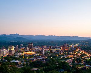
Here are some of the communities in Western North Carolina:
Cities with over 40,000 people
Cities with over 10,000 people
Smaller Towns and Communities
There are many smaller towns and communities throughout Western North Carolina, including:
- Andrews
- Black Mountain
- Blowing Rock
- Brevard
- Bryson City
- Canton
- Cherokee (headquarters for the Eastern Band of the Cherokee)
- Cullowhee (home to Western Carolina University)
- Franklin
- Hot Springs
- Lake Lure
- Marion
- Murphy
- Sylva
- Tryon
 | Laphonza Butler |
 | Daisy Bates |
 | Elizabeth Piper Ensley |


