
Haywood County, North Carolina facts for kids
Quick facts for kids
Haywood County
|
||
|---|---|---|
.jpg)
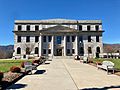
Haywood County Courthouse
|
||
|
||

Location within the U.S. state of North Carolina
|
||
 North Carolina's location within the U.S. |
||
| Country | ||
| State | ||
| Founded | 1808 | |
| Named for | John Haywood | |
| Seat | Waynesville | |
| Largest community | Waynesville | |
| Area | ||
| • Total | 554.50 sq mi (1,436.1 km2) | |
| • Land | 553.56 sq mi (1,433.7 km2) | |
| • Water | 0.94 sq mi (2.4 km2) 0.17% | |
| Population
(2020)
|
||
| • Total | 62,089 | |
| • Estimate
(2023)
|
62,969 | |
| • Density | 112.16/sq mi (43.31/km2) | |
| Time zone | UTC−5 (Eastern) | |
| • Summer (DST) | UTC−4 (EDT) | |
| Congressional district | 11th | |

Haywood County is a county in the state of North Carolina, USA. In 2020, about 62,089 people lived there. Its main town and biggest community is Waynesville. Waynesville is also the "county seat," which means it's where the county government offices are located. Haywood County is part of the Waynesville, NC area, which is a smaller city area.
Contents
History of Haywood County
The first people to live in the area that became Haywood County were the Cherokee Native Americans. Sadly, many of them became sick and died from a smallpox outbreak in 1715.
In July 1776, during the early days of the American Revolutionary War, Cherokee warriors attacked white settlements in western North Carolina. In response, a group of soldiers led by General Griffith Rutherford marched through the area. They destroyed many Cherokee villages.
More white settlers moved into the area after the war. Most of these settlers came from England, Scotland, Ireland, Germany, and the Netherlands.
Forming the County
Haywood County was officially created in 1808. It was formed from the western part of Buncombe County. The county was named after John Haywood. He was the North Carolina State Treasurer for a long time, from 1787 to 1827.
The county seat was first called Mount Pleasant. In 1811, its name was changed to Waynesville. The first county courthouse was finished in 1812.
Over the years, parts of Haywood County were used to create other counties. In 1828, a part became Macon County. In 1851, parts of both Haywood and Macon counties were combined to form Jackson County.
Civil War and Growth
The very last shot of the Civil War east of the Mississippi River happened in Waynesville. This was on May 9, 1865. Soldiers from the Thomas Legion (Confederate) fought with the 2nd North Carolina Mounted Infantry (Union).
In the 1880s, the Western North Carolina Railroad built train lines through the county. This brought new jobs and industries. Logging (cutting down trees for wood) and tourism (people visiting for fun) became important parts of the economy.
Geography and Natural Beauty
Haywood County covers about 554.5 square miles (1,436 square kilometers). Most of this is land, with a small amount of water.
Neighboring Counties
Haywood County shares borders with several other counties:
- In North Carolina: Madison, Buncombe, Henderson, Transylvania, Jackson, and Swain counties.
- In Tennessee: Cocke and Sevier counties.
Rivers and Mountains
The county is part of the French Broad River basin. All the water in Haywood County comes from rain or local springs. No rivers flow into the county from outside its borders. The Pigeon River actually starts in Haywood County.
Haywood County is located in the middle of the Blue Ridge Mountains. It includes parts of famous mountain ranges like the Great Smoky Mountains in the west. It also has parts of the Plott Balsams and Great Balsam Mountains in the south.
Tall Peaks and Protected Lands
Some important mountains in the county are:
- Cold Mountain, which is 6,030 feet (1,838 meters) tall.
- Mount Sterling, at 5,835 feet (1,779 meters).
- Richland Balsam, which reaches 6,410 feet (1,954 meters).
Mt. Guyot is the county's highest point at 6,621 feet (2,018 meters). It is the 4th highest mountain east of the Mississippi River. Black Balsam Knob, in the Great Balsam Mountains, is the highest "grassy bald" in the entire Appalachian range. A "grassy bald" is a mountain top covered in grass instead of trees.
Haywood County is thought to be the highest county (on average) east of the Mississippi River. Its average elevation is about 3,597 feet (1,096 meters). About 40% of the county's land is part of the Great Smoky Mountains National Park and the Pisgah National Forest. These are protected areas.
National Protected Areas
- Blue Ridge Parkway (part)
- Middle Prong Wilderness
- Mount Pisgah (part)
- Nantahala National Forest (part)
- Pisgah National Forest (part)
- Shining Rock Wilderness
- Waterrock Knob (part)
State and Local Protected Areas
- Cold Mountain Game Land
- Harmon Den Wildlife Management Area (part)
- Nantahala National Forest Game Land (part)
- Pisgah National Forest Game Land (part)
- Pisgah View State Park (part)
- William H. Silver Game Land (part)
Major Water Bodies
- Bald Creek
- Big Creek
- Cataloochee Creek
- Cooks Creek
- Cove Creek
- Crabtree Creek
- Jonathans Creek
- Fines Creek
- Lake Junaluska
- Lake Logan
- Laurel Creek
- Little Creek
- Pigeon River
- Richland Creek
- Rocky Branch Lake
- Waterville Lake
People of Haywood County: Demographics
| Historical population | |||
|---|---|---|---|
| Census | Pop. | %± | |
| 1810 | 2,780 | — | |
| 1820 | 4,073 | 46.5% | |
| 1830 | 4,578 | 12.4% | |
| 1840 | 4,975 | 8.7% | |
| 1850 | 7,074 | 42.2% | |
| 1860 | 5,801 | −18.0% | |
| 1870 | 7,921 | 36.5% | |
| 1880 | 10,271 | 29.7% | |
| 1890 | 13,346 | 29.9% | |
| 1900 | 16,222 | 21.5% | |
| 1910 | 21,020 | 29.6% | |
| 1920 | 23,496 | 11.8% | |
| 1930 | 28,273 | 20.3% | |
| 1940 | 34,804 | 23.1% | |
| 1950 | 37,631 | 8.1% | |
| 1960 | 39,711 | 5.5% | |
| 1970 | 41,710 | 5.0% | |
| 1980 | 46,495 | 11.5% | |
| 1990 | 46,942 | 1.0% | |
| 2000 | 54,033 | 15.1% | |
| 2010 | 59,036 | 9.3% | |
| 2020 | 62,089 | 5.2% | |
| 2023 (est.) | 62,969 | 6.7% | |
| U.S. Decennial Census 1790–1960 1900–1990 1990–2000 2010 2020 |
|||
2020 Census Information
| Race | Number | Percentage |
|---|---|---|
| White (non-Hispanic) | 55,685 | 89.69% |
| Black or African American (non-Hispanic) | 656 | 1.06% |
| Native American | 308 | 0.5% |
| Asian | 360 | 0.58% |
| Pacific Islander | 1 | 0.0% |
| Other/Mixed | 2,250 | 3.62% |
| Hispanic or Latino | 2,829 | 4.56% |
In 2020, the census counted 62,089 people living in Haywood County. There were 26,653 households and 17,170 families.
Economy and Jobs
Pactiv Evergreen is the biggest employer in Haywood County. This company runs a large paper mill in Canton and another facility in Waynesville.
In March 2023, the company announced that the Canton mill would close. This closure is expected to cause hundreds of people to lose their jobs. It will also have a big impact on the local economy. After the mill closes, Haywood County Schools is expected to become the largest employer in the county.
Transportation Routes

The Blue Ridge Southern Railroad operates a train line that carries goods through Haywood County.
Major Highways for Travel
 I-40
I-40 US 19
US 19
US 19 Truck US 23
US 23
US 23 Bus.
 US 64 Truck
 US 74
US 74 US 276
 NC 110
 NC 209
 NC 215
Education and Learning
Haywood County Schools manages 15 schools. This includes an early college (Haywood Early College High School). There are also three high schools (Tuscola, Pisgah, and Central Haywood). The district also has three middle schools and eight elementary schools.
The school district has no low-performing schools. In 2021–22, it had the seventh highest combined test results among all school districts in the state. Haywood County is also home to Haywood Community College. In 2021, about 27.7 percent of adults in the county had earned a bachelor's degree or a higher level of education.
Culture and Traditions
High School Sports Rivalry
There's a famous sports rivalry between two high school football teams in the county. These are the Tuscola High School Mountaineers from Waynesville and the Pisgah High School Black Bears from Canton. This rivalry goes back to 1922. The annual football games between these two teams are very popular. Sometimes, more than 10,000 people come to watch!
Local Festivals and Events
Since the 1930s, Haywood County has hosted an annual "ramp" convention. Ramps are a type of wild onion.
Folkmoot USA is an international folk festival that has been held since 1984. It takes place in Waynesville, North Carolina and nearby towns. Over the years, this two-week event has featured about 200 groups from around 100 different countries. The Southeast Tourism Society has named Folkmoot USA one of its top twenty events for 20 years. In 2003, the North Carolina General Assembly declared Folkmoot USA to be the state's official international folk festival.
Communities in Haywood County

Towns in the County
- Waynesville (This is the county seat and the largest community.)
- Canton
- Clyde
- Maggie Valley
Census-Designated Places (CDPs)
Unincorporated Communities
Townships
Haywood County is divided into several townships:
- Beaverdam
- Cataloochee
- Cecil
- Clyde
- Crabtree
- East Fork
- Fines Creek
- Iron Duff
- Ivy Hill
- Jonathan Creek
- Pigeon
- Suttontown
- Waynesville
- White Oak
Images for kids
-
Haywood County Courthouse
See also
 In Spanish: Condado de Haywood (Carolina del Norte) para niños
