Mount Guyot (Great Smoky Mountains) facts for kids
Quick facts for kids Mount Guyot |
|
|---|---|
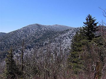
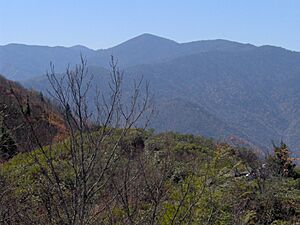
Mt. Guyot, looking south from the Appalachian Trail
|
|
| Highest point | |
| Elevation | 6,621 ft (2,018 m) NAVD 88 |
| Prominence | 1,581 ft (482 m) |
| Geography | |
| Location | |
| Parent range | Great Smoky Mountains |
| Topo map | USGS Mount Guyot |
| Climbing | |
| Easiest route | Snake Den Ridge Trail + Appalachian Trail + bushwhack |
Mount Guyot is a tall mountain found in the eastern part of the Great Smoky Mountains in the southeastern United States. It stands at about 6,621 feet (2,018 m) high. This makes it the fourth-highest peak in the eastern U.S. and the second-highest inside the Great Smoky Mountains National Park.
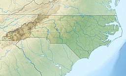
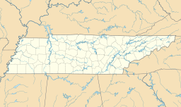
Even though Mount Guyot is far away from towns, the famous Appalachian Trail goes across its southern side. The trail passes very close to the top, only about 1,000 feet (300 m) away. The mountain sits right on the border between Tennessee and North Carolina, specifically between Sevier County and Haywood County.
Mount Guyot has two peaks, about half a mile apart. The true highest point is the one on the southwestern side. The mountain rises very high above the land around it. For example, it's about 3,600 feet (1,100 m) taller than its eastern base. A beautiful waterfall called Ramsey Cascades flows down the western side of Mount Guyot.
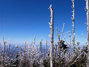
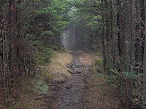
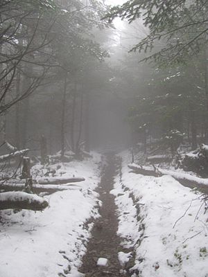
The top and upper parts of Mount Guyot are covered in a thick, special type of forest. It's called a Southern Appalachian spruce–fir forest. Because people didn't settle much in this part of the Smokies, the area around Mount Guyot is still very wild. It hasn't been changed as much as other parts of the mountains. Getting to the very top of Mount Guyot is a long hike and requires going off-trail through thick woods. It's the highest peak in the East that doesn't have a clear trail to its summit.
How Mount Guyot Was Formed
Mount Guyot is made of very old rocks, called Precambrian rocks. These rocks were formed about one billion years ago from sediments that settled at the bottom of an ancient ocean. The mountain mainly sits on a type of rock called Thunderhead sandstone. This kind of sandstone is common throughout the Smoky Mountains.
Many millions of years ago, the Thunderhead sandstone was pushed over another type of rock called Roaring Fork sandstone. Mount Guyot itself was created more than 200 million years ago. This happened during a huge event called the Appalachian orogeny. During this time, the North American and African land plates crashed into each other. This collision pushed the rocks upwards, forming the mountains we see today.
The Story of Mount Guyot
Mount Guyot was named after a Swiss geographer named Arnold Henry Guyot. His friend, Samuel Buckley, gave the mountain its name. Buckley was a naturalist who explored the Smokies in 1858 with Thomas Lanier Clingman.
Arnold Guyot himself led an expedition the next year, in 1859. He took more accurate measurements of the mountains' heights. He also gave early names to many peaks along the mountain ridge. Guyot measured Mount Guyot's height at 6,636 feet (2,023 m). This was very close to today's measurement, off by only about 15 feet (4.6 m).
People who explored the eastern Smokies always agreed on one thing: it was a very remote and isolated place. Arnold Guyot himself said that "neither the white man or the Indian hunter venture in this wilderness."
Horace Kephart, who wrote a lot about the Smoky Mountains in the early 1900s, described Mount Guyot as the center of a dense, almost impossible-to-cross wilderness. He wrote:
The most rugged and difficult part of the Smokies (and of the United States east of Colorado) is in the sawtooth mountains between Collins and Guyot, at the headwaters of the Okona Lufty River. I know but few men who have ever followed this part of the divide ...
Kephart also shared the story of James Ferris and his wife. They were naturalists who hiked through the thick woods to Mount Guyot in 1900. Mrs. Ferris said:
The Tennesseeans seem afraid of the mountains, and the Cherokees of North Carolina equally so; for, two miles (3 km) from camp, all traces of man, except surveyors' marks, had disappeared.
Mount Guyot stayed isolated for a long time. Then, in 1935, the CCC built a part of the Appalachian Trail across the mountain's western slope. This trail helped open up the heart of the Eastern Smokies for backpackers. However, getting there was still quite hard.
Laura Thornborough, an author who climbed Guyot in the late 1930s, wrote about her experience:
My first of three trips to the top of Mt. Guyot remains sharply etched in my memory. It was the hardest, roughest and most exhausting of all the trips I have ever made in the Great Smokies.
Thornborough took a route from Greenbrier that went up Guyot's western side. She remembered that "there was no trail to Guyot, not even a dim one, but our guides knew the way." Her group followed Ramsay Prong creek until it was just a tiny stream. They came out near what is now Guyot Spring. From the state line, they found a "dim trail" leading to the top. Thornborough ended her report by saying, "if it is wilderness you want, then go to Guyot."
How to Reach Mount Guyot
The Appalachian Trail and the Balsam Mountain Trail meet just south of Mount Guyot at Tricorner Knob. These are the only main trails that go across the mountain.
If you start from the Cosby Campground (behind Campsite B51), the Snake Den Ridge Trail goes for about 5.3 miles (8.5 km). It connects with the Appalachian Trail at Inadu Knob. From there, it's about 2 miles (3.2 km) to Guyot Spring, which is on the west side of Mount Guyot.
A 15-mile (24 km) part of the Appalachian Trail stretches from Newfound Gap to Tricorner Knob, near Guyot's south side. The spot where the Appalachian and Balsam Trails meet is about 13 miles (21 km) from Balsam Mountain Road. This gravel road starts near Cherokee, North Carolina.
Mount Guyot's eastern side is very steep. But its western side, called Guyot Spur, slopes down gently for almost five miles to the Little Pigeon River. There's a known way to go off-trail (a "bushwhack") that follows the creek on the north side of Guyot Spur. It starts at Ramsay Cascades and comes out on the Appalachian Trail near Guyot Spring. This is likely the same path Thornborough's guides used in the 1930s. This route is about eight miles from the Ramsay Cascades Trail parking area. Four miles (6 km) of that are on a maintained trail.
Even though the summit is less than half a mile from the Appalachian Trail, the very thick forest makes going off-trail a big challenge. There's a faint path from Guyot Spring to the northern summit, but it's very overgrown. Fallen Fraser fir trees and poor visibility make it hard to find your way from any direction.
 | Janet Taylor Pickett |
 | Synthia Saint James |
 | Howardena Pindell |
 | Faith Ringgold |


