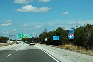
Interstate 40 in North Carolina facts for kids
Quick facts for kids
Interstate 40 |
||||
|---|---|---|---|---|
| Blue Star Memorial Highway | ||||
|
I-40 highlighted in red
|
||||
| Route information | ||||
| Maintained by NCDOT | ||||
| Length | 420.21 mi (676.26 km) | |||
| Existed | 1958–present | |||
| Major junctions | ||||
| West end | ||||
|
||||
| East end | ||||
| Location | ||||
| Counties: | Haywood, Buncombe, McDowell, Burke, Catawba, Iredell, Davie, Forsyth, Guilford, Alamance, Orange, Durham, Wake, Johnston, Sampson, Duplin, Pender, New Hanover | |||
| Highway system | ||||
| Main route of the Interstate Highway System Main • Auxiliary • Business North Carolina Highway System
|
||||
Interstate 40 (I-40) is a major highway that crosses the United States. It stretches over 2,500 miles (4,000 km) from California to North Carolina. In North Carolina, I-40 covers 420 miles (676 km). It runs all the way across the state from the Tennessee border to Wilmington.
I-40 is the longest Interstate Highway in North Carolina. It is also the only Interstate that goes completely across the state from west to east. This highway connects North Carolina's three main areas: the mountains, the central Piedmont, and the eastern coast. It links big cities like Raleigh, Greensboro, Durham, and Winston-Salem. It also connects smaller towns and passes through different landscapes. These include the Blue Ridge Mountains, farmlands, and busy city centers.
I-40 has several other names along its route. It is known as the Blue Star Memorial Highway across the state. Other sections are named after important people. For example, parts are called the Sam Hunt Freeway and the Michael Jordan Highway. The highway was first planned in 1956. The first part of I-40 in North Carolina opened in 1958 in Winston-Salem. The last section was finished in 1992.
Contents
What is I-40 Like?
I-40 goes through all the different types of land in North Carolina. In 2023, some parts of the highway in Raleigh were used by over 193,000 vehicles each day. Other parts in Pender County had much less traffic. I-40 is part of the National Highway System. This means it is important for the country's economy and travel.
Western North Carolina: Mountains and Tunnels
I-40 enters North Carolina near the Pigeon River. It winds through the Pigeon River Gorge. Here, it goes through two tunnels. When these tunnels opened in 1968, they were the first Interstate tunnels east of the Mississippi River. One tunnel is only for eastbound traffic. The westbound lanes use a cut through the mountain.
After the tunnels, I-40 continues towards Asheville. It joins with US 74. In Asheville, I-40 connects with I-26 and I-240. This area is sometimes called "Malfunction Junction" because it can be confusing. I-40 then goes south of Asheville, near the Biltmore Estate.
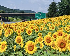
After Asheville, I-40 goes up a steep hill called Old Fort Mountain. This part has winding roads and special ramps for trucks that lose their brakes. It is about 6 miles (9.7 km) long. I-40 passes near Black Mountain and Marion. It also crosses the Eastern Continental Divide. This is where rivers start flowing either to the Atlantic Ocean or the Gulf of Mexico.
When I-40 reaches Hickory, it connects with US 321. This exit leads to Hickory, Lincolnton, and Gastonia. I-40 then crosses the Catawba River. It then enters Iredell County and passes Statesville. Here, it has a big interchange with I-77. This interchange was rebuilt to help with traffic.
Piedmont Region: Cities and Busy Roads
I-40 heads northeast into the Piedmont region. It passes through Mocksville and Clemmons. In Winston-Salem, I-40 becomes six lanes wide. It connects with the Salem Parkway, which leads to downtown Winston-Salem. I-40 continues through the southern part of Winston-Salem, passing Hanes Mall. It then meets I-285/US 52/NC 8. Later, it connects with I-74, which goes south to High Point.
I-40 then goes northeast, bypassing Kernersville. It joins with US 421 and enters Greensboro. In Greensboro, I-40 passes an exit for PTI Airport. It then reaches a large interchange with I-73/US 421/I-840. This is where US 421 leaves I-40.
I-40 goes through southwestern Greensboro. It connects to important areas in the city, including US 70 (Wendover Avenue). It passes Four Seasons Town Centre. Then, US 29 and US 220 join I-40 for about 1 mile (1.6 km). This part of the Interstate usually has six lanes.
This busy section of I-40 in Greensboro is sometimes called "Death Valley." This nickname came about because of the many serious accidents that happened there. One reason for the accidents is how the lanes merge. Traffic from US 29/US 70/US 220 southbound merges from the right and then exits to the left. This means cars often have to cross many lanes. State traffic engineers studied the area and found it had more rear-end collisions than other urban Interstates.
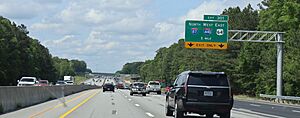
East of Greensboro, I-40 merges with I-85. They run together for about 31 miles (50 km) through Guilford, Alamance, and Orange counties. This section uses I-85 exit numbers. It passes south of Elon, Burlington, Graham, and Mebane. I-40 then separates from I-85 near Hillsborough.
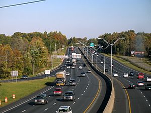
After leaving I-85, I-40 heads southeast towards Chapel Hill. It goes through rural areas and forests. I-40 runs next to NC 86 for a while. It then passes through suburban areas and southern Durham. I-40 enters Research Triangle Park (RTP) after connecting with I-885 and NC 885. This part of I-40 is very important for travel between Raleigh, Cary, and Durham.
Near Raleigh–Durham International Airport, I-40 has an interchange with I-540. Several exits serve the airport. I-40 continues southeast towards downtown Raleigh. It runs north of Cary and south of William B. Umstead State Park. In Raleigh, I-40 turns south at Wade Avenue. It then connects with I-440/US 1/US 64. I-40 then runs with US 64 along the south side of Raleigh. This shared section ends at an interchange with I-87/I-440/US 64. Here, I-40 turns south.
Eastern North Carolina: Farmland to the Coast
Beyond Raleigh, I-40 mostly goes south-southeast towards Wilmington. It leaves Raleigh and passes through eastern Garner. I-40 meets US 70 in Garner. It also starts running next to NC 50. I-40 then reaches an interchange with I-42 and NC 540. I-42 heads east towards Selma and New Bern.
South of this exit, I-40 leaves Wake County and enters Johnston County. It connects with NC 42, NC 210, and NC 242. These exits lead to towns like Clayton and Benson. I-40 passes east of Benson and meets I-95. This interchange was rebuilt to make driving smoother.
I-40 continues southeast through farmland in Johnston County. It meets NC 96. Near Newton Grove, I-40 enters Sampson County. It passes along the side of Newton Grove, connecting with NC 50/NC 55 and US 701. I-40 continues southeast through Sampson County. It meets NC 403 near Faison. Here, I-40 starts running next to US 117.
I-40 then enters Duplin County. It meets NC 24 and NC 24 Bus. west of Warsaw. NC 24 then runs with I-40 for about 8.4 miles (13.5 km). An interchange with US 117 is south of Warsaw. I-40 then goes around Magnolia to the east. NC 24 leaves I-40 at NC 903, which leads to Kenansville. After this, I-40 mostly turns south. It bypasses Teachey, Rose Hill, and Wallace to the east. Exits for NC 11 and NC 41 provide access to these towns. I-40 then runs next to the Northeast Cape Fear River and enters Pender County.
The highway meets US 117 again south of Wallace. I-40 stays on the west side of US 117 for about 5.6 miles (9.0 km). It then bypasses Burgaw to the east, meeting NC 53. Continuing south, I-40 meets NC 210 again near Rocky Point. It then crosses the Northeast Cape Fear River into New Hanover County. Here, it gets the name "Michael Jordan Freeway."
I-40 passes east of Castle Hayne. It connects with Holly Shelter Road. An interchange with I-140 and NC 140 is about 2.5 miles (4.0 km) south of Holly Shelter Road. From I-140 and NC 140, I-40 continues south. It turns southwest and meets US 117 and NC 132. The eastern end of I-40 is at US 117 and NC 132 in Wilmington. The highway continues south as North College Road towards the University of North Carolina Wilmington and Carolina Beach.
Special Names for I-40
I-40 has many special names in addition to its number.
- Blue Star Memorial Highway: This name is used across the entire state.
- Sam Hunt Freeway: This section is shared with I-85 near Graham.
- Harriet Morehead Berry Freeway: This part is in Orange County. It is named after a woman who helped improve roads in North Carolina.
- John Motley Morehead III Freeway: This section is between Chapel Hill and Durham. It is named after a generous person who went to the University of North Carolina at Chapel Hill.
- Dan K. Moore Freeway: This part is in the Research Triangle Park. It is named after a former governor of North Carolina.
- Tom Bradshaw Freeway: This section is from Wade Avenue Extension to US 70 in Garner. It is named after a former mayor of Raleigh.
- James Harrington Freeway: This part runs from US 70 to I-95.
- Robert D. Warren Sr. Highway: This section is in Johnston and Sampson counties. It is named after a former state senator.
- Henry L. Stevens Jr. Highway: This part is in Duplin County. It is named after a judge and leader of the American Legion.
- Michael Jordan Highway: This section is from the Pender–New Hanover county line to the end of I-40. It is named after the famous basketball player Michael Jordan, who grew up in Wilmington.
- Tobacco Road: College sports fans sometimes call I-40 this name. It connects the four North Carolina schools in the Atlantic Coast Conference.
- Jimmy Capps Freeway: Since February 1, 2024, a section of I-40 near Benson is named after Jimmy Capps, a country music singer.
How I-40 Was Built
I-40 was part of the original Interstate Highway plan from 1956. North Carolina was given about 714 miles (1,149 km) for its share of the Interstate system. About 219 miles (352 km) were for a route from Tennessee to Greensboro. This route became I-40.
The first part of I-40 in North Carolina opened in 1958. It was a 3-mile (4.8 km) section in Winston-Salem. For the next 32 years, I-40 was built and extended. It eventually reached its current length from the Pigeon River Gorge to Wilmington.
Early Roads and Planning
Before I-40, there were old trading paths used by Native Americans. One of these paths, Rutherford's Trace, followed a similar route to modern I-40. In 1921, the North Carolina Highway System was created. NC 10, called the "Central Highway," ran between Asheville and Greensboro. By 1926, when US 70 was added to NC 10, most of the road was paved.
After World War II, the government planned a new highway system. In 1947, a map showed a route similar to US 70 from Tennessee to Greensboro. In 1956, the Federal-Aid Highway Act officially created the Interstate system. In 1957, I-40 was approved for this route.
Building the Highway
In 1953, work began on a 6.5-mile (10.5 km) road in Haywood County along the Pigeon River. This road would connect to Tennessee. In 1958, this project was the first I-40 construction job in the country. That same year, the first two sections of I-40 opened in North Carolina. One was in Winston-Salem, and the other was from Kernersville to Greensboro.
Over the years, more sections of I-40 opened:
- In 1960, I-40 expanded in Burke County, from Conover to Statesville, and near Winston-Salem.
- By 1961, it extended west from Dysartsville Road to Marion.
- In 1963, the gap between Winston-Salem and Kernersville was finished.
- In 1968, after 10 years of work, a 20-mile (32 km) section opened from the Tennessee state line to Cove Creek.
- In 1969, I-40 was approved to extend east from Greensboro to Raleigh and then to Smithfield.
- By 1971, more gaps were filled, connecting sections in Enka and Mocksville.
- In 1978, after much discussion, the state decided to route I-40 to Wilmington.
- In 1982, the original I-40 route from Tennessee to Greensboro was officially completed.
- In 1984, I-40 was extended in Raleigh and construction began on the section to Wilmington.
- By 1986, I-40 reached its current eastern end in Wilmington.
- In 1989, I-40 was extended west to I-85 near Hillsborough and east to I-95 in Benson.
- On June 29, 1990, I-40 was fully connected between Raleigh and Wilmington. This helped connect the Port of Wilmington to the rest of the state.
- The final gap of I-40 was completed around 1992. This was when it was added to the existing I-85 from Greensboro to Hillsborough.
Recent Changes and Improvements
By the end of the 1900s, I-40 had many upgrades. The old East-West Expressway in Winston-Salem, which carried I-40, was very busy. In 1988, it was decided to build a new bypass around Winston-Salem. This new 20.89-mile (33.62 km) section opened by the end of 1992. I-40 was moved to this new, wider road. The old road became Interstate 40 Business.
Between 1989 and 1996, a 35-mile (56 km) section between Alamance and Orange counties was widened from four to eight lanes. In 1997, I-40 in Greensboro also received upgrades.
In December 2004, a 10.6-mile (17.1 km) section from Durham to RTP was widened from four to six lanes. However, the paving had problems, and the road had to be repaved again in 2005.
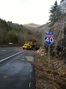
The section of I-40 through the Pigeon River Gorge is known for being curvy and narrow. It has many serious accidents. This is because the road is cut into mountainsides and next to the river. There is little room for cars to move if there is an accident. Speeding trucks and thick fog also cause problems. This area is also known for rockslides. In 1997, a rockslide closed the road for almost three months. In 2009, another large rockslide closed I-40 in both directions for several weeks.
In February 2008, I-40 was briefly moved to the southern part of the Greensboro Urban Loop. This was the first change to I-40 since the Winston-Salem bypass opened. However, many people complained about the confusion. So, in September 2008, I-40 was moved back to its original route through Greensboro. All the signs were changed by July 1, 2009.
In 2011, an 8-mile (13 km) section between Harrison Avenue and Gorman Street in Raleigh was widened. This project cost $49 million.
From 2013 to late 2018, a big project called "Fortify" rebuilt I-40 along the southern edge of Raleigh. This included widening the road, rebuilding bridges, and improving exit ramps.
In Statesville, the I-40/I-77 interchange was upgraded. This project started in March 2012 and was mostly finished by December 2023. It widened both I-40 and I-77 to eight lanes and rebuilt the interchange.
Starting in late 2018, the section of I-40 between the I-40/I-440 split and NC 42 is being widened. Many overpasses are being rebuilt. A new interchange at NC 42 is being built as a diverging diamond interchange. A new ramp between I-440 east and I-40 east opened in December 2020. The new lanes between the Raleigh Beltline and the Clayton Bypass opened in April 2023.
In 2024, Hurricane Helene caused major damage to the eastbound lanes of I-40 in the Pigeon River Gorge. This closed the road completely. Crews worked to fix it, and the road reopened on March 1, 2025, with one lane in each direction. The cost to rebuild the eastbound lanes is estimated to be very high.
Future Plans for I-40
There are plans for more improvements to I-40:
- In Asheville, part of the I-26 Connector project will improve I-40. This will widen the highway and improve interchanges.
- Another widening project is planned for I-40 between mile markers 259 and 279 in Orange and Durham counties. This project has faced some delays.
- A widening project is also planned for I-40 between the I-440/US 1/US 64 interchange and the Lake Wheeler Road interchange in Raleigh. This project will add one or two lanes and redesign the interchange. Construction is expected to begin in 2025.
I-40 Exits in North Carolina
| County | Location | Mile | Roads intersected | Notes | |||
|---|---|---|---|---|---|---|---|
| Haywood | | 0.0 | 0.0 | Continues into Tennessee | |||
| | 6.7 | 10.8 | 7 | Cold Springs Creek Road – Harmon Den | |||
| | 14.8 | 23.8 | 15 | Fines Creek Road | |||
| Cove Creek | 20.5 | 33.0 | 20 | Northern end of US 276 | |||
| | 24.2 | 38.9 | 24 | ||||
| | 27.3 | 43.9 | 27 | West end of US 74 overlap | |||
| Canton | 31.2 | 50.2 | 31 | ||||
| 33.2 | 53.4 | 33 | Newfound Road – Canton | ||||
| Buncombe | | 37.4 | 60.2 | 37 | Wiggins Road – Candler, East Canton | ||
| | 41.9 | 67.4 | 42 | Liberty Road | Future interchange; construction scheduled to begin in 2025 | ||
| Asheville | 44.3 | 71.3 | 44 | ||||
| 45.9 | 73.9 | 46A | East end of US 74 overlap; no eastbound entrance; westbound left exit | ||||
| 46B | No westbound exit; eastbound left exit | ||||||
| 46.7 | 75.2 | 47 | To Farmers Market | ||||
| 50.2 | 80.8 | 50 | Signed as exits 50A (south) and 50B (north) westbound | ||||
| 51.3 | 82.6 | 51 | |||||
| 52.8 | 85.0 | 53A | |||||
| 53B | |||||||
| 55.1 | 88.7 | 55 | To VA Hospital | ||||
| | 58.8 | 94.6 | 59 | Patton Cove Road – Swannanoa | |||
| Black Mountain | 63.8 | 102.7 | 64 | ||||
| 64.8 | 104.3 | 65 | West end of US 70 overlap; westbound exit and eastbound entrance | ||||
| 65.7 | 105.7 | 66 | Dunsmore Avenue – Ridgecrest | ||||
| McDowell | Old Fort | 71.4 | 114.9 | 72 | To Mount Mitchell; East end of US 70 overlap; eastbound exit and westbound entrance | ||
| 72.4 | 116.5 | 73 | Catawaba Avenue – Old Fort | ||||
| 74.8 | 120.4 | 75 | Parker Padgett Road | ||||
| Marion | 81.2 | 130.7 | 81 | Sugar Hill Road – Marion | |||
| 83.4 | 134.2 | 83 | Ashworth Road | ||||
| 84.6 | 136.2 | 85 | |||||
| 86.3 | 138.9 | 86 | |||||
| | 89.8 | 144.5 | 90 | Harmony Grove Road – Nebo, Lake James | |||
| Burke | | 94.1 | 151.4 | 94 | Dysartsville Road | ||
| | 95.8 | 154.2 | 96 | Kathy Road | |||
| Glen Alpine | 97.5 | 156.9 | 98 | Causby Road – Glen Alpine | |||
| 99.5 | 160.1 | 100 | Jamestown Road / Dixie Boulevard – Glen Alpine | ||||
| Morganton | 102.9 | 165.6 | 103 | ||||
| 104.1 | 167.5 | 104 | Enola Road | ||||
| 105.1 | 169.1 | 105 | |||||
| | 106.2 | 170.9 | 106 | Bethel Road | |||
| | 107.4 | 172.8 | 107 | ||||
| Valdese | 110.7 | 178.2 | 111 | Abees Grove Church Road / Milestone Avenue – Valdese | |||
| 111.4 | 179.3 | 112 | Mineral Springs Mountain Road – Valdese | ||||
| Rutherford College | 112.3 | 180.7 | 113 | Rutherford College Road / Malcom Boulevard – Connelly Springs, Rutherford College | |||
| Icard | 116.2 | 187.0 | 116 | Old NC 10 – Icard | |||
| Hildebran | 117.9 | 189.7 | 118 | Old NC 10 | |||
| 118.8 | 191.2 | 119 | Henry River Road / Center Street – Henry River, Hildebran | Signed as exits 119A (Henry River) and 119B (Hildebran) eastbound | |||
| Catawba | Long View | 120.6 | 194.1 | 121 | 33rd Street – Long View | ||
| Hickory | 122.8 | 197.6 | 123A | Cloverleaf interchange with Collector/distributor roadways | |||
| 123B | To Appalachian State University and Hickory Regional Airport | ||||||
| 125.1 | 201.3 | 125 | Lenoir Rhyne Boulevard – Hickory | To Lenoir-Rhyne University | |||
| 126.2 | 203.1 | 126 | |||||
| Conover | 128.1 | 206.2 | 128 | Fairgrove Church Road | To Hickory Motor Speedway | ||
| 130.2 | 209.5 | 130 | Old US 70 | ||||
| 131.1 | 211.0 | 131 | Permanently closed by 2008. | ||||
| 131.6 | 211.8 | 132 | |||||
| 132.6 | 213.4 | 133 | Rock Barn Road | ||||
| Claremont | 134.3 | 216.1 | 135 | Oxford Street – Claremont | |||
| Catawba | 138.1 | 222.3 | 138 | ||||
| Iredell | | 140.4 | 226.0 | 141 | Sharon School Road | ||
| | 144.0 | 231.7 | 144 | Old Mountain Road – West Iredell | |||
| | 145.4 | 234.0 | 146 | Stamey Farm Road | |||
| Statesville | 147.7 | 237.7 | 148 | ||||
| 149.5 | 240.6 | 150 | |||||
| 151.2 | 243.3 | 151 | |||||
| 152.0 | 244.6 | 152 | Signed as exits 152A (south) and 152B (north); I-77 exit 51 | ||||
| 152.9 | 246.1 | 153 | Permanently closed as of October 1, 2012; was an eastbound exit and westbound entrance | ||||
| 153.7 | 247.4 | 154 | |||||
| | 161.8 | 260.4 | 162 | ||||
| Davie | Mocksville | 167.8 | 270.0 | 168 | |||
| 169.5 | 272.8 | 170 | |||||
| | 173.5 | 279.2 | 174 | Farmington Road | |||
| | 179.8 | 289.4 | 180 | Signed as exits 180A (south) and 180B (north) Westbound | |||
| Forsyth | Clemmons | 182.1 | 293.1 | 182 | Harper Road – Tanglewood, Bermuda Run | ||
| 183.5 | 295.3 | 184 | Lewisville–Clemmons Road – Lewisville, Clemmons | ||||
| Winston-Salem | 187.7 | 302.1 | 188 | No access from US 421 south to I-40 west; eastbound left exit | |||
| 188.6 | 303.5 | 189 | |||||
| 189.3 | 304.6 | 190 | Hanes Mall Boulevard | Westbound exit and eastbound entrance | |||
| 191.3 | 307.9 | 192 | |||||
| 192.5 | 309.8 | 193C | Silas Creek Parkway, South Main Street | Westbound exit and eastbound entrance | |||
| 193.2 | 310.9 | 193A | |||||
| 193B | |||||||
| 194.3 | 312.7 | 195 | |||||
| 195.9 | 315.3 | 196 | Future NC 192; I-74 will be rerouted onto a new alignment once construction is complete | ||||
| | 198 | Future interchange (Construction started in Spring 2022; completion date November 2026) | |||||
| Kernersville | 200.7 | 323.0 | 201 | Union Cross Road | Diverging diamond interchange | ||
| 203.5 | 327.5 | 203 | |||||
| Guilford | Colfax | 206.4 | 332.2 | 206 | North end of US 421 overlap; westbound exit and eastbound entrance | ||
| Greensboro | 207.4 | 333.8 | 208 | Sandy Ridge Road | |||
| 209.7 | 337.5 | 210 | |||||
| 210.7 | 339.1 | 211 | Gallimore Dairy Road | SP Diamond Interchange | |||
| 212.1 | 341.3 | 212A | Eastbound left exit; south end of US 421 overlap; I-85 signed eastbound | ||||
| 212B | |||||||
| 213.0 | 342.8 | 213 | Guilford College Road | ||||
| 213.8 | 344.1 | 214 | Signed as exits 214A (west) and 214B (east) eastbound | ||||
| 215.3 | 346.5 | 216 | Patterson Street | Eastbound exit and westbound entrance | |||
| 216.8 | 348.9 | 217 | Gate City Boulevard, Koury Boulevard | ||||
| 218.2 | 351.2 | 218 | West end of US 220 overlap; signed as exits 218A (US 220) and 218B (Freeman Mill Road) | ||||
| 219.0 | 352.4 | 219 | South end of US 29 overlap | ||||
| 219.3 | 352.9 | 220 | Randleman Road | ||||
| 219.9 | 353.9 | 221 | South Elm-Eugene Street – Downtown Greensboro | ||||
| 221.0 | 355.7 | 222 | Martin Luther King Jr. Drive | ||||
| 221.1 | 355.8 | 223 | North end of US 29/US 220 overlap; northbound exit and southbound entrance | ||||
| 223.3 | 359.4 | 224 | Gate City Boulevard, Lee Street | To Bennett College, UNC Greensboro, A&T University and Greensboro College | |||
| 225.7 | 363.2 | 226 | McConnell Road | ||||
| 226.5 | 364.5 | 227 | South end of I-85 overlap | ||||
| I-40 overlaps with Interstate 85 (exits 131 to 163) | |||||||
| Orange | Hillsborough | 258.3 | 415.7 | 259 | North end of I-85 overlap | ||
| 260.8 | 419.7 | 261 | Old NC Highway 86 – Hillsborough | ||||
| 262.9 | 423.1 | 263 | New Hope Church Road | ||||
| 265.8 | 427.8 | 266 | |||||
| Durham | Chapel Hill | 269.9 | 434.4 | 270 | |||
| 272.7 | 438.9 | 273 | Signed as exits 273A (west) and 273B (east) westbound | ||||
| Durham | 274.2 | 441.3 | 274 | ||||
| 275.6 | 443.5 | 276 | Fayetteville Road – Southpoint, North Carolina Central University | SP Diamond Interchange | |||
| 277.8 | 447.1 | 278 | |||||
| Research Triangle Park | 279.1 | ||||||
| 279B | |||||||
| 280.1 | 450.8 | 280 | Davis Drive | ||||
| Durham | 280.8 | 451.9 | 281 | Miami Boulevard | |||
| 281.4 | 452.9 | 282 | Page Road | ||||
| 282.3 | 454.3 | 283 | Signed westbound as exits 283A (East I-540) and 283B (West NC 540); I-540 exit 1 | ||||
| Wake | Morrisville | 283.5 | 456.2 | 284 | Airport Boulevard – RDU International Airport | Signed eastbound as exits 284A (west) and 284B (east); under conversion into Diverging diamond interchange. | |
| Cary | 284.7 | 458.2 | 285 | Aviation Parkway – Morrisville, RDU International Airport | Signed westbound as exits 285A (south) and 285B (north) | ||
| 287.0 | 461.9 | 287 | Harrison Avenue – Cary | ||||
| Raleigh | 288.6 | 464.5 | 289 | To PNC Arena, Carter–Finley Stadium, State Fairgrounds, NCSU Veterinary College, and NC Museum of Art | |||
| 290.5 | 467.5 | 290 | |||||
| 291.4 | 469.0 | 291 | Cary Towne Boulevard – Cary | ||||
| 292.6 | 470.9 | 293A | West end of US 64 overlap | ||||
| 293B | Cloverleaf interchange with Collector/distributor roadways | ||||||
| 295.0 | 474.8 | 295 | Gorman Street | ||||
| 297.1 | 478.1 | 297 | Lake Wheeler Road | ||||
| 298.0 | 479.6 | 298 | Signed as exits 298A (east/south) and 298B (west/north), to be converted into a Diverging diamond interchange | ||||
| 298.8 | 480.9 | 299 | Person Street, Hammond Road | ||||
| 300.3 | 483.3 | 300 | Rock Quarry Road | Signed as exits 300A (south) and 300B (north) westbound | |||
| 301.1 | 484.6 | 301 | East end of US 64 overlap; Eastbound exit is a left exit | ||||
| | 303.5 | 488.4 | 303 | Jones Sausage Road | Diverging diamond interchange | ||
| Garner | 305.6 | 491.8 | 306 | Signed as exits 306A (west) and 306B (east) westbound | |||
| 309.6 | 498.3 | 309 | Western terminus of I-42 | ||||
| 309.8 | 498.6 | 310 | Eastern terminus of NC 540 | ||||
| Johnston | | 311.8 | 501.8 | 312A | Rebuilt into Diverging diamond interchange | ||
| | 312.4 | 502.8 | 312B | Cleveland Road | New interchange opened in April 2024 | ||
| McGee's Crossroads | 318.6 | 512.7 | 319 | ||||
| Benson | 325.4 | 523.7 | 325 | ||||
| 327.8 | 527.5 | 328 | Signed as exits 328A (south) and 328B (north); I-95 exit 81 | ||||
| | 333.6 | 536.9 | 334 | ||||
| Sampson | Newton Grove | 341.0 | 548.8 | 341 | |||
| 343.3 | 552.5 | 343 | to Bentonville Battlefield | ||||
| | 348.0 | 560.1 | 348 | Suttontown Road | |||
| | 355.4 | 572.0 | 355 | ||||
| Duplin | Warsaw | 364.5 | 586.6 | 364 | West end of NC 24 overlap | ||
| 369.6 | 594.8 | 369 | |||||
| | 372.9 | 600.1 | 373 | East end of NC 24 overlap | |||
| Rose Hill | 380.0 | 611.6 | 380 | Charity Road – Rose Hill | |||
| | 384.1 | 618.1 | 384 | ||||
| | 385.4 | 620.2 | 385 | ||||
| Pender | | 390.2 | 628.0 | 390 | |||
| Burgaw | 398.5 | 641.3 | 398 | ||||
| Rocky Point | 408.1 | 656.8 | 408 | To Moores Creek National Battlefield | |||
| New Hanover | Castle Hayne | 414.5 | 667.1 | 414 | Holly Shelter Road – Castle Hayne | ||
| Murraysville | 416.9 | 670.9 | 416 | Signed as exits 416A (west) and 416B (east); I-140 exit 20 | |||
| Wilmington | 419.9 | 675.8 | 420 | Signed as exits 420A (Gordon Road) and 420B (US 117/NC 132) westbound | |||
| 423.6 | 681.7 | — | Continues as US 117/NC 132 | ||||
| 1.000 mi = 1.609 km; 1.000 km = 0.621 mi | |||||||
Other I-40 Routes
North Carolina has five related Interstate routes and three former business routes for I-40.
- I-140 is a route in Wilmington that goes around US 17.
- I-240 forms a loop around downtown Asheville.
- I-440 is part of the inner loop around Raleigh.
- I-540 is an outer loop around the Raleigh area.
- I-840 is part of the northern section of the Greensboro Urban Loop.
There used to be an I-40 Business route that went through downtown Winston-Salem. I-40 itself was rerouted to a newer bypass around the city. In 2020, the I-40 Business route was renamed the Salem Parkway.
Another I-40 Business was briefly created in Greensboro in 2008. This happened when I-40 was moved to a new bypass around the city. However, due to local complaints, I-40 was moved back to its original route through Greensboro later that same year.
 | Mary Eliza Mahoney |
 | Susie King Taylor |
 | Ida Gray |
 | Eliza Ann Grier |


