William B. Umstead State Park facts for kids
Quick facts for kids William B. Umstead State Park |
|
|---|---|
|
IUCN Category V (Protected Landscape/Seascape)
|
|

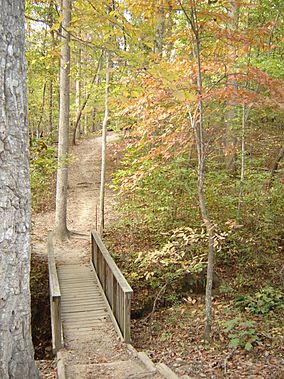
A path through Umstead State Park
|
|
| Location | Wake, North Carolina, United States |
| Area | 5,599 acres (22.66 km2) |
| Established | 1937 |
| Named for | William Bradley Umstead |
| Governing body | North Carolina Division of Parks and Recreation |
| Website | William B. Umstead State Park |
|
Crabtree Creek Recreational Demonstration Area
|
|
| Lua error in Module:Location_map at line 420: attempt to index field 'wikibase' (a nil value). | |
| Architect | J.R. Marks, CCC |
| MPS | Wake County MPS |
| NRHP reference No. | 95000783 |
| Added to NRHP | June 30, 1995 |
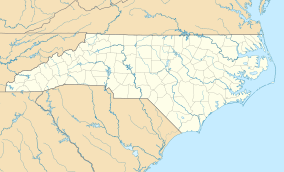
William B. Umstead State Park is a cool state park located in Wake County, North Carolina, USA. It's a huge park, covering about 5,599 acres (22.66 km2) of land. This natural space is nestled between the busy cities of Raleigh, Cary, and Durham, North Carolina.
The park is a great place for outdoor fun. You can enjoy hiking, horseback riding, and biking on its many trails. They also offer boat rentals for the lakes, camping spots, and picnic areas for families. Plus, there are often educational programs to learn more about nature. A part of the East Coast Greenway also runs through the park. This is a super long trail system, about 3,000 miles, connecting Maine all the way to Florida!
Contents
Park History: From Wild Lands to Public Park
Long, long ago, before any settlers arrived, the area that is now William B. Umstead State Park was a wild place. Animals like bison, elk, bobcats, and wolves roamed freely. They lived in thick forests of oak, hickory, and beech trees.
Native American Life and Early Settlements
Later, Native American tribes lived on this land. They created trade routes nearby. Important paths included the Occoneeche trail to the north and the Pee Dee trail to the south. In 1774, new land grants allowed settlers to move into the area.
Farming Challenges and Park Creation
As more people settled, forests were cleared to make way for farms. At first, farming was successful. However, poor farming methods and growing only one type of crop made the soil weak. During a tough time called the Great Depression, farmers tried to grow cotton in the worn-out soil near Crabtree Creek. But it was very difficult.
In 1934, federal and state groups worked together to help. They bought about 5,000 acres (20 km2) of this tired farmland. Their plan was to turn it into a fun recreation area for everyone.
Building the Park: Civilian Conservation Corps
The Civilian Conservation Corps (CCC) and the Works Progress Administration (WPA) played a big part in building the park. These groups provided much-needed jobs during the Depression. They built four camps, along with places for day visits and picnics. The park first opened to the public in 1937.
Becoming William B. Umstead State Park
The state bought this area, then called Crabtree Creek Recreational Demonstration Area, for just $1. More facilities were added as the state government started funding state parks in the 1940s. In 1950, over 1,000 acres (4.0 km2) of the park became a separate area. This section was named Reedy Creek State Park.
A few years later, the Crabtree Creek area was renamed after former Governor William Bradley Umstead. This was to honor his efforts to protect nature. In 1966, the Crabtree Creek and Reedy Creek areas were joined together. They became one big park, William B. Umstead State Park, open for everyone to enjoy.
Historical Remnants and Park Entrances
Before it became a park, the land was used for timber and had several mills along Crabtree Creek. You can still find parts of these old milling operations preserved inside the park today.
Historically, the park had different entrances. The Highway 70 entrance was used by some, and the Reedy Creek entrance by others. Today, the Reedy Creek entrance is often used by North Carolina State University for forestry classes. Many runners in Raleigh also use this quieter entrance. There is no public road connecting the two main entrances within the park. This means cars entering from one side cannot drive through to the other.
Exploring William B. Umstead State Park
Umstead State Park is surrounded by important landmarks. To the west is Raleigh-Durham International Airport. Interstate 40 borders it to the south, and US 70 to the north. The western edge of Raleigh is to the east.
Park Trails and Waterways
- Reedy Creek Road: This is the main trail for horseback riding and biking. It's open to traffic in western Raleigh, connecting the North Carolina Museum of Art to the park entrance. Inside the park, it's closed to regular cars for about 3.5 miles. It then heads south into Cary, where it opens to traffic again. This road also connects to the Black Creek Greenway and Lake Crabtree County Park trails.
- Crabtree Creek: This creek flows through the park. Its source is Lake Crabtree, right at the park's edge. It flows eastward through the southern part of the park. You can find trails along its length.
- Other Trails: Graylyn Road connects the Ebenezer Church entrance to Reedy Creek Road. Turkey Creek Road winds through the northern part of the park. For hikers, popular trails include the Company Mill trail in the south and the Sycamore Trail in the north. Both are loop trails that are moderately challenging. Remember, bikes and horses are not allowed on hiking trails.
Park Entrances and Facilities
The main entrances are at the ends of Reedy Creek Road. There are also two entrances off Ebenezer Church Road in Raleigh. The official Reedy Creek entrance is at the end of Cary's Harrison Avenue. The park's main entrance is at Highway 70 in the north. These main entrances have parking lots, restrooms, and campgrounds. The Highway 70 entrance also has a visitors' center.
Nature and Landscape
Umstead State Park is part of the Southeastern mixed forests ecoregion. This means it has a mix of different tree types. The land is hilly, and there are several man-made lakes. These lakes are common in Wake County. They help control floods in the area.
Piedmont Beech Natural Area: A Special Forest
Inside the park, there's a special place called the Piedmont Beech Natural Area. It covers about 61 acres (0.25 km2) and is a National Natural Landmark. This area protects a unique forest with many different kinds of plants. It also has mature stands of beech trees. This natural area was recognized in 1974. To help protect it, you need a special permit to visit this part of the park.
Nearby State Parks to Explore
If you enjoy Umstead State Park, here are some other state parks not too far away (within 30 miles (48 km)):
 | Claudette Colvin |
 | Myrlie Evers-Williams |
 | Alberta Odell Jones |


