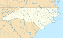
Bermuda Run, North Carolina facts for kids
Quick facts for kids
Bermuda Run, North Carolina
|
|
|---|---|
| Country | United States |
| State | North Carolina |
| County | Davie |
| Area | |
| • Total | 2.56 sq mi (6.64 km2) |
| • Land | 2.50 sq mi (6.46 km2) |
| • Water | 0.07 sq mi (0.18 km2) |
| Elevation | 748 ft (228 m) |
| Population
(2020)
|
|
| • Total | 3,120 |
| • Density | 1,250.50/sq mi (482.77/km2) |
| Time zone | UTC-5 (Eastern (EST)) |
| • Summer (DST) | UTC-4 (EDT) |
| ZIP code |
27006
|
| Area code(s) | 336 |
| FIPS code | 37-05135 |
| GNIS feature ID | 2405248 |
Bermuda Run is a town in Davie County, North Carolina, United States. In 2020, about 3,120 people lived there.
The town was officially created in 1999. It started as a gated community, which means it has controlled entrances. It is close to popular places like the Bermuda Run Country Club and golf courses. In 2000, the town grew by adding a business area from nearby Hillsdale. Bermuda Run is located on the western side of the Yadkin River. Major roads like U.S. Route 158 and North Carolina Highway 801 pass through it. Interstate 40 makes it easy to get to Winston-Salem, the closest big city. In 2012, another area called Kinderton Village joined the town. Locals often see Bermuda Run as a well-off community.
Contents
History of Bermuda Run
A historic place called Win-Mock Farm Dairy was added to the National Register of Historic Places in 2010. This list includes important historical sites.
Where is Bermuda Run?
Bermuda Run is in the northeastern part of Davie County. Across the Yadkin River to the northeast is Clemmons. Clemmons is in Forsyth County.
Interstate 40 has an exit (Exit 180) for Bermuda Run. This highway goes northeast about 13 miles (21 km) to Winston-Salem. It goes southwest about 31 miles (50 km) to Statesville. Mocksville, the main town in Davie County, is 11 miles (18 km) southwest. You can get there using US 158.
The United States Census Bureau says Bermuda Run covers about 4.4 square kilometers (1.7 sq mi). Most of this area, about 4.3 square kilometers (1.6 sq mi), is land. The remaining 0.1 square kilometers (0.04 sq mi) is water.
People in Bermuda Run
| Historical population | |||
|---|---|---|---|
| Census | Pop. | %± | |
| 2000 | 1,431 | — | |
| 2010 | 1,725 | 20.5% | |
| 2020 | 3,120 | 80.9% | |
| U.S. Decennial Census | |||
2020 Census Information
The table below shows the different groups of people living in Bermuda Run in 2020.
| Group | Number of People | Percentage |
|---|---|---|
| White (not Hispanic) | 2,728 | 87.44% |
| Black or African American (not Hispanic) | 118 | 3.78% |
| Native American | 7 | 0.22% |
| Asian | 69 | 2.21% |
| Other/Mixed | 90 | 2.88% |
| Hispanic or Latino | 108 | 3.46% |
According to the 2020 United States census, there were 3,120 people living in Bermuda Run. There were 1,128 households and 710 families in the town.
See also

- In Spanish: Bermuda Run para niños
 | Chris Smalls |
 | Fred Hampton |
 | Ralph Abernathy |


