
McDowell County, North Carolina facts for kids
Quick facts for kids
McDowell County
|
|||
|---|---|---|---|

McDowell County Courthouse in Marion
|
|||
|
|||

Location within the U.S. state of North Carolina
|
|||
 North Carolina's location within the U.S. |
|||
| Country | |||
| State | |||
| Founded | 1842 | ||
| Named for | Joseph McDowell | ||
| Seat | Marion | ||
| Largest community | Marion | ||
| Area | |||
| • Total | 445.35 sq mi (1,153.5 km2) | ||
| • Land | 439.95 sq mi (1,139.5 km2) | ||
| • Water | 5.40 sq mi (14.0 km2) 1.21% | ||
| Population
(2020)
|
|||
| • Total | 44,578 | ||
| • Estimate
(2023)
|
44,893 | ||
| • Density | 101.33/sq mi (39.12/km2) | ||
| Time zone | UTC−5 (Eastern) | ||
| • Summer (DST) | UTC−4 (EDT) | ||
| Congressional district | 11th | ||


McDowell County is a county in the state of North Carolina. In 2020, about 44,578 people lived here. The main town, or county seat, is Marion. This county is part of a larger area around Charlotte, North Carolina.
Contents
A Look Back: History of McDowell County
Early People and Explorers
Long ago, from about 250 to 1500 AD, early people lived in what is now McDowell County. Scientists found old tools and signs of their homes near the Catawba River. The Cherokee and Catawba Native American tribes lived here for many centuries.
In 1566, a Spanish explorer named Juan Pardo traveled through this area. He was looking for new lands for Spain. He also hoped to find valuable metals like silver. Pardo and his men built a small fort called Fort San Juan. It was near a Native American village called Joara.
The Spanish built five more forts in the area. But in 1568, the Native Americans attacked. They killed most of the soldiers and burned all six forts. After this, Spain stopped trying to settle this part of the country.
Settlers and Important Families
In 1748, a man named John McDowell received a large piece of land. This land is now known as Pleasant Gardens. He settled there with his family. John McDowell helped with important meetings between settlers and the Cherokee people.
His son, Joseph McDowell, was a hero in the American Revolutionary War. He fought in the Battle of Kings Mountain. McDowell County is named after him! His old home is still standing today.
The area also had an early settlement called Old Fort. It was one of the farthest western outposts for the colonists. Pioneers built a series of forts to protect their community.
In 1793, Colonel John Carson built a large house. It is known as the historic Carson House. He also owned gold mines in the southern part of the county.

How Marion Became the County Seat
The town of Marion is the county seat of McDowell County. It was planned in 1844. The county leaders met at the Carson House to choose the land. In 1845, Marion officially became the county seat. It was named after Francis Marion, a Revolutionary War hero. He was known as the "Swamp Fox."
Movies have even been filmed in the area! The movie The Last of the Mohicans (1992) was filmed near Lake James.
Gold Rush and County Formation
In the early 1800s, McDowell County was famous for its gold. This was during the Carolina Gold Rush. Places like Muddy Creek and Vein Mountain had a lot of gold. Many old gold mines and towns like Brackettown are now just ruins.
McDowell County was created in 1842. It was formed from parts of Burke County and Rutherford County. It was named for Joseph McDowell, a leader in the Revolutionary War. He also served in the U.S. House of Representatives.
In 1861, parts of McDowell and other nearby counties were used to form Mitchell County. McDowell County has a rich history from the American Civil War.
Exploring McDowell County's Geography
McDowell County covers about 445 square miles. Most of this is land, with about 5 square miles of water.
Rivers, Waterfalls, and Caves
Many small creeks and streams flow through the county. The Catawba River starts here and flows into Lake James. You can see Catawba Falls on the river, which is open to visitors. Other beautiful waterfalls like Toms Creek Falls are also in the county.
Almost half of McDowell County is inside the Pisgah National Forest. This is a large protected area. Linville Caverns is North Carolina's only public limestone cave system. It is located in the northern part of the county.
Mountains and Elevations
McDowell County is in the southern Appalachian Mountains. The Blue Ridge Parkway runs along the county's northwestern edge. The land rises quickly from the eastern side, which is part of the Piedmont (United States). Elevations here are about 1,200 feet above sea level.
To the north and west, the land rises into the Blue Ridge Mountains. The lowest point in the county is 969 feet above sea level. The highest point is Pinnacle, at 5,665 feet. Pinnacle is the second-highest mountain in the Blue Ridge. It is also part of the Black Mountains, which are the highest mountains in eastern America.
Protected Areas and Water Bodies
McDowell County has several important protected areas:
- Blue Ridge Parkway (part)
- Crabtree Falls (part)
- Linville Gorge Wilderness (part)
- Pisgah National Forest (part)
- Lake James State Park (part)
- Mountain Gateway Museum and Heritage Center
Major rivers and creeks in the county include:
- Catawba River
- Lake James
- Lake Tahoma
- Broad River
- Buck Creek
- Toms Creek
Neighboring Counties and Main Roads
McDowell County shares borders with these counties:
- Mitchell County – north
- Avery County – north
- Burke County – east
- Rutherford County – south
- Buncombe County – west
- Yancey County – northwest
Major highways that cross McDowell County include:
 I-40
I-40 US 64
US 64 US 70
US 70 US 221
People of McDowell County: Demographics
| Historical population | |||
|---|---|---|---|
| Census | Pop. | %± | |
| 1850 | 6,246 | — | |
| 1860 | 7,120 | 14.0% | |
| 1870 | 7,592 | 6.6% | |
| 1880 | 9,836 | 29.6% | |
| 1890 | 10,939 | 11.2% | |
| 1900 | 12,567 | 14.9% | |
| 1910 | 13,538 | 7.7% | |
| 1920 | 16,763 | 23.8% | |
| 1930 | 20,336 | 21.3% | |
| 1940 | 22,996 | 13.1% | |
| 1950 | 25,720 | 11.8% | |
| 1960 | 26,742 | 4.0% | |
| 1970 | 30,648 | 14.6% | |
| 1980 | 35,135 | 14.6% | |
| 1990 | 35,681 | 1.6% | |
| 2000 | 42,151 | 18.1% | |
| 2010 | 44,996 | 6.7% | |
| 2020 | 44,578 | −0.9% | |
| 2023 (est.) | 44,893 | −0.2% | |
| U.S. Decennial Census 1790–1960 1900–1990 1990–2000 2010 2020 |
|||
In 2020, there were 44,578 people living in McDowell County. There were over 18,000 households. Most people in the county are White (84.77%). Other groups include Black or African American (3.83%) and Hispanic or Latino (6.61%).
Learning in McDowell County: Education

McDowell County has many schools for students of all ages.
Elementary Schools
- Marion Elementary School
- West Marion Elementary School
- Nebo Elementary School
- Old Fort Elementary School
- Pleasant Gardens Elementary School
- Eastfield Global Magnet School
- Glenwood Elementary School
- North Cove Elementary School
Middle Schools
- West McDowell Middle School
- East McDowell Middle School
High Schools
- Foothills Community School
- McDowell High School
- McDowell Early College High School
- McDowell Academy for Innovation
- Phoenix Academy
- New Manna Christian School
- Nebo Crossing Christian Academy
Community College
- McDowell Technical Community College is a local college for higher education.
Towns and Communities

McDowell County has one main city and one town. It also has many smaller communities.
City
- Marion (This is the county seat and the largest community.)
Town
Other Communities
- Glenwood
- Nebo
- West Marion
- Linville Falls
- Little Switzerland
- North Cove
Images for kids
-
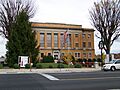
McDowell County Courthouse in Marion
-
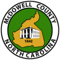
Seal of McDowell County
-
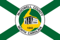
Flag of McDowell County
See also
 In Spanish: Condado de McDowell (Carolina del Norte) para niños
