
Yancey County, North Carolina facts for kids
Quick facts for kids
Yancey County
|
||
|---|---|---|

Yancey County Courthouse
|
||
|
||

Location within the U.S. state of North Carolina
|
||
 North Carolina's location within the U.S. |
||
| Country | ||
| State | ||
| Founded | 1833 | |
| Named for | Bartlett Yancey | |
| Seat | Burnsville | |
| Largest community | Burnsville | |
| Area | ||
| • Total | 313.18 sq mi (811.1 km2) | |
| • Land | 312.59 sq mi (809.6 km2) | |
| • Water | 0.59 sq mi (1.5 km2) 0.19% | |
| Population
(2020)
|
||
| • Total | 18,470 | |
| • Estimate
(2023)
|
18,938 | |
| • Density | 59.09/sq mi (22.81/km2) | |
| Time zone | UTC−5 (Eastern) | |
| • Summer (DST) | UTC−4 (EDT) | |
| Congressional district | 11th | |

Yancey County is a county in North Carolina, a state in the United States. In 2020, about 18,470 people lived there. The main town and county seat is Burnsville.
Contents
History of Yancey County
Before Europeans settled, the Cherokee people lived in the area that is now Yancey County. This was true for much of the southern Appalachian Mountains.
Early Settlers and Land
By the mid-1700s, brave settlers from Scotland, England, and Scotch-Irish backgrounds moved across the Blue Ridge Mountains. They settled in the Toe River Valley. In 1796, a man named John Gray Blount bought a very large piece of land. Part of this land later became Yancey County.
How Yancey County Was Formed
In December 1833, the government of North Carolina created a new county in the western part of the state. They named it Yancey County. It was made from parts of Burke and Buncombe counties.
The county was named after Bartlett Yancey. He was an important leader from Caswell County. He served in the U.S. Congress and as Speaker of the North Carolina Senate. He helped create a fund for education, which was the start of North Carolina's public school system. He also wanted to make sure western counties had fair representation in the government. Sadly, he passed away in 1828, before the county was named in his honor.
Yancey County is home to Mount Mitchell. This is the highest mountain in the eastern United States. It stands at 6,684 feet (2,037 meters) above sea level.
The Founding of Burnsville
On March 6, 1834, a man nicknamed "Yellow Jacket" John Bailey gave 100 acres (0.40 square kilometers) of land for the county seat. He got his nickname because of his strong temper.
The town was named Burnsville to honor Captain Otway Burns. He was a naval hero during the War of 1812. He also voted to create the new western county when he was in the General Assembly.
A statue of Captain Burns stands in the middle of the town's public square. This square is officially called "Bailey Square." Walter Francis Burns, Captain Burns' grandson, gave the statue to the county in 1909. The words on the statue honor Captain Burns as a "Sailor - Soldier - Statesman" and a hero of the War of 1812.
Geography of Yancey County
Yancey County covers about 313.18 square miles (811.13 square kilometers). Most of this is land, with a small amount of water.
Highest Peaks and Mountains
Mount Mitchell is located in Yancey County. It is the highest point in the United States east of the Mississippi River. It is 6,684 feet (2,037 meters) tall.
The Black Mountains are a mountain range that includes Mount Mitchell. This range has five of the ten highest peaks east of the Mississippi River. All of them are over 6,400 feet (1,951 meters) high. These peaks are:
- Mount Mitchell
- Mount Craig
- Balsam Cone
- Mount Gibbes
- Potato Hill
Protected Natural Areas
Yancey County has several important natural areas:
- Blue Ridge Parkway (a scenic road)
- Crabtree Falls
- Pisgah National Forest
Local Parks and Sites
The county also has local protected areas and sites, such as:
- Bare Dark Sky Observatory
- Carolina Hemlocks Recreation Area
- John Wesley McElroy House
- Mount Mitchell State Park
- Nu-Wray Inn
- Ray-Cort Recreation Park
Rivers and Creeks
Important water bodies in Yancey County include:
- Big Crabtree Creek
- Big Creek
- Bowlens Creek
- Cane River
- Nolichucky River
- South Toe River
Neighboring Counties
Yancey County shares borders with these counties:
- Mitchell County (to the northeast)
- McDowell County (to the southeast)
- Buncombe County (to the southwest)
- Madison County (to the west)
- Unicoi County, Tennessee (to the northwest)
Main Roads
Major highways that pass through Yancey County include:
 US 19
US 19 US 19E
 US 19W
 NC 80
NC 80 NC 128
 NC 197
People of Yancey County
Population Changes Over Time
| Historical population | |||
|---|---|---|---|
| Census | Pop. | %± | |
| 1840 | 5,962 | — | |
| 1850 | 8,205 | 37.6% | |
| 1860 | 8,655 | 5.5% | |
| 1870 | 5,909 | −31.7% | |
| 1880 | 7,694 | 30.2% | |
| 1890 | 9,490 | 23.3% | |
| 1900 | 11,464 | 20.8% | |
| 1910 | 12,072 | 5.3% | |
| 1920 | 15,093 | 25.0% | |
| 1930 | 14,486 | −4.0% | |
| 1940 | 17,202 | 18.7% | |
| 1950 | 16,306 | −5.2% | |
| 1960 | 14,008 | −14.1% | |
| 1970 | 12,629 | −9.8% | |
| 1980 | 14,934 | 18.3% | |
| 1990 | 15,419 | 3.2% | |
| 2000 | 17,774 | 15.3% | |
| 2010 | 17,818 | 0.2% | |
| 2020 | 18,470 | 3.7% | |
| 2023 (est.) | 18,938 | 6.3% | |
| U.S. Decennial Census 1790–1960 1900–1990 1990–2000 2010 2020 |
|||
In 2020, the census showed that 18,470 people lived in Yancey County. There were 7,510 households and 5,081 families.
Ancestry and Backgrounds
Many people in Yancey County have roots from different parts of the world. In 2015, the largest groups of people reported their ancestry as:
Education in Yancey County
The Yancey County Schools system provides public education for students from kindergarten to 12th grade. A School Board with five members oversees the schools.
In 2016, the School Board decided to combine three elementary schools into one new school called Blue Ridge Elementary. This helped make school resources more efficient.
Schools in Yancey County
Yancey County currently has these schools:
Elementary Schools (Grades K–5)
- Blue Ridge Elementary School
- Burnsville Elementary School
- Micaville Elementary School
- South Toe Elementary School
Middle Schools (Grades 6–8)
- Cane River Middle School
- East Yancey Middle School
High School (Grades 9–12)
- Mountain Heritage High School
High school students can also choose to attend Mayland Early College High School. This school is located at Mayland Community College in Spruce Pine.
There are also two private schools in the county: Arthur Morgan School in Celo and Yancey County Christian School in Burnsville.
Higher Education Opportunities
Mayland Community College serves Yancey and nearby counties. Its main campus is in Spruce Pine. Yancey County also has a satellite campus, the Yancey Learning Center, near Burnsville.
Library Services
The Avery-Mitchell-Yancey Regional Library (AMY) system serves Yancey County. The local branch, the Yancey County Public Library, is in Burnsville. It is located in the Yancey Collegiate Institute Historic District.
Communities in Yancey County

Town
- Burnsville (This is the county seat and the largest community.)
Townships
- Brush Creek
- Burnsville
- Cane River
- Crabtree
- Egypt
- Green Mountain
- Jacks Creek
- Pensacola
- Price's Creek
- Ramseytown
- South Toe
Unincorporated Communities
These are smaller communities that are not officially towns:
- Bald Creek
- Bent Creek
- Busick
- Cane River
- Celo
- Day Book
- Green Mountain
- Hamrick
- Micaville
- Murchison
- Newdale
- Pensacola
- Ramseytown
- Sioux
- Swiss
- Windom
Images for kids
-
Seal of Yancey County
-
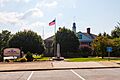
The Yancey County Courthouse
See also
 In Spanish: Condado de Yancey para niños
