
Burnsville, North Carolina facts for kids
Quick facts for kids
Burnsville, North Carolina
|
||
|---|---|---|

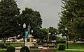
Burnsville Town Square
|
||
|
||

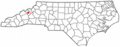
Location of Burnsville, North Carolina
|
||
| Country | United States | |
| State | North Carolina | |
| County | Yancey | |
| Area | ||
| • Total | 1.60 sq mi (4.14 km2) | |
| • Land | 1.60 sq mi (4.14 km2) | |
| • Water | 0.00 sq mi (0.00 km2) | |
| Elevation | 2,749 ft (838 m) | |
| Population
(2020)
|
||
| • Total | 1,614 | |
| • Density | 1,008.75/sq mi (389.40/km2) | |
| Time zone | UTC-5 (Eastern (EST)) | |
| • Summer (DST) | UTC-4 (EDT) | |
| ZIP code |
28714
|
|
| Area code(s) | 828 | |
| FIPS code | 37-09140 | |
| GNIS feature ID | 2405350 | |
Burnsville is a small town in North Carolina, United States. It is the main town, or county seat, of Yancey County. Burnsville is nestled in the beautiful Blue Ridge Mountains of western North Carolina. It sits close to Mount Mitchell, which is the tallest mountain in the eastern United States. In 2020, about 1,614 people lived there.
Contents
History of Burnsville
How Burnsville Got Its Name
The town of Burnsville was started on March 6, 1834. It was built on land bought from John "Yellow Jacket" Bailey. The town was named after Captain Otway Burns. He was a brave naval hero during the War of 1812.
In 1909, Captain Burns' grandson, Walter Francis Burns Sr., gave a statue of his grandfather to the town. This statue was placed on a granite stand in the middle of the town square. Part of the message on the statue says, "He Guarded Well Our Seas, Let Our Mountains Honor Him." The first statue was replaced in the early 2000s because it had been damaged.
Recent Events in Burnsville
In September 2024, Burnsville and the areas around it were greatly affected by Hurricane Helene. This hurricane caused many landslides. It led to a lot of damage to homes and roads in Yancey, Mitchell, and Avery Counties. Officials said that the damage and repair costs were very high.
Historic Places in Burnsville
Burnsville has several old and important buildings. Many of these are listed on the National Register of Historic Places. This means they are special places that are protected for their history.
The Nu-Wray Inn
One of the oldest buildings is the Nu-Wray Inn. It was built in 1833. For a long time, it has been used as a hotel.
The Parkway Playhouse
The Parkway Playhouse is also in Burnsville. It is the oldest summer theater company in North Carolina that has been running without stopping. It started in 1947. A drama professor named W. R. Taylor and local leaders helped create it.
Other Historic Buildings
Other important buildings in Burnsville include:
- The Bald Creek Historic District
- The Chase-Coletta House
- The Citizens Bank Building
- The John Wesley McElroy House
- The Yancey Collegiate Institute Historic District
- The Yancey County Courthouse
Annual Mt. Mitchell Crafts Fair

Burnsville hosts the annual Mt. Mitchell Craft Fair. This popular event started in 1956. It brings in thousands of visitors and over 200 sellers and performers. The fair is famous for its local and visiting artists. They show off their amazing handmade arts and crafts.
The Burnsville-Yancey Chamber of Commerce helps organize this fair. It happens on the first Friday and Saturday in August. You can enjoy bluegrass music, tasty food, and unique handmade items. It's a great way to experience mountain traditions and art.
Geography of Burnsville
Burnsville is located in the mountains of western North Carolina. It sits about 2,825 feet above sea level. The town is on a small stream that flows into the Cane River. It is just north of the Black Mountains. Burnsville is about 30 miles northeast of Asheville.
U.S. Highway 19E goes through the town. This highway connects Burnsville to Interstate 26 and Mars Hill to the west. To the east, it leads to Spruce Pine. The town covers an area of about 1.6 square miles, and all of it is land.
Population of Burnsville
| Historical population | |||
|---|---|---|---|
| Census | Pop. | %± | |
| 1900 | 207 | — | |
| 1910 | 422 | 103.9% | |
| 1930 | 866 | — | |
| 1940 | 997 | 15.1% | |
| 1950 | 1,341 | 34.5% | |
| 1960 | 1,388 | 3.5% | |
| 1970 | 1,348 | −2.9% | |
| 1980 | 1,452 | 7.7% | |
| 1990 | 1,482 | 2.1% | |
| 2000 | 1,623 | 9.5% | |
| 2010 | 1,693 | 4.3% | |
| 2020 | 1,614 | −4.7% | |
| U.S. Decennial Census | |||
In 2020, Burnsville had a population of 1,614 people. Most of the people living in Burnsville are White (about 85%). There are also smaller groups of Black or African American, Native American, Asian, and Pacific Islander residents. About 8.7% of the population is Hispanic or Latino.
Education in Burnsville
Students in Burnsville are served by the Yancey County Schools System.
- Mountain Heritage High School is the public high school for Yancey County. It is located just outside the town.
- A campus of Mayland Community College is also nearby.
- Cane River Middle School is to the west of town.
- Blue Ridge Elementary School opened in 2019, also west of town.
- Burnsville Elementary School and East Yancey Middle School are located to the east of the town limits.
Economy of Burnsville
Burnsville has a few important employers.
- Altec is a manufacturing company in the town.
- Glen Raven is another manufacturing company. It is the only textile factory still working in the county.
In the past, Burnsville had more textile mills. Avondale Mills and Glen Raven, Inc. both had factories here. However, the Avondale Mills factory closed in 2004. A blue jeans factory in Micaville also closed that year.
Fun Places to Visit
- The Nu-Wray Inn has been a hotel since it was built in 1833.
- The Parkway Playhouse started in 1947. It is one of North Carolina's oldest theaters that is still running.
- The John Wesley McElroy House was built around the 1830s. Today, it is a museum.
- Mt. Mitchell is the tallest mountain east of the Mississippi River. It is located close by in southern Yancey County.
- The Mayland Earth to Sky Park offers amazing views of the night sky. It has an observatory and planetarium shows.
Images for kids
-
Burnsville Town Square
-
Location of Burnsville, North Carolina
See also
 In Spanish: Burnsville (Carolina del Norte) para niños
