Mount Mitchell State Park facts for kids
Quick facts for kids Mount Mitchell State Park |
|
|---|---|
|
IUCN Category III (Natural Monument)
|
|

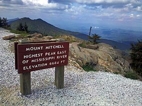
A view from the summit of Mount Mitchell
|
|
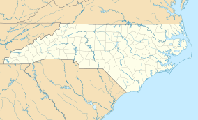
| Location | Yancey, North Carolina, United States |
| Area | 4,789 acres (19.38 km2) |
| Elevation | 6,366 ft (1,940 m) |
| Established | 1915 |
| Named for | Mount Mitchell |
| Governing body | North Carolina Division of Parks and Recreation |
| Website | Mount Mitchell State Park |
| Designated: | 1974 |
Mount Mitchell State Park is a huge North Carolina state park covering 4,789-acre (1,938 ha). It is located in Yancey County, North Carolina, in the United States. This park was created in 1915 by the state government. It was the very first state park in North Carolina. This also started the whole North Carolina State Parks System.
The park is at the end of NC 128. This road branches off the famous Blue Ridge Parkway near Burnsville, North Carolina. The park is home to Mount Mitchell itself. This mountain is the highest peak east of the Mississippi River!
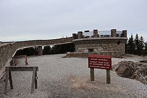
From the parking lot, a paved path leads visitors to the top. There, you'll find an observation platform with amazing 360-degree views. The grave of Elisha Mitchell is at the base of this platform. He was the professor who first figured out the mountain's height. The old observation tower was taken down in 2006. A new, improved observation platform opened in January 2009.
Contents
What to See and Do at Mount Mitchell
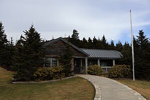
At the summit, there's an exhibit hall that opens during certain seasons. It teaches you about the mountain's nature, history, and culture. The park also has a restaurant and small tent camping spots, open seasonally. These buildings were built in the 1950s and have been updated.
Most people visit between May and November. This is because the main road to the park, the Blue Ridge Parkway, can close in bad weather. Park staff work all year, but it can be hard to reach the park during winter storms. In 2017, about 398,000 people visited the park.
Exploring Other High Peaks
Mount Mitchell State Park isn't just about Mount Mitchell. It also has several other tall peaks. These mountains are all over 6,000 feet (1,800 m) high! Some of them include Mount Hallback, Mount Craig, Big Tom, and Balsam Cone. Mount Craig is the second highest peak east of the Mississippi River. It's only 52 feet (16 m) shorter than Mount Mitchell.
Trails lead to most of these other summits, except Mount Hallback. Exploring these trails lets you get away from the crowds on Mount Mitchell. You'll find equally amazing views and peaceful spots. The park has about 8 miles (13 km) of trails in total.
Discovering Camp Alice
Another cool place you can reach by trail is Camp Alice. It's about 5,800 feet (1,800 m) high, south of Mount Mitchell's summit. This historic spot was once a logging camp. Later, it became a tourist camp. A stream called Lower Creek flows across the main trail here. It's one of the highest streams in the Appalachian Mountains. The forest openings here, surrounded by evergreen trees, look like places found in much higher mountain ranges.
Special Events and Challenges
Mount Mitchell State Park is also famous for some tough races. It's the finish line for a bike race called The Assault on Mount Mitchell. It's also the halfway point for an ultra-marathon called the Mount Mitchell Challenge.
Park Closures and Repairs
The park was closed starting September 26, 2024. This happened because of Hurricane Helene. The hurricane caused a lot of damage to parts of the Blue Ridge Parkway nearby. Because of this, the park will stay closed until all the repairs are finished.
Nearby Parks to Explore
Here are some other state parks and forests close to Mount Mitchell State Park (within 30 miles (48 km)):
- Chimney Rock State Park
- Grandfather Mountain State Park
- Lake James State Park
- Lamar Alexander Rocky Fork State Park, Tennessee
- Pisgah View State Park
- Roan Mountain State Park, Tennessee
- South Mountains State Park
See also
 | George Robert Carruthers |
 | Patricia Bath |
 | Jan Ernst Matzeliger |
 | Alexander Miles |


