Nolichucky River facts for kids
Quick facts for kids Nolichucky River |
|
|---|---|
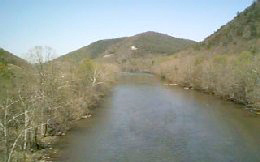
The Nolichucky River at Embreeville, Tennessee
|
|
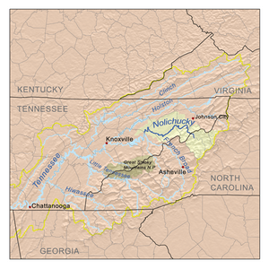
Nolichucky watershed
|
|
| Country | United States |
| State | North Carolina, Tennessee |
| Physical characteristics | |
| Main source | North Toe River Avery County, North Carolina 4,350 ft (1,330 m) 35°15′57″N 81°53′13″W / 35.26583°N 81.88694°W |
| 2nd source | Cane River Yancey County, North Carolina 3,553 ft (1,083 m) 35°45′55″N 82°18′33″W / 35.76528°N 82.30917°W |
| River mouth | French Broad River Cocke County/Hamblen County line, Tennessee 1,001 ft (305 m) 36°04′55″N 83°13′45″W / 36.08194°N 83.22917°W |
| Length | 115 mi (185 km) |
| Basin features | |
| Progression | Nolichucky → French Broad → Tennessee → Ohio → Mississippi → Gulf of Mexico |
| Basin size | 1,744 sq mi (4,520 km2) |
The Nolichucky River is a 115-mile (185 km) long river. It flows through Western North Carolina and East Tennessee in the southeastern United States. This river winds through the Pisgah National Forest and the Cherokee National Forest. These forests are found in the Blue Ridge Mountains. The area around the river, called its watershed, has some of the tallest mountains in the Appalachians. This includes Mount Mitchell in North Carolina, which is the highest point in the eastern United States. The Nolichucky River flows into the French Broad River. It is also held back by the Nolichucky Dam near Greeneville, Tennessee.
Contents
Where Does the Nolichucky River Start?
The Nolichucky River begins where two other rivers meet. These are the North Toe River and the Cane River. This meeting point is near a place called Huntdale, North Carolina. The river then forms the border between Yancey County and Mitchell County, North Carolina.
The River's Journey Through Mountains
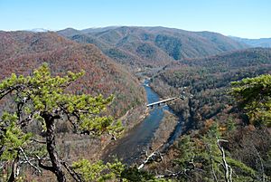
The Nolichucky River generally flows west. It runs along the northern side of Flattop Mountain. The river's path through the mountains is very steep, especially on its north side. The rocks in this area are mostly very old metamorphic rock.
The river then enters Unicoi County, Tennessee. Here, it flows through a whitewater gorge. This gorge is between the Bald Mountains to the south and the Unaka Mountains to the north. The river turns northwest and goes under the Appalachian Trail. Soon after, it passes under U.S. Highway 19W southwest of Erwin, Tennessee. Near Erwin, two smaller streams, South Indian Creek and North Indian Creek, join the Nolichucky.
The river then turns more to the north. It runs alongside State Route 81 for several miles. It then crosses into Washington County. In this area, the river cuts between mountains like Rich Mountain and Buffalo Mountain.
Entering the Ridge and Valley Region
After entering Washington County, the river makes a big curve near Embreeville, Tennessee. Here, it goes under Tennessee 81 and Tennessee 107. The river then comes out of a large water gap at the end of Embreeville Mountain. It turns west-southwest and goes under Tennessee 81 again.
At this point, the Nolichucky River leaves the Blue Ridge Mountains. It enters the Ridge and Valley area. This region has mostly sedimentary rock from a very old time period called the Lower Paleozoic Era. The river continues west-southwest for several miles, with State Route 107 nearby.
The river leaves the road near Mt. Carmel. From there, it flows northwest in a winding path to Davy Crockett Birthplace State Park. This park is near the border of Washington County and Greene County. Many smaller creeks join the river in Washington and Greene Counties. A larger creek, Big Limestone Creek, joins the river at the county line. State Route 351 crosses the river west of Crockett's birthplace.
The Nolichucky Dam and Its Purpose
From Crockett's birthplace, the river flows southwest. It follows the natural curves of the Ridge and Valley area. Tennessee 107 crosses the river again just east of Tusculum. The river continues southwest and then goes under State Route 350. This is just above a lake created by the Nolichucky Dam.
This dam was built in 1912 to make electricity from water power. It was built by the Tennessee Electric Power Company. In 1939, the dam was sold to the Tennessee Valley Authority (TVA). The TVA kept using the dam for power until the 1970s. Over time, too much siltation (dirt and sand) built up in the lake, called Davy Crockett Lake. This made it hard to keep using the dam for electricity.
The TVA stopped using the dam for power. However, they still take care of it. They use it to help control floods and for fun activities like boating. Just west of the dam, the river crosses State Route 70 and State Route 107 one last time.
The River's End Point
The Nolichucky River continues almost directly west. It goes under U.S. Highway 321. Just before reaching the border of Greene County and Cocke County, the river goes under State Route 340. After this, the river becomes the border between Greene County and Cocke County.
A few miles downstream, Knob Creek Road, a Cocke County road, crosses the river. South of Interstate 81, the counties of Greene, Cocke, and Hamblen meet at a bend in the river. Here, Lick Creek joins the Nolichucky. From this point on, the river forms the border between Hamblen County and Cocke County.
The Nolichucky River finally meets the French Broad River. This happens in the upper part of Douglas Lake. Douglas Lake is a large lake created by the Douglas Dam. This dam was built by the TVA during World War II. The mouth of the Nolichucky River is near where Hamblen, Cocke, and Jefferson County meet. Near its mouth is the Rankin Wildlife Management Area. This is a special place for wildlife run by the Tennessee Wildlife Resources Agency.
History of the Nolichucky River
The name "Nolichucky" has been discussed for a long time. It is thought to come from a Cherokee village name, Na’na-tlu gun’yi. This means "Spruce-Tree Place." The village was once near modern Jonesborough, Tennessee. Some local stories say the name means "Rushing Water," "Dangerous Water," or "Black Swirling Water."
In the 1770s, European settlers created "Nolichucky settlements" along the river. This was in what is now Greene County, Tennessee. At that time, it was part of Cherokee land. These settlements were connected to the Watauga settlements. As fighting grew between the settlers and a group of Cherokee called the "Chickamaugas," John Sevier became important. He was a young militia officer. He started building Fort Lee.
In July 1776, the Chickamauga leader Dragging Canoe attacked. Sevier left the unfinished fort and went to the Watauga settlements. John Sevier later became known as "Nolichucky Jack" or "Chucky Jack." This nickname came from his brave actions along the river.
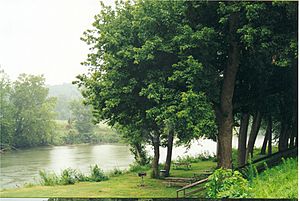
The famous frontiersman Davy Crockett was born along the river in 1786. This was near Limestone, Tennessee. Today, this spot is part of Davy Crockett Birthplace State Park.
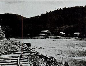
Around the year 1900, trains started running along the river. The Clinchfield Railroad (now CSX) carried people until 1955. It mostly carried coal. This railroad still runs alongside the river through the gorge. It crosses the river at Unaka Springs (Erwin, Tennessee) and Poplar, North Carolina. There is even a sunken train car at the bottom of the river. It is near the entrance to the Lost Cove Settlement. This was a ghost town from the Civil War era.
Whitewater Rafting Adventures
The Nolichucky River Gorge offers an exciting whitewater trip. This section is between Poplar, North Carolina, and Unaka Springs, Tennessee. It is known for its beautiful views and challenging rapids. The river's water levels can change quickly, making each trip unique.
The Nolichucky River is a popular place for whitewater rafting and canoeing. It has parts with fast rapids and parts with calm water. When it rains a lot upstream around Mount Mitchell, the rapids become even more impressive. Heavy rain can make the water extremely high and some routes too dangerous to use.
Sometimes, there isn't enough rain during the summer. This makes the rapids harder to navigate. The lower water levels reveal many rocks and features that are usually hidden. These can be new challenges for rafters.
If there are long periods of dry weather, rafting trips might not be safe or even possible. When this happens, local rafting companies in Unicoi County sometimes take people to the Watauga River. This river runs through Elizabethton, Tennessee in Carter County. The Tennessee Valley Authority (TVA) controls the flow of the Watauga River. They release water from the Watauga Dam and the Wilbur Dam on a regular schedule. This helps rafting companies have enough water during the summer.
See also
 In Spanish: Río Nolichucky para niños
 | Audre Lorde |
 | John Berry Meachum |
 | Ferdinand Lee Barnett |


