Morrisville, North Carolina facts for kids
Quick facts for kids
Morrisville, North Carolina
|
|||
|---|---|---|---|
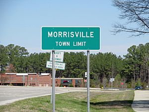
Morrisville town limit sign
|
|||
|
|||
| Motto(s):
"Live Connected. Live Well."
|
|||
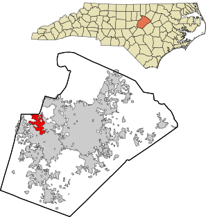
Location in Wake County and the state of North Carolina.
|
|||
| Country | United States | ||
| State | North Carolina | ||
| Counties | Wake, Durham | ||
| Area | |||
| • Total | 8.89 sq mi (23.02 km2) | ||
| • Land | 8.83 sq mi (22.86 km2) | ||
| • Water | 0.06 sq mi (0.16 km2) | ||
| Elevation | 299 ft (91 m) | ||
| Population
(2020)
|
|||
| • Total | 29,630 | ||
| • Density | 3,356.75/sq mi (1,296.00/km2) | ||
| Time zone | UTC−5 (Eastern (EST)) | ||
| • Summer (DST) | UTC−4 (EDT) | ||
| ZIP codes |
27519, 27560
|
||
| Area code(s) | 919 & 984 | ||
| FIPS code | 37-44520 | ||
| GNIS feature ID | 2406198 | ||
Morrisville is a town mostly in Wake County, North Carolina, United States. A small part of it is in Durham County. In 2020, about 29,630 people lived there. Morrisville is in the Research Triangle area. This area is between the cities of Raleigh and Durham. The main office for the company Lenovo is in Morrisville.
Contents
History
The town of Morrisville got its name in 1852. It was named after Jeremiah Morris. He gave land to the North Carolina Railroad. This land was used for a train station and other buildings. The town grew because of the railroad. It was also located where roads to Chapel Hill, Raleigh, and Hillsborough met.
On April 13, 1865, a battle happened in Morrisville. United States soldiers fought against Confederate soldiers. The Confederates were trying to move their supplies and wounded soldiers. They managed to send their wounded soldiers away. But they had to leave their train behind. This fight was part of a larger campaign. It led to a big surrender of Confederate forces later.
Morrisville officially became a town in 1875. It stopped being a town in 1933. But its town status was given back in 1947.
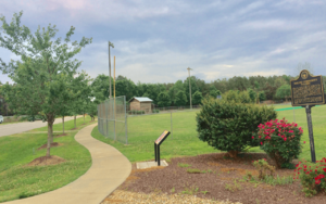
A historical marker in Morrisville shares more about its past: "On April 16, 1865, Union soldiers captured Raleigh. They chased the Confederate soldiers west along the railroad. Small fights happened until they reached Morrisville. Union forces attacked a Confederate train. This train was full of supplies and wounded soldiers. The Confederate soldiers fought back. They held off the attack long enough. This allowed the cars with wounded soldiers to escape. But they had to leave the supplies behind. This was the last big cavalry fight in that campaign. The next night, a message came to the Union camp in Morrisville. It was a proposal for peace. Talks between the generals led to the largest Confederate surrender. This happened at the Bennett Farm in Durham on April 26."
Sadly, on December 13, 1994, a plane crash happened in Morrisville. It was Flagship Airlines Flight 3379. This accident sadly resulted in the loss of 15 lives.
Geography
Morrisville is about 8.89 square miles (23.02 square kilometers) in total. Most of this area is land. Only a small part is water.
The town is in the central part of North Carolina. This area is where the Piedmont and Atlantic Coastal Plain regions meet. This meeting point is called the "Fall Line." It's where rivers start to have waterfalls. So, Morrisville has gentle rolling hills. These hills slope east towards the flat coastal plain. From Morrisville, you can drive to Atlantic Beach in about three hours. The Great Smoky Mountains are about four hours away.
The main part of Morrisville is along Crabtree Creek. This creek flows into Lake Crabtree. Lake Crabtree is in the southeastern part of the town.
Climate
Morrisville has a mild subtropical climate. Spring, fall, and winter have moderate temperatures. Summers are usually hot and humid. In winter, temperatures are often in the 50s°F (10-13°C). Nights are usually in the 30s°F (-2-2°C). Sometimes, winter days can reach 60°F (16°C) or warmer. But there are also days when it stays in the 30s°F. There are usually one or two snowfalls each winter, mostly in February.
Spring and fall days are often in the low to mid-70s°F (low 20s°C). Nights are in the lower 50s°F (10-14°C). Summer days often reach the upper 80s to low 90s°F (29-35°C). July and August are the months with the most rain.
Demographics
| Historical population | |||
|---|---|---|---|
| Census | Pop. | %± | |
| 1880 | 165 | — | |
| 1890 | 149 | −9.7% | |
| 1900 | 100 | −32.9% | |
| 1910 | 151 | 51.0% | |
| 1920 | 166 | 9.9% | |
| 1930 | 161 | −3.0% | |
| 1950 | 221 | — | |
| 1960 | 222 | 0.5% | |
| 1970 | 209 | −5.9% | |
| 1980 | 251 | 20.1% | |
| 1990 | 1,022 | 307.2% | |
| 2000 | 5,208 | 409.6% | |
| 2010 | 18,576 | 256.7% | |
| 2020 | 29,630 | 59.5% | |
| U.S. Decennial Census | |||
Morrisville has grown a lot over the years. In 1990, about 1,000 people lived there. By 2020, the population was almost 30,000!
Population in 2020
In 2020, there were 29,630 people living in Morrisville. There were 9,699 households. A household is a group of people living in one home. About 6,781 families lived in the town.
Morrisville is known for being a very diverse town. Many different cultures and backgrounds are represented. This is partly because of the growing technology industry in the area.
Economy
Morrisville is a great place for businesses. It is close to the Research Triangle Park. It's also near the Raleigh-Durham International Airport and Interstate 40. This makes it a good spot for offices, factories, and hotels.
Some big companies have offices in Morrisville. These include Oracle, Syneos Health, and Lenovo. Lenovo's main operations office is here.
The Morrisville Chamber of Commerce helps businesses grow in the town.
Major Employers
Many companies in computer technology, clinical trials, and telecommunications are in Morrisville. Here are some major employers from 2019:
- Catalent Pharma Solutions
- ChannelAdvisor
- Credit Suisse
- Fujifilm Diosynth Biotechnologies
- Labcorp
- Lenovo
- Metabolon
- NetApp
- Oracle
- PPD, Inc.
- Spectrum
- TrialCard Inc
- UNC Rex Healthcare
- Worldwide Clinical Trials
Arts and culture
Historic Places
Several buildings in Morrisville are on the National Register of Historic Places. This means they are important historical sites. These include the Morrisville Christian Church, the Williamson Page House, and the Pugh House.
Parks and recreation
Morrisville has many places for fun and exercise. It has eight parks, two community centers, four greenways, and a fitness center. Some of these are:
- Morrisville Community Park: This park has places to rent for parties. It also has sports fields, a gazebo, and picnic areas. The Hatcher Creek greenway is also here.
- Shiloh Community Park & Luther Green Community Center: This park has a sports field, picnic spots, a basketball court, and a playground.
- Crabtree Creek Nature Park: This is a 34-acre (13.76-hectare) area with woods and wetlands. It has a field for many uses.
- Ruritan Park: Here you can find a gazebo, open grassy areas, and sand volleyball courts.
- Indian Creek Greenway and Trailhead: This spot has two picnic shelters, a playground, and restrooms. It also has a 1.8-mile (2.9 km) trail.
- Cedar Fork District Park: This 37-acre (14.97-hectare) park has eight fields for different sports.
- Church Street Park: This park has a cricket pitch and tennis courts.
- Northwest Park: This park offers open seating and a small playground. It is surrounded by a walking path.
Morrisville also has many youth sports groups. Kids can play basketball, baseball, softball, soccer, and cricket.
Infrastructure
Transportation
Getting Around by Air and Train
- Air: The Raleigh-Durham International Airport is very close to Morrisville. It's just north of the town.
- Trains: Morrisville does not have its own passenger train station. But you can catch Amtrak trains in nearby Cary and Raleigh.
- Local Bus: The Triangle Transit bus system serves the area. You can use it to connect to bus systems in Raleigh, Durham, and Chapel Hill.
Roads
Several important roads run through or near Morrisville:
 NC 54: This is a main highway that goes through town. It connects to Cary, Raleigh, Durham, and Chapel Hill.
 I-40: This major interstate highway runs through the eastern part of Morrisville.
 I-540 / NC 540: This highway is west of Morrisville. It connects to I-40, North Raleigh, the RDU airport, and eastern Wake County.
 NC 147: This road is in the northern part of town. It provides easy access to Durham.
Notable people
Some well-known people have connections to Morrisville:
- David Ray Boggs: A former NASCAR race car driver.
- Hill Carrow: An executive known for sports tourism.
- Tom Murry: A politician, lawyer, and pharmacist.
- Mabel Pugh (1891–1986): An art teacher, painter, and illustrator.
- Vic Sorrell: A former Major League Baseball pitcher.
- Alvin Kallicharran: A former West Indies cricket team player.
See also
 In Spanish: Morrisville (Carolina del Norte) para niños
 | Lonnie Johnson |
 | Granville Woods |
 | Lewis Howard Latimer |
 | James West |


