
Clay County, North Carolina facts for kids
Quick facts for kids
Clay County
|
||
|---|---|---|

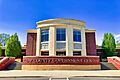
Clay County Government Center
|
||
|
||
| Motto(s):
"Clay County – It's Good for the Soul"
|
||

Location within the U.S. state of North Carolina
|
||
 North Carolina's location within the U.S. |
||
| Country | ||
| State | ||
| Founded | 1861 | |
| Named for | Henry Clay | |
| Seat | Hayesville | |
| Largest community | Hayesville | |
| Area | ||
| • Total | 220.78 sq mi (571.8 km2) | |
| • Land | 214.98 sq mi (556.8 km2) | |
| • Water | 5.80 sq mi (15.0 km2) 2.63% | |
| Population
(2020)
|
||
| • Total | 11,089 | |
| • Estimate
(2023)
|
11,864 |
|
| • Density | 50.226/sq mi (19.3925/km2) | |
| Time zone | UTC−5 (Eastern) | |
| • Summer (DST) | UTC−4 (EDT) | |
| Congressional district | 11th | |
Clay County is a county found in the far western part of North Carolina. In 2020, about 11,089 people lived here. The main town and county seat is Hayesville.
Contents
History of Clay County

Who lived here first?
People have lived in the area that is now Clay County for a very long time. Around 1000 CE, a large earth mound was built in what is now Hayesville. This was likely by people of the South Appalachian Mississippian culture. It was the center of their village.
Later, the Cherokee Native Americans built a town called Quanassee in the same spot. By 1550, hundreds of people lived there. In 1716, officials from South Carolina met with Cherokee leaders at Quanassee. They wanted the Cherokee to help them in a war. The next year, South Carolina built a trading post in Quanassee. Here, English goods were traded for things like deerskins from the Cherokee.
In 1725, a group from the Coosa (Creek) tribe attacked Quanassee. The village was badly damaged, and many residents were captured or lost their lives. The village was rebuilt for a short time before the American Revolution. In 1776, soldiers from the Rutherford expedition camped there.
The Unicoi Turnpike was an old trading path, about 1,000 years old. It went through Quanassee and what is now Brasstown. In 1813, this path became a toll road from Tennessee to Georgia. This was the first main road through the area. Today, Brasstown is the oldest town in the county that has always had people living there.
How Clay County was formed
The land that became Clay County was part of other counties over time. It was part of Buncombe County in 1791, Haywood County by 1810, and Macon County in 1828. In the 1820s, Baptist missionaries visited Quanassee to preach.
The first white settlers moved into the area in the early 1830s. Most of these people were of Scots-Irish descent. They had moved south from Pennsylvania and Virginia after the American Revolution. Most were farmers and did not own slaves. The first school opened in 1834. It was a private school started by Leonard Butterfield. From 1836 to 1838, North Carolina surveyed the land to sell it. The land was sold in Franklin in the fall of 1838.
In October 1837, soldiers from Tennessee built Fort Hembree in Hayesville. This was to prepare for moving the Cherokee people. About 1,000 Cherokee were held there before being forced to leave the area. The U.S. Military left Fort Hembree in June 1838. In 1839, most of the area became part of Cherokee County.
In 1860, George Hayes promised to help create a new county. This would bring new businesses and make government closer to the people. In February 1861, the North Carolina General Assembly created Clay County. It was mostly made from Cherokee County, with a small part from Macon County. The county was named after Henry Clay, a famous American statesman. The new county seat was named Hayesville, in honor of Mr. Hayes. The town officially became a town on March 12, 1913.
Fort Hembree was used again in 1860 to train soldiers for the Civil War. Early county meetings were held at the fort. Clay County did not have a formal government until 1868 because of the war. Hicksville Academy, which became Hayesville High School, started in 1870. In the 1890s, it offered college courses.
The first wooden courthouse burned down in 1870. A new brick courthouse was built in 1888. It is now a historic landmark. In 2007, county offices moved to a new building about 1 mile (1.6 km) west of the town square.
The first post office in Clay County opened in 1844 at Fort Hembree. At one point, Clay County had 17 post offices. By 1976, only three were left: in Hayesville, Warne, and Brasstown.
Clay County's borders have changed twice. In 1872, it added land from Macon County. In 1874, it added part of the Brasstown Creek area, reaching the Georgia state line.
In the late 1870s, a toll road called the Tusquittee Turnpike operated. Tiger’s Store is believed to be the oldest business in Clay County that has always been open. It started around 1899 and moved to Hayesville around 1908. A ruby from Clay County is even part of the Crown Jewels of the United Kingdom.
Clay County in the 20th century
Clay County's two-story brick jail was built in 1912. In 1972, students from Hayesville High School built a new jail. This was used until 2008, when a new detention center opened. Today, the old brick jail is the Clay County Historical & Arts Museum.
The county's first official bank opened in 1910. A creamery opened in Brasstown in 1924. Mission Dam was built in 1924. Gold mines operated in the 1930s. In the 1940s and 50s, lumber mills were the biggest employers. Lidseen of North Carolina, Inc., a metal factory, has been in Warne since 1957. Another factory, American Components Incorporated, made a part for the Saturn V rocket that took Neil Armstrong to the moon. Clay County has also made ladies’ dresses, items for soldiers, and kitchen and bathroom parts.
The county got its first electric power in 1920 from a small dam. By 1950, every community in the county had electricity.
The first car came to Clay County in 1914. For many years, men aged 18 to 45 had to work five days a year for free to help maintain roads. Construction on US 64 started in 1921. In 1959, a new highway was built to connect Hayesville to Andrews. This made it faster to get to the new hospital. NC 69 was built in 1922. It had to be moved when Chatuge Lake was created.
In 1920, Clay County's only railroad line, the Peavine, was finished. It connected Hayesville to Andrews. The Peavine mainly carried lumber and kaolin (a type of clay). The line was taken apart in 1951.
A silent film theater opened in the 1920s. A movie theater operated in Hayesville from the 1940s to the 1960s. The county has not had a movie theater since. Clay County's public library started in the 1930s. A new library building opened in 1967. It was named the Moss Memorial Library after Dr. Fred A. Moss, who helped fund it. It is the only public library in Clay County today.

Chatuge Dam was built near Hayesville in the early 1940s. This created Chatuge Lake. At the time, Chatuge Dam was the tallest earthen dam in the world. The dam was added to the National Register of Historic Places in 2017.
In the 1950s, Clay County got its official song, "Clay County Song." The Hinton Rural Life Center, a mission retreat, started in 1957. The Clay County Rescue Squad began in 1964. The county's first golf course opened in 1970. The Clay County Historical & Arts Council was founded in 1974. The Peacock Performing Arts Center, a community theater, opened in Hayesville in 1986. The Clay County Chamber of Commerce also started in 1986. The Clay County Recreation Center was built in 2007.
Since the 1800s, Clay County has mostly been a farming area. Most residents today are of European-American background.
Geography of Clay County

Clay County covers about 220.78 square miles (571.8 km²). Most of this is land, with about 5.80 square miles (15.0 km²) of water. It is the third-smallest county in North Carolina by land area. It is the smallest by total area.
The state of Georgia borders Clay County to the south. The Chattahoochee National Forest is also to the south. The Nantahala River forms part of its northeastern border. The Hiwassee River flows through the county. In the southern part of Clay County is Chatuge Lake. This lake is on the North Carolina–Georgia border.
Much of Clay County is part of the Nantahala National Forest. The Fires Creek Bear Reserve is north of Tusquittee. It has many hiking trails. The Appalachian Trail also goes through the southeast part of Clay County.
Before 1941, the U.S. government bought most of Clay County’s forest land. This was to protect it as National Forest Service property. The Forest Service manages about 60 percent of Clay County’s land. About 65,934 acres (26,683 ha) are part of the Nantahala National Forest. As of 2024, 14,515 acres (5,874 ha) are used for farming. There are 178 farms. Clay County has 11 dams. Six of these are considered high-hazard, meaning a dam failure could be dangerous.
Climate
Clay County has a humid subtropical climate. This means it has hot, humid summers. Winters are mild, but can sometimes be cold.
Like the rest of the southeastern U.S., Clay County gets a lot of rain. Rain falls fairly evenly throughout the year. The average yearly rainfall is about 55.9 inches (1,420 mm). Heavy snowstorms are rare but can happen. A very big storm, called the Storm of the Century, hit in March 1993.
Protected areas
- Appalachian Trail (part)
- Nantahala National Forest (part)
- Fires Creek Wildlife Management Area (part)
- JackRabbit Mountain Recreation Area
- Nantahala National Forest Game Land (part)
Major water bodies
- Buck Creek
- Chatuge Lake
- Crawford Creek
- Hiwassee River
- Little Tennessee River
- Nantahala River
- Park Creek
- Tusquitee Creek
Neighboring counties
- Cherokee County – northwest and west
- Macon County – east
- Union County, Georgia – southwest
- Towns County, Georgia – south
- Rabun County, Georgia – southeast
Main roads
 US 64
US 64
US 64 Bus. NC 69
NC 69 NC 175
Population of Clay County
| Historical population | |||
|---|---|---|---|
| Census | Pop. | %± | |
| 1870 | 2,461 | — | |
| 1880 | 3,316 | 34.7% | |
| 1890 | 4,197 | 26.6% | |
| 1900 | 4,532 | 8.0% | |
| 1910 | 3,909 | −13.7% | |
| 1920 | 4,646 | 18.9% | |
| 1930 | 5,434 | 17.0% | |
| 1940 | 6,405 | 17.9% | |
| 1950 | 6,006 | −6.2% | |
| 1960 | 5,526 | −8.0% | |
| 1970 | 5,180 | −6.3% | |
| 1980 | 6,619 | 27.8% | |
| 1990 | 7,155 | 8.1% | |
| 2000 | 8,775 | 22.6% | |
| 2010 | 10,587 | 20.6% | |
| 2020 | 11,089 | 4.7% | |
| 2023 (est.) | 11,864 | 12.1% | |
| U.S. Decennial Census 1790–1960 1900–1990 1990–2000 2010 2020 |
|||
As of 2024, Clay County has one of the oldest populations in North Carolina. The average age of people living here is 51.5 years old.
Clay County has the fifth lowest total economic output in the state as of 2024.
2020 census details
| Race / Ethnicity (NH = Non-Hispanic) | Pop 2000 | Pop 2010 | Pop 2020 | % 2000 | % 2010 | % 2020 |
|---|---|---|---|---|---|---|
| White alone (NH) | 8,536 | 10,080 | 10,044 | 97.28% | 95.21% | 90.58% |
| Black or African American alone (NH) | 70 | 64 | 60 | 0.80% | 0.60% | 0.54% |
| Native American or Alaska Native alone (NH) | 27 | 32 | 44 | 0.31% | 0.30% | 0.40% |
| Asian alone (NH) | 7 | 24 | 40 | 0.08% | 0.23% | 0.36% |
| Native Hawaiian or Pacific Islander alone (NH) | 6 | 2 | 7 | 0.07% | 0.02% | 0.06% |
| Other Race alone (NH) | 8 | 0 | 23 | 0.09% | 0.00% | 0.21% |
| Mixed race or Multiracial (NH) | 48 | 127 | 433 | 0.55% | 1.20% | 3.90% |
| Hispanic or Latino (any race) | 73 | 258 | 438 | 0.83% | 2.44% | 3.95% |
| Total | 8,775 | 10,587 | 11,089 | 100.00% | 100.00% | 100.00% |
In 2020, there were 11,089 people living in Clay County. There were 4,996 households and 3,424 families.
Education in Clay County
Clay County Schools serves all students in the county. About 1,200 students attend 4 schools, all on one campus in Hayesville. After the county government, Clay County Schools is the biggest employer. It has 205 staff members. Hayesville High School is for grades 9–12.
You can find higher education nearby at Tri-County Community College, Young Harris College, and Western Carolina University.
The John C. Campbell Folk School is in Brasstown. It is the largest and oldest folk school in the United States. The school teaches creative folk arts to people of all ages. It also offers community dances and concerts.
Media
The Clay County Progress is a newspaper published every week in Hayesville. It is the only newspaper in the county. Other newspapers, like the Clay County Courier and the Clay County News, used to serve the area. The Progress started in 1951.
Communities in Clay County

Town
- Hayesville (This is the county seat and the largest community.)
Unincorporated communities
These are smaller communities that are not officially towns:
- Brasstown
- Elf
- Shooting Creek
- Tusquittee
- Warne
Townships
The county is divided into six areas called townships:
- Brasstown is the westernmost township.
- Hayesville is in the center and includes the county seat.
- Hiawassee is the smallest township. It is named after the main river and surrounds Chatuge Lake.
- Shooting Creek is the easternmost township.
- Sweetwater is a small township northwest of Hayesville.
- Tusquittee is one of the larger and most northern townships.
Images for kids
-
Clay County Government Center
See also
 In Spanish: Condado de Clay (Carolina del Norte) para niños
