Bryson City, North Carolina facts for kids
Quick facts for kids
Bryson City, North Carolina
|
|
|---|---|

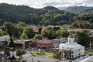
Downtown Bryson City
|
|
| Country | United States |
| State | North Carolina |
| County | Swain |
| Named for | Thaddeus Dillard Bryson |
| Area | |
| • Total | 2.29 sq mi (5.94 km2) |
| • Land | 2.18 sq mi (5.66 km2) |
| • Water | 0.11 sq mi (0.28 km2) |
| Elevation | 1,752 ft (534 m) |
| Population
(2020)
|
|
| • Total | 1,558 |
| • Density | 713.37/sq mi (275.48/km2) |
| Time zone | UTC-5 (Eastern (EST)) |
| • Summer (DST) | UTC-4 (EDT) |
| ZIP code |
28713
|
| Area code(s) | 828 |
| FIPS code | 37-08480 |
| GNIS feature ID | 2405339 |
Bryson City is a small town in Swain County, North Carolina, United States. It is the main town, also known as the county seat. In 2020, about 1,558 people lived there.
Bryson City is in an area that was once home to the Cherokee people. It was first called Charleston. The town became an important place for trains. Today, Bryson City is a popular spot for tourists. It is close to the entrance of the Great Smoky Mountains National Park. People visit for outdoor fun in the Nantahala National Forest, along the Nantahala River, and near Fontana Lake. It is also home to the Great Smoky Mountains Railroad, which offers scenic train rides through the Nantahala valley. The Nantahala Outdoor Center helps visitors with many outdoor activities in the area.
Contents
History of Bryson City
Early Native American Life
For nearly 14,000 years, Native American groups lived and hunted along the Tuckasegee River where Bryson City is now. The Cherokee people believed the village of Kituwa was their oldest and most important town. This ancient village site is now protected by the Eastern Band of Cherokee Indians.
In 1567, a Cherokee leader from Kituwa may have met with Spanish explorer Juan Pardo. During the American Revolutionary War, many Cherokee sided with the British. They hoped to keep European settlers off their land. American soldiers burned Kituwa in 1776. Even after this, the Cherokee still held their yearly dances there for many years.
Around 1818, a Cherokee chief named Big Bear owned a large piece of land near the Tuckasegee River. He sold parts of his land to others. Over time, a small community called Bear Springs grew there.
How Bryson City Grew
In 1871, Swain County was created from parts of other counties. The leaders of the new county met at a store in Bear Springs. They decided to make Bear Springs the county seat. The town was first named Charleston. Its streets were laid out in a T-shape, which are now Main and Everett streets. The first county courthouse was finished in 1874.
In 1889, the people of Charleston changed the town's name to "Bryson City." They did this to honor Colonel Thaddeus Bryson, who helped the town grow. It also helped avoid confusion with Charleston, South Carolina.
The Western North Carolina Railroad built tracks through Bryson City in 1884. This made travel and trade much easier for the area. A bank opened in 1904, and the current Swain County Courthouse was built in 1908.
Modern Times and Tourism
The Great Smoky Mountains National Park was created in 1933. This park brings many visitors and a lot of money to Swain County. Horace Kephart, a writer and outdoor lover who lived in Bryson City, helped make the park happen. The Deep Creek area of the park, just north of Bryson City, has a big campground and hiking trails. The main entrance to the park is a few miles east, near Cherokee.
Cherokee is also where the Blue Ridge Parkway ends. It is home to the Eastern Band of Cherokee Indians, who are descendants of Cherokee people who stayed in North Carolina.
In 1944, the Fontana Dam was finished. This created a large lake called Fontana Lake. The lake covered the only road connecting Bryson City to a remote part of the Smokies. The U.S. government started building a new road, called Lakeview Drive, in 1948. But it was built very slowly. By 1972, only about 7 miles (11 km) were done. Problems with the environment and money stopped the project. Locals started calling it "The Road to Nowhere."
In 2007, the National Park Service decided the road should not be finished. They began working with Swain County to find other solutions.
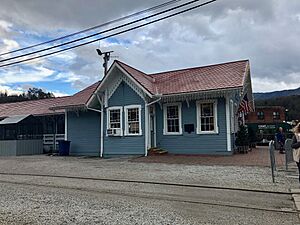
Over time, more people started using cars, and fewer used trains. The Southern Railway stopped passenger service in 1948. In 1988, the state of North Carolina bought the train tracks. They created a special train line called the Great Smoky Mountains Railroad. Its main station and starting point are in Bryson City.
In 2015, Bryson City got its first FM radio station, WTIJ-LP (100.7). It plays Christian music and broadcasts talks from ministers.
Geography
Bryson City is located where the Tuckasegee River and Deep Creek meet. The Tuckasegee River flows southwest from Bryson City and eventually joins the Little Tennessee River. Fontana Lake, a large lake created by a dam, covers the lower part of the Tuckasegee River.
Mountains surround the town. The Great Smoky Mountains are to the north, the Cowee Mountains to the south, and the Plott Balsams to the east. The Nantahala National Forest is just south of the city, and the Great Smoky Mountains National Park is just to the north. The Qualla Boundary, which is the main land of the Eastern Band of Cherokee Indians, is to the east.
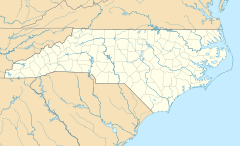
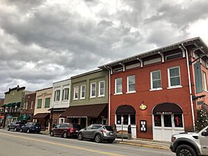
The center of Bryson City is where Everett Street and Main Street meet. Main Street is part of U.S. Route 19. This road connects Bryson City to Cherokee in the northeast and Murphy in the southwest.
The town covers about 2.2 square miles (5.94 square kilometers). Most of this area is land, with a small part being water.
Climate
| Climate data for BRYSON CITY 4, NC, 1991-2020 normals | |||||||||||||
|---|---|---|---|---|---|---|---|---|---|---|---|---|---|
| Month | Jan | Feb | Mar | Apr | May | Jun | Jul | Aug | Sep | Oct | Nov | Dec | Year |
| Mean daily maximum °F (°C) | 47.7 (8.7) |
51.8 (11.0) |
59.9 (15.5) |
68.8 (20.4) |
75.0 (23.9) |
80.3 (26.8) |
83.6 (28.7) |
83.0 (28.3) |
78.2 (25.7) |
69.7 (20.9) |
59.9 (15.5) |
50.4 (10.2) |
67.4 (19.7) |
| Daily mean °F (°C) | 36.9 (2.7) |
40.2 (4.6) |
47.0 (8.3) |
55.4 (13.0) |
63.0 (17.2) |
69.9 (21.1) |
73.3 (22.9) |
72.6 (22.6) |
67.3 (19.6) |
56.9 (13.8) |
47.1 (8.4) |
39.9 (4.4) |
55.8 (13.2) |
| Mean daily minimum °F (°C) | 26.0 (−3.3) |
28.5 (−1.9) |
34.1 (1.2) |
42.0 (5.6) |
51.0 (10.6) |
59.5 (15.3) |
63.0 (17.2) |
62.2 (16.8) |
56.4 (13.6) |
44.1 (6.7) |
34.3 (1.3) |
29.3 (−1.5) |
44.2 (6.8) |
| Average precipitation inches (mm) | 5.26 (134) |
5.31 (135) |
5.44 (138) |
4.96 (126) |
5.20 (132) |
5.06 (129) |
5.06 (129) |
4.38 (111) |
4.08 (104) |
3.21 (82) |
4.50 (114) |
6.14 (156) |
58.60 (1,488) |
| Average precipitation days (≥ 0.01 in) | 0.0 | 0.0 | 0.0 | 0.0 | 0.0 | 0.0 | 0.0 | 0.0 | 0.0 | 0.0 | 0.0 | 0.0 | 0.0 |
| Source: NOAA | |||||||||||||
Population Information
| Historical population | |||
|---|---|---|---|
| Census | Pop. | %± | |
| 1900 | 417 | — | |
| 1910 | 612 | 46.8% | |
| 1920 | 882 | 44.1% | |
| 1930 | 1,806 | 104.8% | |
| 1940 | 1,612 | −10.7% | |
| 1950 | 1,499 | −7.0% | |
| 1960 | 1,084 | −27.7% | |
| 1970 | 1,290 | 19.0% | |
| 1980 | 1,556 | 20.6% | |
| 1990 | 1,145 | −26.4% | |
| 2000 | 1,411 | 23.2% | |
| 2010 | 1,424 | 0.9% | |
| 2020 | 1,558 | 9.4% | |
| 2022 (est.) | 1,525 | 7.1% | |
| U.S. Decennial Census | |||
2020 Census
| Race | Number | Percentage |
|---|---|---|
| White (non-Hispanic) | 1,264 | 81.13% |
| Black or African American (non-Hispanic) | 47 | 3.02% |
| Native American | 86 | 5.52% |
| Asian | 10 | 0.64% |
| Pacific Islander | 1 | 0.06% |
| Other/Mixed | 71 | 4.56% |
| Hispanic or Latino | 79 | 5.07% |
In 2020, there were 1,558 people living in Bryson City. There were 654 households and 424 families.
2010 Census
In 2010, about 1,424 people lived in Bryson City. The town had 588 households. About 21.8% of households had children under 18. Many households were made up of individuals living alone, especially those 65 or older.
Important Buildings
Bryson City has a federal building and a federal courthouse. The courthouse is part of the United States District Court for the Western District of North Carolina.
Schools
The local school district is Swain County Schools. The main high school for the area is Swain County High School.
Famous People from Bryson City
- Horace Kephart – an outdoorsman and author
- Jerry Reed – a baseball pitcher for the Seattle Mariners
- Franklin Paul Rogers – a famous tattoo artist
- Heath Shuler – a professional football player and a North Carolina Congressman
- Red Smiley – a bluegrass musician
- Ellen Black Winston – the first United States Commissioner of Welfare
- The Inspirations – a Southern Gospel music group
See also
 In Spanish: Bryson City para niños
 | Sharif Bey |
 | Hale Woodruff |
 | Richmond Barthé |
 | Purvis Young |


