Fontana Lake facts for kids
Quick facts for kids Fontana Lake |
|
|---|---|

Fontana Lake
|
|
| Location | Graham / Swain counties, North Carolina, United States |
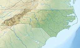
| Coordinates | 35°27′10″N 083°48′18″W / 35.45278°N 83.80500°W |
| Type | reservoir |
| Primary inflows | Little Tennessee River Nantahala River |
| Primary outflows | Little Tennessee River |
| Basin countries | United States |
| Max. length | 17 miles (27 km) |
| Average depth | 135 ft (41 m) |
| Max. depth | 440 ft (130 m) |
| Surface elevation | 1,703 ft (519 m) |
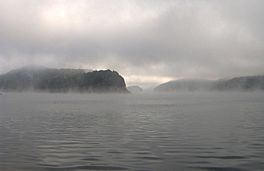
Fontana Lake is a large lake in North Carolina, USA. It was created by the Fontana Dam on the Little Tennessee River. You can find it in Graham and Swain counties.
This lake is very important for the area. It forms part of the southern edge of the Great Smoky Mountains National Park. It also borders the northern part of the Nantahala National Forest. Fontana Lake is about 17 miles (27 km) long. Its eastern end is near the Tuckasegee River and Bryson City.
Fontana Lake is the deepest lake in North Carolina. It has an average depth of 135 feet (41 m). At its deepest point, it reaches 440 feet (130 m)! The lake has many small inlets and coves. It also has many islands. These islands were once mountain peaks before the lake was filled. When the water level is low, you can see the steep banks of the lake.
When Fontana Lake was created, several towns were covered by water. These included places like Proctor and Judson.
Contents
Exploring Fontana Lake and Its Surroundings
Fontana Lake offers a special way to reach parts of the Great Smoky Mountains National Park. These areas are very remote. Without a boat on the lake, you would need to hike for many days to get there.
Accessing Remote Trails
During summer, the lake's water level is usually high. This allows boats to reach distant trailheads. One popular spot is Hazel Creek. From the observation tower on Clingmans Dome, you can see the lake far below. It looks like it's almost a mile down!
Lake Levels and Roads
The highest controlled water level for the lake is 1,710 ft (520 m). However, the normal summer water level is about 1,703 ft (519 m). NC 28 runs along the southern side of the lake. Also, US 19 briefly touches an inlet on the lake's southeastern edge. This happens between Bryson City and Wesser/Lauada.
What Does "Fontana" Mean?
The name "Fontana" comes from a logging town. This town used to be located at the mouth of Eagle Creek. Eagle Creek is on the north shore of the lake. The word "Fontana" is Italian. It means "fountain."
 | George Robert Carruthers |
 | Patricia Bath |
 | Jan Ernst Matzeliger |
 | Alexander Miles |


