
River Alre facts for kids
Quick facts for kids River Alre |
|
|---|---|

Alre Valley
|
|
|
|
|

Confluence into the Itchen, in Hampshire
|
|
| Other name(s) | River Arle |
| Country | England |
| County | Hampshire |
| Physical characteristics | |
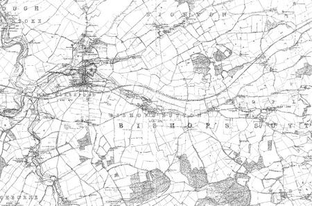
| Main source | east end of Bishop's Sutton, Hampshire 72 m (236 ft) 51°4′56″N 1°7′11″W / 51.08222°N 1.11972°W |
| River mouth | River Itchen near New Alresford, Hampshire 51 m (167 ft) 51°5′16″N 1°11′2.9″W / 51.08778°N 1.184139°W |
| Length | 6.0 km (3.7 mi) |
| Basin features | |
| Progression | Alre, Itchen, Southampton Water arm of The Solent (English Channel) |
| River system | Itchen basin |
| Basin size | 56.31 km2 (21.74 sq mi) |
The River Alre is a small river in Hampshire, England. It's sometimes called the Arle. This river is like a helper, or 'tributary', to a bigger river called the River Itchen. The River Alre starts in a village called Bishop's Sutton. It then flows west for about 6 km (3.7 mi) before joining the Itchen near New Alresford.
The Alre is a special kind of river called a chalk stream. This means it flows over a shallow bed of gravel. Its water comes from natural chalk springs all year round, making it flow quite fast. In Bishop's Sutton, the river is a great place for trout fishing. It also helps grow watercress, a leafy green plant. A famous old steam railway, the Watercress Line, is even named after this watercress!
Contents
Where Does the River Alre Flow?
Starting Point and Early Journey
The River Alre begins at a spring in the area of Bishop's Sutton. This spring is about 800 meters east of the main part of the village. As the river flows west, it passes under Water Lane, which is a ford (a shallow place where you can cross a river). Here, the Alre runs between the old church of St Nicholas and where the bishop's palace used to be. This palace belonged to the Bishop of Winchester for many centuries, and it's how the village got its name.
Watercress Farms and the Watercress Line
The river then flows through Western Court Farm. Here, its waters are used for growing watercress in special beds. Soon after, it goes under a railway bridge. This bridge is part of the Mid Hants Railway, which is famously known as the Watercress Line. This railway used to carry fresh watercress from New Alresford to Alton and then on to London.
Old Alresford Pond and Mills
North-east of Alresford, the river splits into different channels. One channel flows through the Old Alresford Pond. This pond was made by people in the 12th century. It was a 'stew pond' used to keep fish for the Bishop of Winchester. It might also have helped control water levels for a navigation channel built nearby. Today, this pond is a protected area called a Site of Special Scientific Interest.
The Alre flows just north of New Alresford, separating it from the smaller village of Old Alresford. For much of its path here, it forms the boundary between the two villages. In this area, the river powers two old water mills: Arle Mill and The Fulling Mill. It also helps support more watercress farms. 'Fulling' is an old process used to clean oils from wool. The Fulling Mill dates back to the 13th century. It was falling apart by the 1800s but was saved in 1951 and is now a private home.
Joining the River Itchen
The final part of the River Alre flows a few hundred meters south-west through fields. It then joins the winding path of the River Itchen.
History of the River Alre's Name
The name 'Alre' comes from an old English word, alor, which means alder tree. The name 'Alresford' itself has been around since at least the early 700s. It means 'alder tree ford', likely referring to an important place to cross the river where a big alder tree stood. Over time, the river became known by the same name as the town.
Sometimes, people still call the river the Arle. However, experts believe this is because of mistakes made in the 20th century, not because it was an older name. A book from 1937 might have caused this confusion by wrongly quoting an older text from 1586.
In ancient English maps and documents, the River Alre was sometimes thought of as the very beginning of the River Itchen. Also, the River Itchen itself was once called the River Alre.
A famous writer named Daniel Defoe mentioned the river in his book A tour thro' the whole island of Great Britain. He wrote about crossing the River Alre, noting how it started near Alresford but became a large river further downstream.
River Health and Water Quality
The Environment Agency checks the health of rivers in England. They give each river an overall 'ecological status'. This status can be high, good, moderate, poor, or bad. To figure this out, they look at different things. They check the types and numbers of tiny creatures (invertebrates), plants like angiosperms, and fish living in the river. They also check the 'chemical status' by measuring chemicals in the water to make sure they are at safe levels. Chemical status is either good or fail.
In 2019, the River Alre had a 'good' ecological status. This means it was a healthy home for plants and animals. However, its chemical status was 'fail'. This suggests that some chemicals were present at levels that were not considered safe.
