River Balder facts for kids
Quick facts for kids River Balder |
|
|---|---|

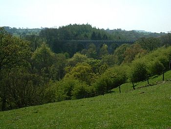
The Balder Railway Viaduct over the River Balder
|
|
| Country | England |
| Physical characteristics | |
| Main source | Stainmore Common 480 m (1,570 ft) |
| River mouth | River Tees |
| Length | 21 km (13 mi) |
The River Balder is a river in England. It starts high up on the eastern side of Stainmore Common. This area is part of the Pennines, a famous mountain range. The river then flows towards the east for about 21 kilometers (13 miles). Finally, it joins another river called the River Tees near a village named Cotherstone.
The River Balder is located in County Durham. Where the river begins, the valley is a wide, open moorland. The hills around this area are quite tall, reaching over 500 meters (1640 feet) high.
Contents
Journey of the River Balder
The River Balder's journey is interesting because it flows through several large reservoirs. These reservoirs are like big lakes built to store water.
Reservoirs Along the Way
About 7 kilometers (4.3 miles) from where it starts, the River Balder flows into its first big reservoir. This is called Balderhead Reservoir. The river is about 330 meters (1080 feet) above sea level here.
As the river continues its path down the valley, which is known as Baldersdale, it enters two more reservoirs:
- Blackton Reservoir
- Hury Reservoir
Scenery Changes
After Balderhead Reservoir, the landscape around the river becomes less wild. It gets a bit gentler as the river flows past the Baldersdale Youth Hostel. You might also see the unique flat-topped hill called Goldsborough to the south.
The valley starts to open up more as the river reaches Blackton Reservoir. Here, the river is about 280 meters (920 feet) above sea level.
The river then continues almost exactly east into Hury Reservoir. This is around 260 meters (850 feet) above sea level. The small village of Hury is located just north of this reservoir.
Meeting the River Tees
After leaving the reservoirs, the River Balder begins to twist and turn. It flows under the Balder Railway Viaduct. This old bridge was once part of a railway line that connected Barnard Castle to Middleton-in-Teesdale. The railway line is no longer used today.
Finally, the River Balder reaches its end. It joins the larger River Tees near the village of Cotherstone. This meeting point is about 160 meters (520 feet) above sea level.
 | Kyle Baker |
 | Joseph Yoakum |
 | Laura Wheeler Waring |
 | Henry Ossawa Tanner |

