River Meese facts for kids
Quick facts for kids Meese |
|
|---|---|

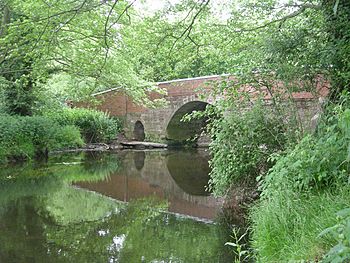
River Meese near Cherrington
|
|

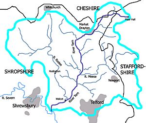
Map showing the River Meese, the other tributaries of the River Tern, and its drainage basin
|
|
| Country | England |
| Physical characteristics | |
| Main source | Weston-under-Lizard 123 m (404 ft) 52°41′33″N 2°15′40″W / 52.6926°N 2.2610°W |
| River mouth | River Tern near Great Bolas 54 m (177 ft) 52°47′01″N 2°32′14″W / 52.7836°N 2.5372°W |
The River Meese is a small river located in Shropshire, England. It is an important part of the local water system. The Meese flows into the River Tern, which then joins the larger River Severn.
Contents
Journey of the River Meese
The River Meese has an interesting journey. It starts as a small stream near Weston-under-Lizard. This area is close to the old Roman road, Watling Street (now the A5).
Different Names Along the Way
Before it is called the River Meese, the stream has several different names. It starts as Dawford Brook. Then it becomes Lynn Brook, Moreton Brook, Back Brook, and Coley Brook.
It only officially becomes the River Meese after it flows into a lake called Aqualate Mere. This lake is a special place for wildlife.
Where Two Counties Meet
For about 2 kilometers (1.2 miles), the River Meese forms a natural border. This border is between the counties of Shropshire and Staffordshire.
At this point, another stream called Lonco Brook joins the River Meese from the north. This adds more water to the river as it continues its journey.
The River's Path
The River Meese flows generally north and then west. It winds through the countryside of Shropshire. Its journey ends when it meets the River Tern near a village called Great Bolas. The Tern then carries the water towards the River Severn.
 | Leon Lynch |
 | Milton P. Webster |
 | Ferdinand Smith |

