River Mease facts for kids
Quick facts for kids Mease |
|
|---|---|

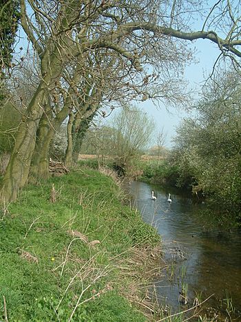
River Mease south of Lullington, near Clifton Campville
|
|
| Country | England |
| Region | Leicestershire, Derbyshire, Staffordshire |
| Physical characteristics | |
| Main source | Nr. Norton Juxta Twycross, Leicestershire, England 130 m (430 ft) |
| River mouth | River Trent Nr. Croxall, Staffordshire, England 52°43′0″N 1°43′0″W / 52.71667°N 1.71667°W |
| Length | 25 km (16 mi) |
| Basin features | |
| Tributaries |
|
The River Mease is a special river in the Midlands area of England. It flows through three counties: Leicestershire, Derbyshire, and Staffordshire. For some parts of its journey, it even forms the border between these counties.
This river and one of its smaller streams, the Gilwiskaw Brook (pronounced jill-a-whiskey), are very important. They are protected because they are great examples of a natural, winding lowland river. The River Mease is so special that it has protection under European law as a Special Area of Conservation (SAC). It is also protected by UK law as a Site of Special Scientific Interest (SSSI).
Contents
Journey of the River Mease
The River Mease starts from smaller streams near Norton Juxta Twycross in North West Leicestershire. It flows west for about 25 kilometers (16 miles). The river travels through farms and countryside.
It eventually joins the River Trent at Croxall in Staffordshire. From there, its water flows into the Humber Estuary and then out to the North Sea. The river flows over layers of sandstone and mudstone.
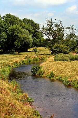
The land around the river is mostly flat. This means the river flows slowly and gently. It also creates many natural bends, which are called meanders. The river's path has not changed much over a long time. In the past, some small changes were made near villages like Clifton Campville to help old mills.
The village of Measham gets its name from the river. Measham means 'the homestead on the River Mease'.
Amazing River Wildlife
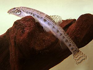
The River Mease is a Site of Special Scientific Interest because of its fish. It is home to some very important and rare fish. These include the spined loach (Cobitis taenia) and the European bullhead (Cottus gobio). These fish are special because they are native to England and are not found in many other places.
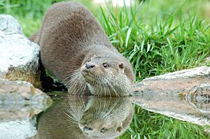
Other cool animals also live here. You can find white-clawed crayfish (Austropotamobius pallipes). There are also European otters (Lutra lutra), which are playful mammals. The most common fish are chub and roach. You might also see dace, pike, perch, and gudgeon.
Sadly, the river's wildlife is very sensitive to pollution. The number of fish has gone down since 2007. Experts found that the special fish, spined loach and European bullhead, were affected by pollution. Their populations were smaller than expected. The river conditions were not good enough for them to live well.
Other animals, like the white-clawed crayfish, have moved away. They have been pushed towards where the River Mease joins the River Trent. Also, foreign American signal crayfish have entered the river. They compete with the native white-clawed crayfish.
River Pollution Concerns
The River Mease gets water from several places. This includes water from nine sewerage treatment plants. These plants are located in different villages along the river. The river also receives water from private sewerage systems.
The river has had fewer fish since 2007. This is when the Environment Agency stopped adding fish to the river. Instead, they want the river to recover naturally. This is after several "pollution incidents" happened.
The main problem is thought to be too many phosphates. These often come from the sewage treatment plant at Packington. This plant is working at its maximum capacity. This means extra water sometimes flows into the river. This extra water goes into the Gilwiskaw Brook, which then joins the Mease.
The water quality of most of the river is "moderate." But the section closer to the River Trent is considered "poor." Because of these concerns, the Environment Agency put pressure on local councils. North West Leicestershire District Council stopped new building plans. This was to prevent more sewage from flowing into the river.
In 2012, a new plan was made. Developers building new houses would pay a fee. This money would then be used to help improve the river's water quality. However, some people worry that this plan does not stop pollution. They fear that more building will lead to more sewage and more pollution.
There are also worries about flooding. Large areas of the Gilwiskaw Brook and the River Mease often flood after heavy rain. More water from new developments could make this problem worse.
Villages Along the River Mease
Here are some of the places the River Mease flows through:
- Norton Juxta Twycross - This is the village closest to where the river starts.
- Snarestone - The river passes to the west of this village.
- Measham - The river forms the southwest edge of this village.
- Stretton en le Field - The river flows just north of this village.
- Netherseal - The river forms the southern edge of this village.
- Clifton Campville - The river passes just north of this village.
- Haunton - The river passes just north of this village.
- Harlaston - The river passes just north of this village.
- Edingale - The river passes just south of this village.
- Croxall - The river forms the southwest edge of this village.
- The River Mease joins the River Trent north of Croxall.
 | Aaron Henry |
 | T. R. M. Howard |
 | Jesse Jackson |


