River Smite facts for kids
Quick facts for kids River Smite |
|
|---|---|

Smite near Shelton
|
|
|
Mouth of the Smite in Nottinghamshire
|
|
| Country | England |
| Counties | Leicestershire, Nottinghamshire |
| Physical characteristics | |
| Main source | Holwell, Leicestershire |
| River mouth | Shelton, Nottinghamshire 52°59′50″N 0°49′25″W / 52.9972°N 0.8235°W |
| Length | 32 km (20 mi) |
| Basin features | |
| Basin size | 193 km2 (75 sq mi) |
| Progression : Smite—Devon—Trent—Humber | |
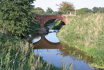
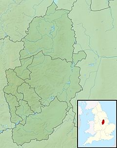
The River Smite is a river in England. It flows for about 32 kilometers (20 miles) through Leicestershire and south-east Nottinghamshire. The Smite is a branch, or tributary, of the River Devon.
The river starts near a small village called Holwell, Leicestershire. It then flows until it joins the River Devon near Shelton, Nottinghamshire. The Smite and its smaller branches, like the River Whipling, help drain a large area of farmland. This area is about 193 square kilometers (75 square miles) in a place called the Vale of Belvoir.
What's in a Name?
The name of the River Smite has a long history. In the 1600s, people called it the "Snite." Both "Snite" and "Smite" likely come from an old English word, smita. This word meant a dirty or muddy place.
Another old English word, smitan, meant to cover with dirt or to pollute. So, the name "Smite" probably means that the river was a muddy or dirty stream a long time ago.
The Smite's Journey
The River Smite starts its journey by flowing north-west. As it moves, smaller streams from the Bleak Hills join it. These streams add more water to the Smite.
The river then turns north-east when it reaches the lower part of the Vale of Belvoir. An aqueduct (a bridge that carries water) of the Grantham Canal crosses over the Smite.
The Smite continues flowing north-west and meets the Dalby Brook. The Dalby Brook is another stream that flows from near Old Dalby. It passes between villages like Upper and Nether Broughton before joining the Smite.
After this meeting, the river flows through Colston Bassett. It also passes by Wiverton Hall, where the Stroom Dyke joins it. The Smite then continues through farmland.
It goes under the A52 road, flowing between Whatton-in-the-Vale and Aslockton. Here, the River Whipling joins the Smite. The Smite also flows past the old remains of Aslockton Castle. This castle was a motte and bailey type, which means it had a mound (motte) and a walled area (bailey).
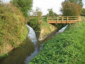
Finally, the river continues north-east. It passes by the villages of Orston, Thoroton, Flawborough, and Shelton. This is where the River Smite meets the River Devon.
Meet the River Whipling
The River Whipling is the most important branch of the Smite. It is about 10 kilometers (6 miles) long. The Whipling actually starts when two smaller streams, the Rundle Beck and the Grimmer, meet. This meeting point is near a village called Granby.
The Whipling flows around Granby and then heads north-east. It joins the River Smite near Whatton. The Whipling and its own small branches drain about 52 square kilometers (20 square miles) of the Vale of Belvoir. This means the Whipling system collects about a quarter of all the water that flows into the Smite.
 | Isaac Myers |
 | D. Hamilton Jackson |
 | A. Philip Randolph |


