Nottinghamshire facts for kids
Quick facts for kids
Nottinghamshire
|
|||||||||||||||||||||||||||||||||||||||||||||||||||||
|---|---|---|---|---|---|---|---|---|---|---|---|---|---|---|---|---|---|---|---|---|---|---|---|---|---|---|---|---|---|---|---|---|---|---|---|---|---|---|---|---|---|---|---|---|---|---|---|---|---|---|---|---|---|
|
|
|||||||||||||||||||||||||||||||||||||||||||||||||||||
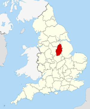
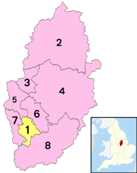
Nottinghamshire within England
|
|||||||||||||||||||||||||||||||||||||||||||||||||||||
| Sovereign state | United Kingdom | ||||||||||||||||||||||||||||||||||||||||||||||||||||
| Constituent country | England | ||||||||||||||||||||||||||||||||||||||||||||||||||||
| Region | East Midlands | ||||||||||||||||||||||||||||||||||||||||||||||||||||
| Established | Ancient | ||||||||||||||||||||||||||||||||||||||||||||||||||||
| Time zone | UTC±00:00 (Greenwich Mean Time) | ||||||||||||||||||||||||||||||||||||||||||||||||||||
| • Summer (DST) | UTC+01:00 (British Summer Time) | ||||||||||||||||||||||||||||||||||||||||||||||||||||
| Members of Parliament | 8 MPs | ||||||||||||||||||||||||||||||||||||||||||||||||||||
| Police | Nottinghamshire Police | ||||||||||||||||||||||||||||||||||||||||||||||||||||
|
|||||||||||||||||||||||||||||||||||||||||||||||||||||
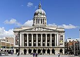
Nottinghamshire (pronounced Not-ing-um-sheer) is a special county in the East Midlands of England. It shares borders with South Yorkshire to the north-west, Lincolnshire to the east, Leicestershire to the south, and Derbyshire to the west. The biggest city in Nottinghamshire is Nottingham, which is also the county town.
The county covers about 2,160 square kilometers (834 square miles) and has over 1.1 million people. Most people live in the Nottingham built-up area in the south-west. This area even stretches into Derbyshire. The north-east of the county is more rural, with towns like Worksop and Newark-on-Trent. For local government, Nottinghamshire has seven districts and the city of Nottingham, which manages itself.
The River Trent is very important to Nottinghamshire's geography. It flows through a wide valley from the south-west to the north-east. North of the river, in the middle of the county, you'll find Sherwood Forest. This is a small part of a much larger, very old woodland.
Contents
Exploring Nottinghamshire's Past
Nottinghamshire has a long and interesting history. It was once part of the Roman road called Fosse Way. You can still find signs of Roman settlements here, like in Mansfield.
Early Settlements and Kingdoms
Around the 5th century, people called the Angles settled in the county. Nottinghamshire then became part of the Kingdom of Mercia. The name "Nottinghamshire" first appeared in 1016. For many years, until 1568, Nottinghamshire and Derbyshire were managed together.
After the Normans arrived in 1066, the county started to develop industries. These included making malt and wool products.
Sherwood Forest and Royal Connections
In 1066, King William I the Conqueror made Sherwood Forest a special hunting ground for kings. Many kings, including those from Mercia, visited it often.
The Domesday Book of 1086, ordered by King William I, listed many areas in Nottinghamshire that belonged to King Edward the Confessor. These included places like Mansfield and Sutton in Ashfield.
Near Kings Clipstone, you can find the ruins of King John's Palace. This was a royal home for King John. It was close to Sherwood Forest. King William the Lion of Scotland even met King Richard I of England here. King John, King of England later died at Newark Castle in 1216.
The Industrial Revolution and Mining
During the Industrial Revolution, Nottinghamshire had lots of valuable minerals like coal and iron ore. Some of the world's first experimental wagonways were built here. For example, the Wollaton wagonway (1603–1616) moved minerals from mining areas. This led to the building of canals and railways. The lace and cotton industries also grew.
In the 18th and 19th centuries, deeper coal mines opened. Mining became a very important part of the economy. However, most of these mines closed after the miners' strike in 1984–85.
How Nottinghamshire's Areas Changed
Before 1610, Nottinghamshire was divided into eight areas called Wapentakes. By 1719, these were reduced to six: Newark, Bassetlaw, Thurgarton, Rushcliffe, Broxtowe, and Bingham. Some of these names are still used for the modern districts today.
The Legend of Robin Hood
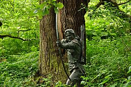
Nottinghamshire is famous for its connection to the legend of Robin Hood. This is why many tourists visit places like Sherwood Forest and the City of Nottingham. To help people learn more about Robin Hood, the University of Nottingham started the Nottingham Caves Survey in 2010. This project uses a 3D laser scanner to record over 450 sandstone caves around Nottingham. This helps to make these sites more interesting for visitors.
Mapping the County
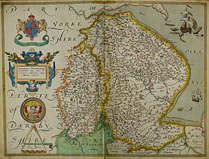
The first map of Nottinghamshire was made by Christopher Saxton in 1576. The first detailed map was by John Chapman in 1774. This map was very useful because it showed village layouts, roads, and other features.
In 1974, a small part of northern Nottinghamshire changed. The villages of Blaxton, Finningley, and part of Auckley became part of the City of Doncaster in South Yorkshire.
Nottinghamshire's Landscape and Climate
Nottinghamshire has a varied landscape. Like Derbyshire and South Yorkshire, it sits on large coal deposits. These can be up to 900 meters (2,950 feet) thick. There is also an oilfield near Eakring.
Hills, Rivers, and Green Spaces
The western part of the county has sandstones and limestones. The east has clay. The north is part of a flat plain called the Humberhead Levels. The middle and south-west, around Sherwood Forest, have rolling hills with old oak woodlands.
The main rivers are the Trent, Idle, Erewash, and Soar. The Trent flows through wide, flat valleys. The highest point in Nottinghamshire is just north of Newtonwood Lane, at 205 meters (673 feet). The lowest point is Peat Carr, which is at sea level.
Weather in Nottinghamshire
Nottinghamshire is protected by the Pennines mountains to the west. This means it doesn't get a lot of rain, usually between 641 and 740 mm (25 to 29 inches) each year. The average temperature is between 8.8 and 10.1 degrees Celsius (48–50 degrees Fahrenheit). The county gets between 1321 and 1470 hours of sunshine every year.
Green Belt Areas
Nottinghamshire has a "green belt" area. This was created in the 1950s. It completely surrounds the Nottingham city area and stretches into nearby districts. This helps to protect the countryside from too much building.
Economy and Industries in Nottinghamshire
Historically, Nottinghamshire's economy relied on industries like coal mining and manufacturing. After William Lee invented the knitting frame, Nottingham became famous for its lace industry.
In 1998, Nottinghamshire's total economic output (GDP) was about £12,023 million. This means the county produces a lot of goods and services. The unemployment rate in the Nottingham area is usually quite low.
Learning and Education in Nottinghamshire
Nottinghamshire offers a good education system.
Secondary Schools
The county has 47 state secondary schools and 10 private schools. The city of Nottingham has its own education authority with 18 state schools and six independent schools.
In 2007, about 9,700 students took their GCSE exams in Nottinghamshire. Some of the top-performing schools included the West Bridgford School and Rushcliffe Spencer Academy. For A-levels, The Becket School and the West Bridgford School had excellent results. Private schools like Nottingham High School also perform very well.
Worksop College is another private school located near Worksop.
Universities and Higher Education
Nottingham is home to several important universities. The University of Nottingham is a highly respected university, offering many different courses. Nottingham Trent University is also very successful. These universities, along with a campus of the University of Law, make Nottingham one of England's biggest student cities.
Nottingham Trent University has an agricultural college near Southwell. The University of Nottingham also has one at Sutton Bonington.
Culture and Fun in Nottinghamshire
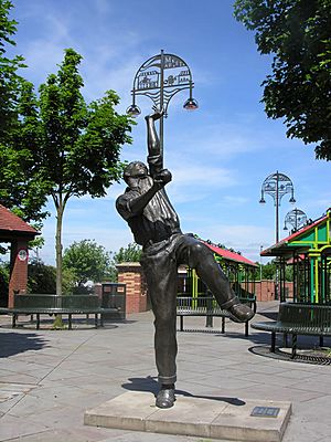
Nottinghamshire is famous for Sherwood Forest and its connection to the legend of Robin Hood.
Famous People and Places
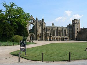
The poet Lord Byron once lived at Newstead Abbey in Nottinghamshire. He sold it in 1818. Now, Nottingham City Council owns it, and you can visit it. The famous author D. H. Lawrence was from Eastwood in Nottinghamshire. The folk singer-songwriter Anne Briggs was born in Toton.
The north of the county is also important for its links to the Pilgrim Fathers. For example, William Brewster came from Scrooby village.
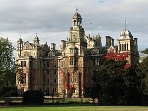
Thoresby Hall was once owned by Robert Pierrepont, who bought the land in 1633. His son built the first grand house around 1670. Today, Thoresby Hall is a hotel, but its park is open to visitors.
Rufford Abbey was built between 1560 and 1590. It was owned by George Talbot, 6th Earl of Shrewsbury, who was married to Bess of Hardwick.
Sports in Nottinghamshire
The Nottinghamshire County Cricket Club (NCCC) plays at Trent Bridge in West Bridgford. They won the County Championship in 2010.
The most successful football team in Nottinghamshire is Nottingham Forest. They won the English championship in 1978 and the European Cup in 1979 and 1980. Mansfield Town and Notts County are other professional football teams in the county.
Other notable sports teams include the Nottingham Rugby Football Club and the Nottingham Panthers Ice Hockey Club.
International Connections and County Flower
Nottinghamshire has special "twinning" agreements with the province of Wielkopolska in western Poland and its capital city, Poznań.
In 2002, the Crocus nudiflorus (Autumn crocus) was chosen by the public as Nottinghamshire's county flower.
Local Media
BBC East Midlands is based in Nottingham and broadcasts news around the county. ITV Central also covers regional news. BBC Radio Nottingham is the local public radio station. There are also several local commercial radio stations. In northern parts of the county, like Worksop and Retford, people often get TV signals from Emley Moor. This means they are covered by BBC Yorkshire and ITV Yorkshire.
Areas and Towns of Nottinghamshire
Administrative Areas and Main Settlements
Nottinghamshire is divided into several administrative areas, each with its own main towns:
| Administrative area | Administrative centre | Main settlements | |
|---|---|---|---|
| Ashfield |
 |
Kirkby-in-Ashfield | Sutton-in-Ashfield, Annesley, Hucknall |
| Bassetlaw |
 |
Worksop | Retford, Askham, Carlton in Lindrick, Harworth, Bircotes |
| Broxtowe |  |
Beeston | Kimberley, Stapleford, Attenborough, Bramcote, Chilwell |
| City of Nottingham |  |
Nottingham (County town) | Bulwell, Bestwood, Sneinton, Clifton, Aspley, Radford, Basford, Hyson Green, Wollaton |
| Gedling |  |
Arnold | Carlton, Burton Joyce, Colwick, Ravenshead, Gedling, Netherfield |
| Mansfield |  |
Mansfield | Rainworth (part), Forest Town, Mansfield Woodhouse, Warsop |
| Newark and Sherwood |  |
Newark-on-Trent | Southwell, Ollerton, Edwinstowe, Rainworth (part), Farnsfield, Sutton-on-Trent |
| Rushcliffe |  |
West Bridgford | East Leake, Ruddington, Bingham, Cotgrave, Tollerton, Keyworth, Radcliffe-on-Trent |
Towns and Transport Links
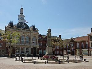
The city of Nottingham is the traditional county town and the largest settlement. Even though it's now managed separately, towns like Arnold, Carlton, West Bridgford, Beeston, and Stapleford are still part of the administrative county. The county council is based in West Bridgford.
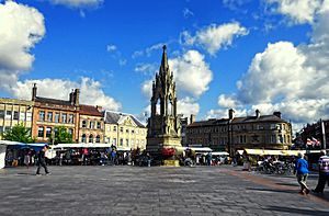
Nottinghamshire has several market towns. Newark-on-Trent is an old Anglo-Saxon market town with a ruined castle. Mansfield is the second-largest settlement after Nottingham. Worksop in the north also grew quickly during the Industrial Revolution. Other market towns include Arnold, Bingham, Hucknall, Kirkby-in-Ashfield, Tuxford, Retford and Sutton-in-Ashfield.
The main railway line is the Midland Main Line, connecting London to Sheffield through Nottingham. The Robin Hood Line runs between Nottingham and Worksop. The East Coast Main Line serves Newark and Retford.
The M1 motorway runs through the county, linking Nottingham to London and Leeds. The A1 road also passes through Nottinghamshire. Many old coaching inns can still be seen along its traditional route.
East Midlands Airport is just outside the county, and Doncaster Sheffield Airport is within its historic boundaries. These airports offer flights to many European destinations. Nottingham and its suburbs also have a tram system called Nottingham Express Transit.
Places to Visit in Nottinghamshire
- Attenborough Nature Reserve
- Beauvale Priory
- Beth Shalom Holocaust Centre
- Clumber Park National Trust
- Creswell Crags
- D. H. Lawrence Birthplace Museum
- Felley Priory
- The Harley Gallery
- Hawton Church
- Mansfield Museum
- Mr Straw's House National Trust
- Newark Air Museum
- Newark Castle, Nottinghamshire
- Newstead Abbey
- Nottingham Castle
- Papplewick Pumping Station
- Rufford Country Park
- Rushcliffe Country Park
- Sherwood Forest
- Sherwood Observatory
- Sherwood Pines Forest Park
- Silverhill, Nottinghamshire
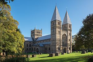
- Southwell Minster
- St Mary's Church, Edwinstowe
- Sundown Adventureland
- Teversal
- The Royal Lancers and Nottinghamshire Yeomanry Museum
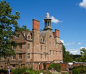
- The Workhouse, Southwell National Trust
- Thoresby Hall Park
- Wheelgate Park
- Welbeck Abbey
- Wollaton Hall
- Wollaton Park
- Ye Olde Trip To Jerusalem
See also
 In Spanish: Nottinghamshire para niños
 | Emma Amos |
 | Edward Mitchell Bannister |
 | Larry D. Alexander |
 | Ernie Barnes |


