Attenborough, Nottinghamshire facts for kids
Quick facts for kids Attenborough |
|
|---|---|
 Attenborough Parish Church |
|
| Population | 2,328 (Ward. 2011) |
| OS grid reference | SK 51782 34486 |
| District |
|
| Shire county | |
| Region | |
| Country | England |
| Sovereign state | United Kingdom |
| Post town | NOTTINGHAM |
| Postcode district | NG9 |
| Dialling code | 0115 |
| Police | Nottinghamshire |
| Fire | Nottinghamshire |
| Ambulance | East Midlands |
| EU Parliament | East Midlands |
| UK Parliament |
|
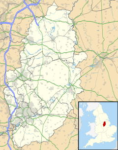
Attenborough is a village in Nottinghamshire, England. It's part of the larger Greater Nottingham area. You can find it about 4.5 miles (7.2 km) southwest of the city of Nottingham. It sits between the towns of Long Eaton and Beeston. The village is also next to the areas of Toton and Chilwell. In 2011, about 2,328 people lived here.
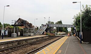
Attenborough is well-known for its Attenborough railway station and the amazing Attenborough Nature Reserve.
Contents
Exploring Attenborough Village
Attenborough is a place with interesting features, from its wildlife haven to its historic buildings.
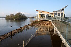
Attenborough Nature Reserve
The Attenborough Nature Reserve is a special place. It used to be gravel pits where gravel was dug out. After the digging stopped, the pits filled with water. Now, they are a safe home for many different birds and other wildlife. It's a great spot for nature lovers!
Village Life and History
The main part of Attenborough with shops and businesses is around the crossing of Nottingham Road (the A6005) and Attenborough Lane.
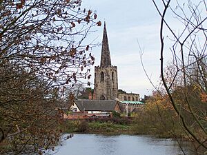
Near the nature reserve, you'll find a tennis club and a private day-nursery. There's also the Attenborough Cricket Club, which is like the village's main green space. The historic St. Mary's Church is also in this area. This part of Attenborough is very old, with some buildings that are officially protected because of their history.
In 1944, some land was given to build a village hall. It took a while, but construction started in 1955. The hall was named the Lucy Brown Village Hall. It cost about £8,200 to build and opened on September 15, 1956.
In 1966, a collection of Roman coins was discovered on a walking path that goes over the railway line.
Protecting Attenborough's Heritage
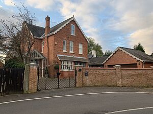
The local council has marked two special "conservation areas" in Attenborough. These areas are protected to keep their unique character and history.
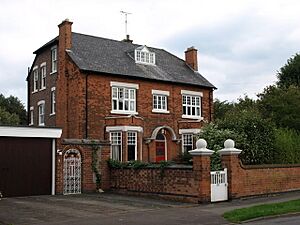
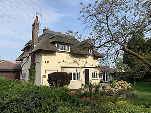
Attenborough Village Conservation Area
This area includes Church Lane, part of Shady Lane, The Strand, and Attenborough Lane. It was first protected in 1977. Many important old buildings are found here, like:
- Hycroft (202 Attenborough Lane)
- Cloud House (233 Attenborough Lane)
- St. Mary's Church (a very important historic building)
- The Orchards (1 Church Lane)
- Blue Gate (Church Lane)
- Woodbine Cottage (9 Church Lane)
- Red Ridges (Church Lane)
- Thatched Cottage (Church Lane)
- Croft Cottage (13 Church Lane)
- Ireton House (15 Church Lane)
- Rothmere (17 Church Lane)
- Vale Cottage (19 Church Lane)
- Field House (Shady Lane)
- Long Acres (25 Shady Lane)
- Rose Cottage (45 The Strand)
- Brookside (49 The Strand)
- The Willows (51 The Strand)
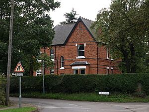
Attenborough Barratt Lane Conservation Area
This area covers most of Barratt Lane, part of Attenborough Lane, and Long Lane. It was protected in 1980. Some of the first houses here were built in the late 1800s. They were built to face the railway, giving great views towards the church and the River Trent. Notable buildings include:
- The Haven (15 Barratt Lane)
- 16 Barratt Lane
- 17 Barratt Lane
- 18 Barratt Lane
- The Firs (19 Barratt Lane)
- Attenborough House (21 Barratt Lane)
- Norfolk House (1 Long Lane)
- 2 Long Lane
- 3 Long Lane
Protecting Against Floods
The village experienced flooding in November 2000. To prevent future floods, plans for strong flood walls were made in 2006. At first, there were some disagreements about where the walls should go. But after talks, permission was given in 2010. The flood defenses were finished in the summer of 2012, helping to protect the village.
Attenborough's Past
Attenborough has a long history. In Saxon times, it was called Addensburgh.
It was the home village of Henry Ireton (1611–1651). He was an English general who fought for Parliament during the English Civil War. He was also the son-in-law of Oliver Cromwell.
In the graveyard of St Mary's Church, there is a memorial. It remembers the 134 people who died on July 1, 1918. This happened because of a huge explosion at a shell factory in nearby Chilwell. This was the largest number of deaths from a single explosion in mainland Britain.
A ferry called Barton Ferry used to cross the River Trent from near Attenborough to Barton in Fabis. People have been crossing the river at this spot since before 1774.
Getting Around Attenborough
Attenborough is connected by various ways of transport.
Bus Services
Bus services in the area are run by Trent Barton and Nottsbus Connect. Some key routes include:
- Indigo: Connects Nottingham, Beeston, Chilwell, Attenborough, Long Eaton, and Derby.
- Skylink: Travels between Nottingham, Beeston, Chilwell, Attenborough, Long Eaton, and East Midlands Airport.
- 510: Goes between Beeston, Toton, and Stapleford.
Railway Travel
Attenborough railway station is managed by East Midlands Railway. Trains stopping here include:
- A service every two hours (hourly at busy times) between Matlock and Nottingham, going through Derby.
- An hourly service between Leicester and Lincoln or Grimsby.
A few CrossCountry trains also stop here early in the morning and late in the evening. These trains go between Nottingham, Birmingham, and Cardiff.
Beeston railway station is about 1.5 miles (2.4 km) away. You can find more train services there, including hourly inter-city trains to London St Pancras.
Road Connections
Driving is the main way to get in and out of the area. The A6005 connects Attenborough to Nottingham.
Air Travel
East Midlands Airport is about 7.5 miles (12 km) away. This airport has flights to places within the UK and many cities in Europe.
Sports in Attenborough
The village has its own football club, Attenborough F.C.. It was started in 1947. They play their games at the Strand.
Famous People from Attenborough
- Henry Ireton: A general during the English Civil War and son-in-law of Oliver Cromwell. He was born in Attenborough in 1611.
- Sophia Di Martino: An actress who has been in TV shows like Flowers, Friday Night Dinner, Casualty, and Loki. She was born in Attenborough in 1983.
 | Shirley Ann Jackson |
 | Garett Morgan |
 | J. Ernest Wilkins Jr. |
 | Elijah McCoy |


