Aspley, Nottingham facts for kids
Quick facts for kids Aspley |
|
|---|---|
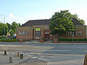 Aspley Library |
|
| Population | 17,622 (Ward 2011) |
| OS grid reference | SK 53645 42405 |
| Unitary authority | |
| Ceremonial county | |
| Region | |
| Country | England |
| Sovereign state | United Kingdom |
| Post town | NOTTINGHAM |
| Postcode district | NG8 |
| Police | Nottinghamshire |
| Fire | Nottinghamshire |
| Ambulance | East Midlands |
| EU Parliament | East Midlands |
| UK Parliament |
|
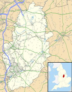
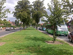
Aspley is a neighbourhood and a local area (called a ward) in the city of Nottingham, Nottinghamshire, England. It's located about 3 miles (4.8 km) west of Nottingham City Centre. Aspley is part of the Nottingham City Council area. It sits south of Bulwell, west of Basford, and north of Bilborough. The main road running through Aspley is the A610. In 2011, about 17,622 people lived here.
For many centuries, Aspley was just a few small settlements. It was home to two important buildings: Broxtowe Hall and Aspley Hall. In the early 1900s, Nottingham City Council bought land here. They then built a large housing area, turning Aspley into the neighbourhood we see today.
Aspley includes three main housing areas: Aspley, Broxtowe (not to be confused with the larger area called Broxtowe), and Bells Lane estate. Aspley has many shops, a local library, and good bus links. You can easily travel by bus to Nottingham City Centre and other nearby places.
Contents
History of Aspley
The first time Aspley was written about was in 1108. It was called 'Aspeleia,' which means a place with Aspen trees.
Aspley Hall
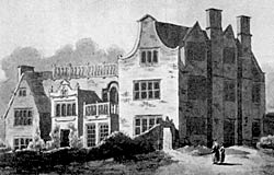
Aspley Hall, originally known as 'Asshelepley Halle,' was built before the 1500s. It was first used to house monks from nearby Lenton. They had to leave their old homes because of a big change in England called the dissolution of the monasteries in 1538. After that, many different families owned the hall. The most famous owners were the wealthy Willoughby family, who also owned Wollaton Hall nearby.
The Willoughby family managed Aspley Hall until 1925. Then, a person named Alderman G. E. Taylor bought it. After he passed away in 1965, the hall became run down. It was eventually taken down in 1968. Now, several houses stand where the hall used to be.
Broxtowe Hall
Broxtowe Hall was located where Broxtowe Lane is today. It was taken down in 1937. The name Broxtowe comes from Brocul, who was an ancient landholder. The area was even one of the six "wapentakes" (old local government areas) of Nottinghamshire. This happened when King Alfred divided England into counties.
The earliest mention of Broxtowe Hall is from the 1000s. Gifts from Gilbert, son of Eustachius de Broculstowe, were sent to Lenton Priory. Centuries later, the famous Arctic explorer Sir Hugh Willoughby lived there. In 1590, the hall was owned by Thomas Helwys. He helped start the General Baptist church. Broxtowe Hall became a safe place for religious groups like the Puritans. People like John Smyth, who became a close friend of Helwys, found refuge there.
During the English Civil War, Broxtowe Hall was a stronghold for the Parliament's side. It was led by Captain Thornhagh. Aspley Hall, on the other hand, was used by the Willoughby family to support King Charles I.
Developing the Area
Before and after the housing areas were built, there was a railway called The Mineral Railway. It ran from Nuthall Road to Aspley Lane. Its main job was to carry goods and supplies to and from the local Cinderhill Colliery coal mine.
The development of Aspley began in the 1920s. The local council wanted to clear crowded, old housing areas in the city. They started buying land in 1928. Building stopped for a while because of World War II. However, construction started again after the war and was finished soon after.
Geography
 |
Kimberley | Bulwell | Basford |  |
| Strelley | Basford | |||
| Bilborough | Bilborough | Radford |
People of Aspley (Demography)
In 2001, about 15,689 people lived in Aspley. The largest group of people were 25 to 44 years old. They made up 28.8% of the population.
In 2001, the unemployment rate (people looking for jobs but not finding them) in Aspley was low, at 3%. However, this rate has increased. A group called BEST (Broxtowe Education, Skills & Training) found that unemployment rose by over 7% in eight years. This meant that over 10% of the people were not working. By June 2012, 10.7% of people were without a job.
Education
Aspley has several schools. These include Trinity School, Nottingham Girls' Academy, and Bluecoat Aspley Academy. There was also a school called William Crane Comprehensive School, which is no longer there. In 1999, it had very low exam results. It closed in 2003 because it faced many challenges, including low staff morale and low parent involvement.
Since William Crane closed, the two main primary schools in the area are Ambleside Primary School and Rosslyn Park Primary & Nursery School. Rosslyn Park has moved to a new site.
In 2012, research from the University of Nottingham showed that fewer children from Aspley and nearby areas went to university. Only 13% went, compared to the national average of 34%.
Culture and Community
Community Life
The Aspley Cinema first opened on December 18, 1932. It was special because it had Nottingham's first "panoramic screen" in 1953. Over the years, the building changed names several times. In 1957, it became the Commodore Cinema and Ballroom. The cinema part was removed a year later. In 1964, it was renamed the Commodore International. The building finally closed on August 31, 2002. It has now been taken down and replaced by a local Sainsbury's supermarket.
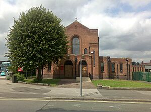
You can find The Beacon public house on Aspley Lane. Aspley Library is on Nuthall Road. Building the library started in early 1937 and it opened on November 25, 1937.
The Aspley Community and Training Centre is on Minver Crescent. It was built in 2001. Minver Crescent also has the Minver Crescent Sports Centre. This centre was built where William Crane Comprehensive School used to be. It has a sports hall and a fitness room.
Aspley has two parks: Melbourne Park (off Melbourne Road) and the King George V Playing Fields (between Beechdale Road and Aspley Lane). Melbourne Park has been home to a branch of the YMCA since 2000.
There are also two nature reserves in the area. The Quarry Holes Plantation is in the Bells Lane estate. It used to be a quarry (a place where stone is dug out). Now, it has many different plants like false oat-grass and wood avens. Work began in 2012 to clear overgrown plants there. This helps new wildlife grow.
Broxtowe Country Park is also in the area. It covers over 46 hectares (about 114 acres). This park has been here since before 1066! It was then known as Broculeston. Recently, the park has had many improvements. In February 2012, it received money for a new cycle path. This path was finished in March 2012. The new 2 km (1.2 mile) cycle path connects two main roads: Nottingham Road and Woodhouse Way. The local council is now looking into building BMX facilities in the park too.
Culture
Aspley has several churches. These include St. Margaret's Church, Aspley (built in 1936), Aspley Methodist Church, Aspley Evangelical Church (1931), Aspley Pentecostal Church (1948), and the Aspley branch of the Salvation Army. All of these are located on Aspley Lane.
Famous People from Aspley
The Willoughby family is one of the most notable families from Aspley because they owned Aspley Hall. Sir Nesbit Josiah Willoughby was born at Aspley Hall in 1777. He was a British Royal Navy officer. He became a "rear-admiral" (a high-ranking naval officer) in 1847. He fought in battles like the Battle of Copenhagen in 1801. He also commanded a ship called Néréide during the Battle of Grand Port. Henry Willoughby, 8th Baron Middleton (1817–1877) also lived at Aspley Hall.
Transport
Aspley is served by many bus services. Most of these are run by Nottingham City Transport. These bus services connect Aspley to the City of Nottingham.
Nottingham City Transport
Turquoise Line
- 77: Nottingham → Maid Marian Way → Broadmarsh → Victoria Centre → Canning Circus → Alfreton Road → Aspley Lane → Strelley
- 77C: Nottingham → Maid Marian Way → Broadmarsh → Victoria Centre → Canning Circus → Alfreton Road → Aspley Lane → Strelley → Cinderhill
- 78: Nottingham → Maid Marian Way → Broadmarsh → Victoria Centre → Canning Circus → Alfreton Road → Strelley
- 79: Nottingham → Maid Marian Way → Broadmarsh → Victoria Centre → Canning Circus → Alfreton Road → Nuthall Road → Cinderhill → Bulwell, Bus Station → Rise Park → Top Valley → Bestwood Park → Arnold
- 79A: Nottingham → Maid Marian Way → Broadmarsh → Victoria Centre → Canning Circus → Alfreton Road → Nuthall Road → Cinderhill → Bulwell, Bus Station → Rise Park → Top Valley → Bestwood Park → Arnold
Orange Line
- 35: Nottingham, Victoria Centre → Angel Row → Derby Road → QMC/Nottingham University → Wollaton Vale → Bilborough → Strelley → Cinderhill → Bulwell
 | James Van Der Zee |
 | Alma Thomas |
 | Ellis Wilson |
 | Margaret Taylor-Burroughs |


