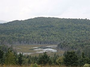
Rivière au Pin (Bécancour River tributary) facts for kids
Quick facts for kids Rivière au Pin |
|
|---|---|
| Country | Canada |
| Province | Quebec |
| Region | Centre-du-Quebec, Chaudière-Appalaches |
| MRC | Arthabaska Regional County Municipality, Les Appalaches Regional County Municipality |
| Physical characteristics | |
| Main source | Sunday Lake Saints-Martyrs-Canadiens 368 m (1,207 ft) 45°53′42″N 71°28′59″W / 45.89499°N 71.483005°W |
| River mouth | Bécancour River Irlande 194 m (636 ft) 46°03′30″N 71°28′32″W / 46.05833°N 71.47556°W |
| Length | 31.0 km (19.3 mi) |
| Basin features | |
| Progression | Bécancour River, St. Lawrence River |
| Tributaries |
|
The Rivière au Pin (which means Pine River in English) is a river in Quebec, Canada. It flows into the Bécancour River, which then flows into the St. Lawrence River.
The Pine River flows through different areas called Regional County Municipalities (MRCs):
- In the Arthabaska Regional County Municipality, it passes through Saints-Martyrs-Canadiens.
- In the Les Appalaches Regional County Municipality, it flows through Saint-Jacques-le-Majeur-de-Wolfestown, Disraeli (parish), Saint-Julien, and Irlande.
Contents
About the Pine River's Path
Where the River Starts
The Pine River begins at Sunday Lake. This lake is about 2.5 kilometers (1.6 miles) long. It sits at an elevation of 367 meters (1,204 feet) above sea level.
Sunday Lake is located in the town of Saints-Martyrs-Canadiens. You can find it north of Mont Louise (Arthabaska) and northeast of the village of Saints-Martyrs-Canadiens.
Rivers and Lakes Nearby
The areas around the Pine River that collect water are called watersheds. Here are some of the main ones:
- To the north: The Bécancour River and William Lake.
- To the east: The Bécancour River, Lac à la Truite, and the Coleraine River.
- To the south: The Coulombe North River.
- To the west: The Blanche River (rivière au Pin tributary), Nicolet River, and Bulstrode River.
The River's Journey
The Pine River flows for about 31 kilometers (19.3 miles). Its journey can be split into two main parts:
Upper Part of the Pine River
This first part of the river is about 12.7 kilometers (7.9 miles) long.
- It flows northeast for 0.9 kilometers (0.6 miles), going through Breeches Lake.
- Then it continues northeast for 3.3 kilometers (2.1 miles) to the end of the lake.
- Next, it flows north for 2.2 kilometers (1.4 miles), crossing a small lake called "Mud Pond."
- It goes northward for 1.1 kilometers (0.7 miles) to the end of Petit lac Long.
- The river then flows northeast for 2.4 kilometers (1.5 miles).
- Finally, it turns north for 2.8 kilometers (1.7 miles) in this upper section.
Lower Part of the Pine River
After the upper section, the Pine River continues its journey for about 18.3 kilometers (11.4 miles).
- It flows north for 2.7 kilometers (1.7 miles) to a road bridge.
- Then it goes northward for 1.9 kilometers (1.2 miles) until Vimy Creek joins it.
- It turns westward for 4.1 kilometers (2.5 miles) to meet the Blanche River.
- The river flows north for 1.3 kilometers (0.8 miles).
- It continues north for 3.8 kilometers (2.4 miles) to another road.
- The last part of the river flows north for about 4.5 kilometers (2.8 miles), winding through a marshy area.
Where the River Ends
The Pine River eventually flows into the Bécancour River. This meeting point is in a marshy area. It is about 1.5 kilometers (0.9 miles) upstream from a place called Stater Pond. It is also near Cranberry hamlet and Mont Dillon.
Why the River is Called Pine River
The name "Rivière au Pin" (Pine River) comes from the history of the area. Long ago, logging, especially cutting down pine trees, was very important for people settling in the Appalachian region.
The name "Rivière aux Pins" was first seen on a map of the Ireland area in 1883.
The official name, "Rivière au Pin," was made official on December 5, 1968, by the Commission de toponymie du Québec, which is the Quebec place-names board.
 | Isaac Myers |
 | D. Hamilton Jackson |
 | A. Philip Randolph |


