Roberson Creek (Haw River tributary) facts for kids
Quick facts for kids Roberson Creek |
|
|---|---|
|
Location of Roberson Creek mouth
|
|
| Other name(s) | Tributary to Haw River |
| Country | United States |
| State | North Carolina |
| County | Chatham |
| City | Pittsboro |
| Physical characteristics | |
| Main source | divide between Roberson Creek and Rocky River about 0.5 miles northeast of Round Top Mountain 460 ft (140 m) 35°42′04″N 079°13′34″W / 35.70111°N 79.22611°W |
| River mouth | Haw River B. Everett Jordan Lake 217 ft (66 m) 35°42′09″N 079°05′02″W / 35.70250°N 79.08389°W |
| Length | 11.81 mi (19.01 km) |
| Basin features | |
| Progression | east |
| River system | Haw River |
| Basin size | 28.61 square miles (74.1 km2) |
| Tributaries |
|
| Bridges | Alston Chapel Road, NC 902, US 15, Hanks Chapel Road |
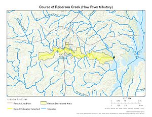
Roberson Creek is a stream in North Carolina, United States. It flows for about 11.81 mi (19.01 km), which is nearly 12 miles long. This creek is a "third-order tributary" to the Haw River. This means it's a smaller stream that flows into a bigger river, and it has other smaller streams flowing into it. Roberson Creek is located in Chatham County, North Carolina.
Contents
About Roberson Creek
Roberson Creek is an important part of the local water system in Chatham County. It helps carry water from the land into larger rivers and lakes.
Other Names for Roberson Creek
Sometimes, creeks and rivers have more than one name, or their names change over time. Historically, Roberson Creek has also been known by the name:
- Robeson Creek
Where Roberson Creek Flows
Roberson Creek starts near a place called Round Top Mountain in Chatham County, North Carolina. From there, it flows generally towards the east. Its journey ends when it flows into the Haw River. The place where it joins the Haw River is at B. Everett Jordan Lake. This creek actually forms one of the "arms" or branches of Jordan Lake.
Understanding the Roberson Creek Watershed
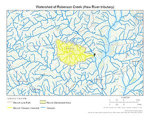
A watershed is like a big bowl or area of land where all the rain and water eventually drain into a specific river, lake, or ocean. The watershed for Roberson Creek covers about 28.61 square miles (74.1 km2) of land.
- Rainfall: This area gets a good amount of rain, about 47.4 inches every year.
- Wetness Index: It has a wetness index of 413.14, which helps scientists understand how much water the land holds.
- Forests: About 70% of the land in the Roberson Creek watershed is covered by forests. These forests are important because they help filter the water and provide homes for wildlife.
Images for kids
 | Bayard Rustin |
 | Jeannette Carter |
 | Jeremiah A. Brown |


