Roquelaure-Saint-Aubin facts for kids
Quick facts for kids
Roquelaure-Saint-Aubin
|
||
|---|---|---|
|
||
| Country | France | |
| Region | Occitanie | |
| Department | Gers | |
| Canton | Gimone-Arrats | |
| Area
1
|
4.21 km2 (1.63 sq mi) | |
| Population
(Jan. 2020)
|
102 | |
| • Density | 24.23/km2 (62.8/sq mi) | |
| Time zone | UTC+01:00 (CET) | |
| • Summer (DST) | UTC+02:00 (CEST) | |
| INSEE/Postal code |
32349 /32430
|
|
| Elevation | 160–211 m (525–692 ft) (avg. 190 m or 620 ft) |
|
| 1 French Land Register data, which excludes lakes, ponds, glaciers > 1 km2 (0.386 sq mi or 247 acres) and river estuaries. | ||
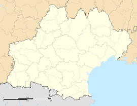
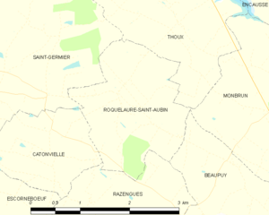
Roquelaure-Saint-Aubin (Occitan: Ròcalaura Sent Aubin) is a small and charming village located in the southwestern part of France. It is part of the Gers department, which is known for its beautiful countryside and quiet towns. This village is a "commune," which is like a local area with its own government, similar to a small town or parish.
Where is Roquelaure-Saint-Aubin?
Roquelaure-Saint-Aubin is nestled in the French countryside. It has a varied landscape, with its lowest point at 160 meters (about 525 feet) above sea level. Its highest point reaches 211 meters (about 692 feet). The village covers an area of 4.21 square kilometers (about 1.6 square miles).
How Many People Live Here?
The number of people living in Roquelaure-Saint-Aubin has changed over the years. In 1962, there were 67 residents. The population dropped to 44 people in 1975.
| Historical population | ||
|---|---|---|
| Year | Pop. | ±% |
| 1962 | 67 | — |
| 1968 | 47 | −29.9% |
| 1975 | 44 | −6.4% |
| 1982 | 58 | +31.8% |
| 1990 | 54 | −6.9% |
| 1999 | 60 | +11.1% |
| 2008 | 106 | +76.7% |
By 1982, the population grew to 58. It then went down slightly to 54 in 1990. In 1999, 60 people lived in the village. By 2008, the population had increased to 106. As of January 2020, there were 102 people living in Roquelaure-Saint-Aubin.
Learn More
 In Spanish: Roquelaure-Saint-Aubin para niños


