Roscoe, South Dakota facts for kids
Quick facts for kids
Roscoe, South Dakota
|
|
|---|---|
|
City
|
|

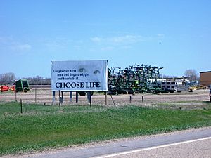
Billboard and farmland in Roscoe, May 2007
|
|

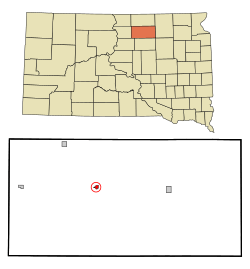
Location in Edmunds County and the state of South Dakota
|
|
| Country | United States |
| State | South Dakota |
| County | Edmunds |
| Founded | 1877 |
| Area | |
| • Total | 0.38 sq mi (0.99 km2) |
| • Land | 0.38 sq mi (0.99 km2) |
| • Water | 0.00 sq mi (0.00 km2) |
| Elevation | 1,834 ft (559 m) |
| Population
(2020)
|
|
| • Total | 269 |
| • Density | 704.19/sq mi (271.91/km2) |
| Time zone | UTC-6 (Central (CST)) |
| • Summer (DST) | UTC-5 (CDT) |
| ZIP code |
57471
|
| Area code(s) | 605 |
| FIPS code | 46-55820 |
| GNIS feature ID | 1267554 |
Roscoe is a small city located in the middle of Edmunds County, South Dakota, in the United States. In 2020, about 269 people lived there.
The city of Roscoe was started in 1877. It was named after Roscoe Conkling, who was a very important politician. He served as a United States Senator for New York.
Contents
Geography of Roscoe
Roscoe is a small city in terms of its size. The United States Census Bureau reports that the city covers an area of about 0.47 square miles (1.2 square kilometers). All of this area is land, meaning there are no large lakes or rivers within the city limits.
Roscoe's Climate and Weather
Roscoe experiences a wide range of weather throughout the year. Summers can be quite warm, while winters are very cold. The area gets a fair amount of rain, especially in the spring and summer months. Snowfall is common during the winter.
| Climate data for Roscoe, South Dakota (1991−2020 normals, extremes 1935−present) | |||||||||||||
|---|---|---|---|---|---|---|---|---|---|---|---|---|---|
| Month | Jan | Feb | Mar | Apr | May | Jun | Jul | Aug | Sep | Oct | Nov | Dec | Year |
| Record high °F (°C) | 59 (15) |
68 (20) |
83 (28) |
94 (34) |
102 (39) |
107 (42) |
112 (44) |
108 (42) |
102 (39) |
93 (34) |
77 (25) |
62 (17) |
112 (44) |
| Mean daily maximum °F (°C) | 21.4 (−5.9) |
26.1 (−3.3) |
38.7 (3.7) |
54.2 (12.3) |
66.9 (19.4) |
76.8 (24.9) |
82.8 (28.2) |
81.4 (27.4) |
72.6 (22.6) |
56.7 (13.7) |
39.8 (4.3) |
26.4 (−3.1) |
53.7 (12.1) |
| Daily mean °F (°C) | 12.3 (−10.9) |
16.4 (−8.7) |
28.3 (−2.1) |
42.1 (5.6) |
54.9 (12.7) |
65.5 (18.6) |
70.8 (21.6) |
68.8 (20.4) |
59.6 (15.3) |
45.0 (7.2) |
29.9 (−1.2) |
17.8 (−7.9) |
42.6 (5.9) |
| Mean daily minimum °F (°C) | 3.2 (−16.0) |
6.7 (−14.1) |
17.9 (−7.8) |
29.9 (−1.2) |
43.0 (6.1) |
54.2 (12.3) |
58.7 (14.8) |
56.2 (13.4) |
46.6 (8.1) |
33.3 (0.7) |
19.9 (−6.7) |
9.2 (−12.7) |
31.6 (−0.2) |
| Record low °F (°C) | −37 (−38) |
−34 (−37) |
−24 (−31) |
1 (−17) |
17 (−8) |
29 (−2) |
38 (3) |
36 (2) |
21 (−6) |
−2 (−19) |
−19 (−28) |
−35 (−37) |
−37 (−38) |
| Average precipitation inches (mm) | 0.54 (14) |
0.66 (17) |
0.95 (24) |
1.84 (47) |
3.16 (80) |
3.70 (94) |
3.24 (82) |
2.30 (58) |
1.91 (49) |
1.79 (45) |
0.69 (18) |
0.64 (16) |
21.42 (544) |
| Average snowfall inches (cm) | 8.1 (21) |
8.8 (22) |
7.3 (19) |
5.8 (15) |
0.1 (0.25) |
0.0 (0.0) |
0.0 (0.0) |
0.0 (0.0) |
0.0 (0.0) |
2.3 (5.8) |
5.9 (15) |
8.7 (22) |
47.0 (119) |
| Average precipitation days (≥ 0.01 in) | 6.9 | 6.6 | 6.6 | 8.1 | 10.7 | 11.8 | 9.9 | 8.0 | 7.4 | 7.4 | 5.5 | 6.2 | 95.1 |
| Average snowy days (≥ 0.1 in) | 7.3 | 6.9 | 4.6 | 2.4 | 0.1 | 0.0 | 0.0 | 0.0 | 0.0 | 1.3 | 3.7 | 6.7 | 33.0 |
| Source: NOAA | |||||||||||||
People Living in Roscoe (Demographics)
The number of people living in Roscoe has changed over the years. Here's a quick look at the population from different census reports:
| Historical population | |||
|---|---|---|---|
| Census | Pop. | %± | |
| 1890 | 114 | — | |
| 1900 | 92 | −19.3% | |
| 1910 | 357 | 288.0% | |
| 1920 | 459 | 28.6% | |
| 1930 | 491 | 7.0% | |
| 1940 | 608 | 23.8% | |
| 1950 | 726 | 19.4% | |
| 1960 | 532 | −26.7% | |
| 1970 | 398 | −25.2% | |
| 1980 | 370 | −7.0% | |
| 1990 | 362 | −2.2% | |
| 2000 | 324 | −10.5% | |
| 2010 | 329 | 1.5% | |
| 2020 | 269 | −18.2% | |
| U.S. Decennial Census | |||
Roscoe's Population in 2010
In 2010, the census showed that 329 people lived in Roscoe. There were 153 households, which are groups of people living together in one home. About 83 of these households were families.
- Most people living in Roscoe (97%) were White.
- A small number of people were African American (0.9%) or Native American (0.3%).
- About 4.6% of the population identified as Hispanic or Latino.
About 26.1% of households had children under 18 living with them. Many households (42.5%) were made up of people living alone. Also, 24.8% of households had someone aged 65 or older living by themselves. The average age of people in Roscoe was 38.2 years.
Getting Around Roscoe (Transportation)
Roscoe is connected by two main roads that help people travel in and out of the city:
 US 12 (U.S. Route 12)
 SD 247 (South Dakota Highway 247)
See also
 In Spanish: Roscoe (Dakota del Sur) para niños
 | Precious Adams |
 | Lauren Anderson |
 | Janet Collins |

