
Rose City, Michigan facts for kids
Quick facts for kids
Rose City, Michigan
|
|
|---|---|
| City of Rose City | |
.jpg)
Looking north along M-33 toward Main Street
|
|

Location within Ogemaw County
|
|

Rose City, Michigan
Location in Michigan

Rose City, Michigan
Location in the United States
|
|
| Country | United States |
| State | Michigan |
| County | Ogemaw |
| Settled | 1875 |
| Incorporated | 1910 |
| Government | |
| • Type | Mayor–council |
| Area | |
| • Total | 1.08 sq mi (2.81 km2) |
| • Land | 1.08 sq mi (2.79 km2) |
| • Water | 0.01 sq mi (0.02 km2) |
| Elevation | 958 ft (292 m) |
| Population
(2020)
|
|
| • Total | 577 |
| • Density | 535.75/sq mi (206.90/km2) |
| Time zone | UTC-5 (Eastern (EST)) |
| • Summer (DST) | UTC-4 (EDT) |
| ZIP code(s) |
48654
|
| Area code(s) | 989 |
| FIPS code | 26-69680 |
| GNIS feature ID | 636193 |
Rose City is a small city in Ogemaw County, Michigan. In 2020, about 577 people lived there. It is one of the smallest cities in Michigan.
Contents
History of Rose City
Rose City started as a logging town called Churchill. It was first settled in 1875 by Hiram Hodge. He built a hotel, but later left the area.
How Rose City Got Its Name
In 1875, the Rose family, including Allan S. Rose, moved to the area from New York. Allan S. Rose and M.H. French started a new settlement. They called their company the "French and Rose Land Company." They built a general store, cabins, and boarding houses. The town was busy with logging operations, cutting down large pine trees.
The post office opened on September 8, 1875, still named Churchill. But on July 23, 1892, the town moved a little to the east. The post office name changed to Rose City, honoring the Rose family. Rose City officially became a city in 1905.
The Big Fire and Changes
In 1910, a huge fire destroyed the main business area of Rose City. Thirty buildings burned down in just one hour. This fire ended Rose City's time as a major logging center. Many businesses decided not to rebuild.
From 1945 to 1960, the city improved a lot. They built a sewer system, paved streets, and added streetlights. Rose City is known for its many artesian wells, which are natural springs that bring water to the surface. Because of these wells, Rose City was once called "The Home of Artesian Wells."
In 1962, the Rose City school district joined with West Branch. They became the West Branch-Rose City Area Schools district.
Historic Sites in Rose City
In 2002, Rose City and the place where the big fire happened became Michigan State Historic Sites. A special marker was put up in Rose City Park to tell its story. The Cleveland Park Pavilion, near Rose City Park, is also a registered historic site.
Geography and Nature
Rose City covers about 1.09 square miles (2.81 square kilometers). Most of this area is land, with a small amount of water.
Houghton Creek, a small stream, flows through part of the city. This creek eventually joins the Rifle River. The Rifle River State Recreation Area is only about 3 miles (5 km) east of Rose City. This park is great for outdoor fun all year, like canoeing, swimming, fishing, and snowmobiling. There are also 75 lakes within 15 miles of Rose City.
Population Information
Rose City has seen its population change over the years:
| Historical population | |||
|---|---|---|---|
| Census | Pop. | %± | |
| 1910 | 542 | — | |
| 1920 | 331 | −38.9% | |
| 1930 | 338 | 2.1% | |
| 1940 | 355 | 5.0% | |
| 1950 | 446 | 25.6% | |
| 1960 | 435 | −2.5% | |
| 1970 | 530 | 21.8% | |
| 1980 | 661 | 24.7% | |
| 1990 | 686 | 3.8% | |
| 2000 | 721 | 5.1% | |
| 2010 | 653 | −9.4% | |
| 2020 | 577 | −11.6% | |
| U.S. Decennial Census | |||
Rose City in 2010
In 2010, 653 people lived in Rose City. There were 238 households. About 35.7% of these households had children under 18 living there. The average age of people in Rose City was 44.6 years old.
Most people in Rose City were White (96.9%). A small number were Native American (1.2%) or Asian (0.3%). About 1.7% of the population was Hispanic or Latino.
Images for kids
-
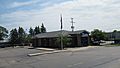
U.S. Post Office in Rose City
-
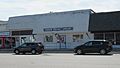
Rose City City Hall
-
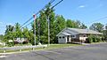
Ogemaw District Library
-
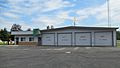
Rose City Police and Fire Department
-
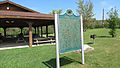
Rose City state historic marker
-
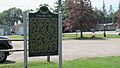
The Big Fire state historic marker


.jpg)


_historic_marker.jpg)
See also
 In Spanish: Rose City (Míchigan) para niños
