Rosedale, South Australia facts for kids
Quick facts for kids RosedaleSouth Australia |
|||||||||||||||
|---|---|---|---|---|---|---|---|---|---|---|---|---|---|---|---|

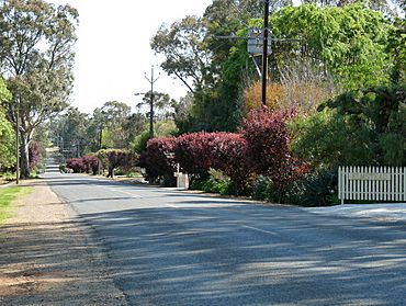
Rosedale street view
|
|||||||||||||||
| Established | 1849 | ||||||||||||||
| Postcode(s) | 5350 | ||||||||||||||
| Location | |||||||||||||||
| LGA(s) |
|
||||||||||||||
| State electorate(s) | Schubert | ||||||||||||||
| Federal Division(s) | Barker | ||||||||||||||
|
|||||||||||||||
|
|||||||||||||||
| Footnotes |
|
||||||||||||||
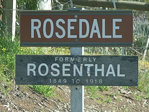
Rosedale is a small town located in the beautiful Barossa Valley in South Australia. It is known for its lovely scenery and quiet charm. Before 1918, Rosedale had a different name: Rosenthal. This name was changed as part of a rule to rename places that had German names during World War I.
Exploring Rosedale
Rosedale is found in the southwestern part of the Barossa Valley. This region is famous for its vineyards and pretty landscapes.
Where is Rosedale Located?
A special thing about Rosedale is that the North Para River flows right through it. This river also acts as a border between two different local government areas. A local government area is like a local council that manages services for a specific region.
- North of the river, Rosedale is part of the Light Regional Council.
- South of the river, it belongs to the Barossa Council.
Just outside the town, on the north side of the river, you can find the Turretfield Research Centre. This center is a place where scientists and researchers study things related to farming and agriculture.
 | Aurelia Browder |
 | Nannie Helen Burroughs |
 | Michelle Alexander |


