Rossville, Illinois facts for kids
Quick facts for kids
Rossville
|
|
|---|---|
|
Village (United States)
|
|

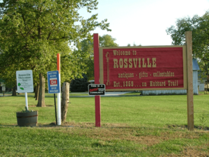
Welcome sign at the north edge of town, 2007
|
|

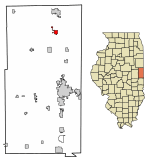
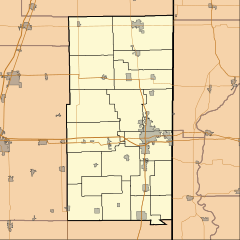
Location of Rossville in Vermilion County, Illinois.
|
|
| Country | |
| State | |
| County | Vermilion |
| Township | Grant, Ross |
| Post office established | 1839 |
| Founded | 1862 |
| Area | |
| • Total | 1.40 sq mi (3.62 km2) |
| • Land | 1.40 sq mi (3.62 km2) |
| • Water | 0.00 sq mi (0.00 km2) |
| Elevation | 679 ft (207 m) |
| Population
(2020)
|
|
| • Total | 1,221 |
| • Density | 873.39/sq mi (337.32/km2) |
| ZIP code |
60963
|
| Area code(s) | 217 |
| FIPS code | 17-65962 |
| GNIS ID | 2399127 |
| Website | Village Website |
Rossville is a small village located in Vermilion County, Illinois, United States. It is part of Ross Township. In 2020, about 1,221 people lived there. Rossville is also part of the larger Danville, Illinois area.
Contents
Discovering Rossville's Past
How Rossville Got Its Name
The area where Rossville now stands was first known as Liggett's Grove. This name honored John Liggett, who built a place for travelers to stay in 1829. His cabin was on the Hubbard Trail. This trail was an important trading route from Chicago to Danville, Illinois.
In 1833, the trail became the first state highway, now known as Illinois Route 1. Later, in 1914, it became part of the famous Dixie Highway.
Early Settlers and Growth
In 1838, Alvan Gilbert bought Liggett's farm. The next year, he became the postmaster when a new post office opened. Rossville officially became a village in August 1859. The village and Ross Township were named after Jacob Ross, an early settler in the area.
A Downtown Fire
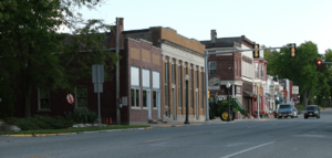
In February 2004, a fire broke out in the downtown area. It sadly destroyed several old buildings and antique shops. Rossville was known for these shops.
Where is Rossville Located?
Rossville covers an area of about 1.4 square miles (3.6 square kilometers). All of this area is land. It is located at the crossing of Illinois Route 1 and County Road 14. Rossville is about 7 miles south of Hoopeston, Illinois and 15 miles north of Danville, Illinois. A railroad line, operated by CSX Transportation, runs along the east side of the village.
Who Lives in Rossville?
| Historical population | |||
|---|---|---|---|
| Census | Pop. | %± | |
| 1880 | 768 | — | |
| 1890 | 879 | 14.5% | |
| 1900 | 1,435 | 63.3% | |
| 1910 | 1,422 | −0.9% | |
| 1920 | 1,588 | 11.7% | |
| 1930 | 1,453 | −8.5% | |
| 1940 | 1,428 | −1.7% | |
| 1950 | 1,382 | −3.2% | |
| 1960 | 1,470 | 6.4% | |
| 1970 | 1,420 | −3.4% | |
| 1980 | 1,363 | −4.0% | |
| 1990 | 1,334 | −2.1% | |
| 2000 | 1,217 | −8.8% | |
| 2010 | 1,331 | 9.4% | |
| 2020 | 1,221 | −8.3% | |
| U.S. Decennial Census | |||
Population Changes Over Time
In 2000, there were 1,317 people living in Rossville. The population density was about 905 people per square mile. By 2020, the population was 1,221.
A Look at the Community
The average age in Rossville in 2000 was 41 years old. About 23.3% of the people were under 18. About 18.6% were 65 years or older. Most people in the village were White (97.78%). A small percentage were from other racial backgrounds.
Fun Things to Do in Rossville
Local Attractions
Rossville has several interesting places to visit. You can explore the Rossville Historical Society Museum. There is also the Rossville Railroad Depot Museum. For outdoor fun, there is Christman Park. Don't forget to see the Hubbard Trail Monument. South of Rossville, you can find Historic Mann's Chapel, built in 1857. There is also an original State Road Mile Marker from 1833.
Community Events
The Rossville Community Organization hosts many fun events. These include "Free A-Train week" in September. "Drivin' The Dixie Days" happens in June. And "Christmas in the Village" is held on the first weekend of December.
Annual Truck and Tractor Pull
Rossville is famous for its annual truck and tractor pull event. This exciting event takes place in Christman Park. Drivers compete in different divisions. These include the National Tractor Pull Association (NTPA) and Illiana Pullers Association (IPA). There are also local classes. This event brings in large crowds and helps raise money for FFA scholarships.
Famous People from Rossville
- Tom Merritt (1911-1991) was born in Rossville. He became an Illinois state senator and a well-known politician.
See also
 In Spanish: Rossville (Illinois) para niños
 | Bayard Rustin |
 | Jeannette Carter |
 | Jeremiah A. Brown |


