Ruamahanga River facts for kids
Quick facts for kids Ruamahanga River |
|
|---|---|

The Ruamahanga River system
|
|
| Country | New Zealand |
| Physical characteristics | |
| Main source | Mount Dundas, Tararua Ranges 1,504 m (4,934 ft) |
| River mouth | Palliser Bay, Cook Strait 0 m (0 ft) |
| Length | 124 km (77 mi) |
| Basin features | |
| Basin size | 3,470 km2 (1,340 sq mi) |
| Tributaries |
|
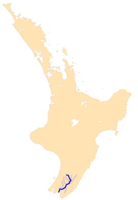
The Ruamahanga River is an important river in the southeastern part of New Zealand's North Island. It flows for about 124 kilometers (77 miles) from its source in the mountains all the way to the sea. This river helps shape the land and is home to different types of wildlife.
Contents
Ruamahanga River: A Journey Through New Zealand
The Ruamahanga River is one of the main rivers in the Wairarapa region of New Zealand. It plays a big role in the local environment and has been important for people living there for a long time.
Where Does the River Start and End?
The Ruamahanga River begins high up in the Tararua Ranges. This is a mountain range located northwest of a town called Masterton. The river's source is Mount Dundas, which is about 1,504 meters (4,934 feet) high.
From these mountains, the river flows south. It then turns southwest for about 130 kilometers (81 miles). Finally, it empties into the Cook Strait at Palliser Bay. This is the body of water that separates New Zealand's North and South Islands.
The River's Path and Friends
As the Ruamahanga River flows, it passes near several towns. These include Masterton and Martinborough. Many other rivers join the Ruamahanga along its journey. These smaller rivers are called tributaries.
One of its friends is the Tauweru River, which joins near a place called Gladstone. Other rivers that flow into the Ruamahanga include the Waipoua River, the Waingawa River, and the Waiohine River.
Wetlands and Palliser Bay
In its lower parts, the Ruamahanga River flows across a wide, flat area called a floodplain. This area can sometimes get covered with water when the river overflows. The river then reaches the wetlands around Lake Wairarapa. Wetlands are special areas of land that are always wet.
The river used to flow directly into Lake Wairarapa. However, its path has been changed. Now, the river flows past the lake and drains into Palliser Bay. This bay is about 10 kilometers (6 miles) further south.
Keeping the River Clean
Sadly, the Ruamahanga River has become polluted. This pollution comes from things like sewage and farming activities. Because of this, it is not safe for people to swim in the river or its smaller streams. People are working to make the river cleaner so that it can be enjoyed safely again.
 | Laphonza Butler |
 | Daisy Bates |
 | Elizabeth Piper Ensley |

