Rumicucho facts for kids
| Location | Ecuador |
|---|---|
| Coordinates | 0°00′43″N 78°25′53″W / 0.01194°N 78.43139°W |
| Type | Fort and Settlement |
| History | |
| Founded | c. 1480s CE |
| Site notes | |
| Condition | In ruins |
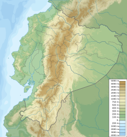
Rumicucho or Pucara de Rumicucho is an ancient site built by the Inca Empire. It is located in San Antonio de Pichincha, near Quito, Ecuador. A pucara is a type of hilltop fortress. Rumicucho is about 23 kilometers (14 miles) north of Quito. It sits at an elevation of 2,401 meters (7,877 feet).
The name Rumicucho comes from the Quechua language. It means "stone corner." This name might refer to its important location. It was between the Yumbo people's land to the east and the Pais Caranqui chiefdoms to the north.
The Incas likely built Rumicucho between 1480 and 1500. They controlled this area until the Spanish arrived in the 1530s. Rumicucho was also called Lulumbamba, meaning "fertile plain." This refers to the valley nearby, which was once used for farming. Today, Rumicucho is a popular place for tourists to visit.
Contents
Why Rumicucho Was Important
Rumicucho is one of over 100 known pucaras in northern Ecuador. This large number shows how much the local people resisted the Incas. Many of these pucaras were built by local people long before the Incas arrived.
The Incas either built new pucaras or made existing ones stronger. They used these forts as bases to conquer the chiefdoms of the Pais Caranqui. The Cayambe people were likely the strongest of these groups. The Inca war against the Pais Caranqui lasted for many years. The Incas finally conquered northern Ecuador in the early 1500s.
What Rumicucho Looks Like
The Rumicucho site is about 380 meters (1,247 feet) long and 75 meters (246 feet) wide. People lived here before the Incas. The Incas then added their own building styles to the existing structures.
Unlike many pucaras, Rumicucho is not on the highest point of the land. It is on a smaller hill. Its location made it a crossroads for travel and trade, as well as a fortress. Rumicucho is one of the few pucaras in Ecuador where many Inca items have been found.
These items include everyday things like cloth and ceramic pots. These pots were used to make Chicha, a fermented Inca drink. Tools made from camelid bones, seashells, and metal objects were also found. Rumicucho was used for many things. It was a place to live, for ceremonies, to control trade, and for defense.
Terraces and Their Uses
The archaeological site has five terraces. These terraces step up the hill, one after another. Each terrace had a special purpose. The first and second terraces were used for rituals and large gatherings. The third terrace was for ceremonies. Terraces one and two were also likely used for homes and workshops.
Astronomy at Rumicucho
Rumicucho was probably also used to study the stars and sun. It is about 1 kilometer (0.6 miles) from the equator. It lines up perfectly with two snow-capped volcanoes: Cayambe to the east and Cotopaxi to the south. This suggests it was a sacred place.
The Incas and earlier peoples knew a lot about astronomy. They often built their sites in places good for watching the sun. This included the equatorial solstice. They called this "the day when man has no shadow."
See also
 In Spanish: Pucará de Rumicucho para niños
 | George Robert Carruthers |
 | Patricia Bath |
 | Jan Ernst Matzeliger |
 | Alexander Miles |


