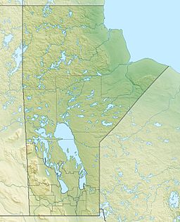
Rushforth Lake facts for kids
Quick facts for kids Rushforth Lake |
|
|---|---|
| Location | Census Division No. 22 - Thompson-North Central, Northern Region, Manitoba |
| Coordinates | 54°12′29″N 96°03′07″W / 54.20806°N 96.05194°W |
| Primary inflows | Bolton River |
| Primary outflows | Bolton River |
| Basin countries | Canada |
| Max. length | 11 km (6.8 mi) |
| Max. width | 1.4 km (0.87 mi) |
| Surface elevation | 218 m (715 ft) |
Rushforth Lake is a lake found in the northern part of Manitoba, Canada. It's a key part of the larger Hayes River water system. The lake is about 11 kilometres (6.8 mi) long and 1.4 kilometres (0.9 mi) wide. It sits at an elevation of 218 metres (715 ft) above sea level. The main river flowing into and out of Rushforth Lake is the Bolton River.
Where is Rushforth Lake Located?
Rushforth Lake is in a region of Manitoba known as the Northern Region. Specifically, it's in Census Division No. 22 - Thompson-North Central. This area is known for its many lakes, rivers, and vast wilderness.
How Water Flows Through the Lake
The Bolton River is very important to Rushforth Lake. It acts as both the main river that brings water into the lake and the main river that carries water out of it. This means the water in Rushforth Lake is always moving.
Journey to Hudson Bay
The water from Rushforth Lake, carried by the Bolton River, eventually flows into a much larger lake called Gods Lake. From Gods Lake, the water continues its journey through the Gods River. Finally, the Gods River joins the Hayes River, which then empties into Hudson Bay. This shows how Rushforth Lake is connected to a huge network of waterways across Canada.
 | Delilah Pierce |
 | Gordon Parks |
 | Augusta Savage |
 | Charles Ethan Porter |


