Russell–Brasstown Scenic Byway facts for kids
Quick facts for kids
[[File:|x70px|alt= marker]] |
||||
|---|---|---|---|---|
| Lua error in Module:Infobox_road/map at line 15: attempt to index field 'wikibase' (a nil value). | ||||
| Route information | ||||
| Length | 40.6 mi (65.3 km) | |||
| Component highways |
|
|||
| Major junctions | ||||
| Counterclockwise end | ||||
|
||||
| Clockwise end | ||||
| Location | ||||
| Counties: | White, Towns, Union | |||
| Highway system | ||||
| Georgia State Routes Former SR
|
||||
The Russell–Brasstown Scenic Byway is a special road in Georgia, USA. It's called a National Scenic Byway because of its amazing natural beauty. This road includes parts of several state routes like SR 17, SR 75, SR 180, and SR 75 Alternate. It also covers the entire length of SR 348.
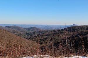
This scenic byway winds through the southern Appalachian Mountains. It's surrounded by the beautiful Chattahoochee-Oconee National Forest. Along the way, you can see incredible views from places like Brasstown Bald. You might also enjoy the cool mist from waterfalls.
Contents
Exploring the Scenic Byway Loop
The Russell–Brasstown Scenic Byway is a loop, which means it forms a circle. You can start your journey northwest of Helen. This is where SR 17/SR 75 meets SR 75 Alternate.
Following the Road North
From the start, the byway follows SR 17/SR 75 north. It goes into the Chattahoochee-Oconee National Forest. Here, it meets SR 180. The byway then turns west onto SR 180.
Detours and Western Path
You can take an optional side trip on SR 180 Spur. This road leads to the Brasstown Bald Visitor Center. Brasstown Bald is the highest point in Georgia! The byway continues west and southwest on SR 180. It reaches SR 348, also known as the Richard B. Russell Scenic Highway, in Choestoe.
Completing the Loop
From Choestoe, the byway turns southeast on SR 348. It then connects back to SR 75 Alternate. Finally, it turns northeast to return to SR 17/SR 75, completing the loop. This road is not part of the main "National Highway System." That system includes roads important for the country's economy and travel.
History of the Scenic Byway Designation
The roads that make up the Russell–Brasstown Scenic Byway have been around for a long time. They were built and improved over many years.
Early Road Development
For example, the part of SR 75 on the byway was first set up between May and August 1932. By 1939, this section had a "semi-hard surface." This means it was partly paved. By 1941, some parts were fully paved. Other roads like SR 66 and SR 180 were also established and improved over the years. By 1966, all the roads that form the byway were paved. Later, in 1982, SR 356 became SR 75 Alternate. Also, SR 66 was changed and became an extension of SR 180.
Becoming a Scenic Byway
The Russell–Brasstown Scenic Byway received its special titles over time:
- It was named a National Forest Scenic Byway on June 5, 1989.
- It became a Georgia State Scenic Byway in 1992.
- Finally, it was named a National Scenic Byway on June 15, 2000.
Major Road Connections
These are the main intersections and connections you'll find along the Russell–Brasstown Scenic Byway. They are listed starting from the southeast and going counter-clockwise around the loop.
| County | Location | Mile | Roads intersected | Notes | |
|---|---|---|---|---|---|
| White | | 0.0 | 0.0 | This is where the byway officially begins in the southeast. It's the start of SR 17/SR 75 and the end of SR 75 Alternate. | |
| Towns | Chattahoochee-Oconee National Forest | 10.3 | Here, SR 17/SR 75 ends its shared path, and SR 180 begins its shared path with the byway. | ||
| Towns–Union county line |
15.6 | 25.1 | This is the start of the road that leads to Brasstown Bald, Georgia's highest point. | ||
| Union | Choestoe | 22.0 | 35.4 | SR 180's shared path ends here, and SR 348's shared path begins. This is in the town of Choestoe. | |
| White | Chattahoochee-Oconee National Forest | 35.4 | SR 348's shared path ends here, and SR 75 Alternate's shared path begins. | ||
| 37.7 | 60.7 | This is where SR 75 Alternate ends its shared path, and SR 17/SR 75 begins its shared path again, completing the loop. | |||
| 1.000 mi = 1.609 km; 1.000 km = 0.621 mi | |||||
 | Jessica Watkins |
 | Robert Henry Lawrence Jr. |
 | Mae Jemison |
 | Sian Proctor |
 | Guion Bluford |


