Sage, Wyoming facts for kids
Quick facts for kids
Sage, Wyoming
|
|
|---|---|
| Country | United States |
| State | Wyoming |
| County | Lincoln |
| Elevation | 6,332 ft (1,930 m) |
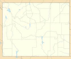
Sage is a ghost town located in the very southwest part of Lincoln County, Wyoming, in the United States. A ghost town is a place that used to be a busy community but now has very few or no people living there. Sage is found at an elevation of about 6,332 feet (1,930 meters) above sea level. This means it is quite high up, just west of the Sublette Mountains.
Getting to Sage
You can reach Sage using US Route 30. This main road goes north about 19 miles (31 km) to Cokeville. It also goes east about 25 miles (40 km) to Kemmerer. Another road, Wyoming Highway 89, runs west from Sage. It goes about 4 miles (6 km) to the border of Utah. From there, it continues another 5 miles (8 km) to Sage Creek Junction, Utah. The Union Pacific Railroad also passes through Sage. It heads east towards Rock Springs and west towards Pocatello, Idaho.
Historical Routes
Long ago, an important travel path called the Overland Stage Route passed through Sage. This route was used by stagecoaches and travelers. It ran north through Sage, coming from Fort Bridger, a historic fort in Wyoming.
Climate in Sage
The weather in Sage, Wyoming, changes a lot throughout the year. Summers are generally warm, while winters can be very cold. The area gets some rain and snow, with more precipitation in the spring and fall months.
 | Charles R. Drew |
 | Benjamin Banneker |
 | Jane C. Wright |
 | Roger Arliner Young |


