Saint-Rambert-en-Bugey facts for kids
Quick facts for kids
Saint-Rambert-en-Bugey
|
||
|---|---|---|
 |
||
|
||
| Country | France | |
| Region | Auvergne-Rhône-Alpes | |
| Department | Ain | |
| Arrondissement | Belley | |
| Canton | Ambérieu-en-Bugey | |
| Intercommunality | Vallée de l'Albarine | |
| Area
1
|
28.55 km2 (11.02 sq mi) | |
| Population
(2008)
|
2,167 | |
| • Density | 75.902/km2 (196.59/sq mi) | |
| Time zone | UTC+01:00 (CET) | |
| • Summer (DST) | UTC+02:00 (CEST) | |
| INSEE/Postal code |
01384 /01230
|
|
| Elevation | 271–819 m (889–2,687 ft) (avg. 290 m or 950 ft) |
|
| 1 French Land Register data, which excludes lakes, ponds, glaciers > 1 km2 (0.386 sq mi or 247 acres) and river estuaries. | ||
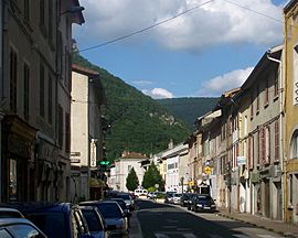
Saint-Rambert-en-Bugey is a small town, also known as a commune, located in the eastern part of France. It is found in the region called Auvergne-Rhône-Alpes. This town is part of the Ain department.
Contents
About Saint-Rambert-en-Bugey
Saint-Rambert-en-Bugey is a charming place in the Ain department. It is known for its beautiful natural surroundings. The town is nestled in the Bugey area, which is famous for its hills and valleys.
Where is Saint-Rambert-en-Bugey?
This commune is located in the eastern part of France. It is part of the Auvergne-Rhône-Alpes region. This region is one of the largest in France. Saint-Rambert-en-Bugey is also in the Ain department. Departments are like counties in other countries. The town is specifically in the Belley arrondissement. An arrondissement is a smaller administrative area within a department.
Who runs the town?
Like all communes in France, Saint-Rambert-en-Bugey has a mayor. The mayor is the head of the local government. From 2008 to 2014, Gilbert Bouchon was the mayor. The town also works with other nearby towns in a group called Vallée de l'Albarine. This helps them share resources and services.
Fun Facts and Figures
Saint-Rambert-en-Bugey covers an area of about 28.55 square kilometers. That's roughly 11 square miles. In 2008, the town had a population of 2,167 people. The town sits at an elevation of about 290 meters (951 feet) above sea level. Its lowest point is 271 meters, and its highest point reaches 819 meters.
Related pages
See also
 In Spanish: Saint-Rambert-en-Bugey para niños
 | William L. Dawson |
 | W. E. B. Du Bois |
 | Harry Belafonte |


