Salt Flat, Texas facts for kids
Quick facts for kids
Salt Flat, Texas
|
|
|---|---|
| Country | United States |
| State | Texas |
| County | Hudspeth F |
| Elevation | 3,730 ft (1,140 m) |
| Time zone | UTC−07:00 (Mountain (CST)) |
| • Summer (DST) | UTC−06:00 (MDT) |
| ZIP Code |
79847
|
| GNIS feature ID | 1367427 |
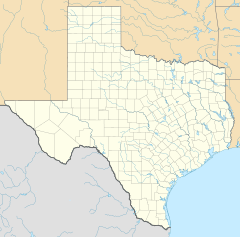
Salt Flat is a ghost town in Hudspeth County, Texas, United States. It's located in the northeastern part of the county. This small community sits along U.S. Routes 62 and 180. It is north of Sierra Blanca, which is the main town in Hudspeth County. Salt Flat is about 3,730 feet (1,137 meters) above sea level. Even though it's not officially a town with its own government, it has a ZIP Code (79847). The main office for Guadalupe Mountains National Park uses this ZIP Code, even though it's closer to another place called Pine Springs.
Contents
The Amazing Salt Deposits
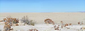
Just outside Salt Flat, you'll find a huge, flat area called a dry salt pan. It's known as Salt Flat Playa or Salt Basin. This amazing natural feature stretches across the border between New Mexico and Texas. It's about 150 miles long and 5 to 15 miles wide. This makes it one of the biggest gypsum playas in the United States!
How the Salt Pan Formed
The Salt Flat Playa is in a long valley called the Salt Basin Grabben. This valley is between the Guadalupe and Delaware Mountains to the east and the Sierra Diablo and Diablo Plateau to the west. Long, long ago, during the late Pleistocene epoch (a time period in Earth's history), this area was a lake. But over time, the climate became much drier. This caused the lake to dry up, leaving behind the salt pan we see today.
What's Under the Surface?
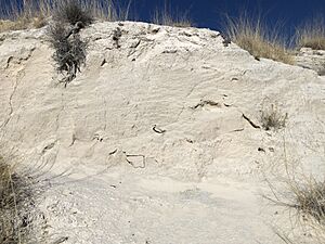
Today, there's salty water about three feet below the surface. When the weather is hot and dry, this salty water is pulled up to the surface. As the water evaporates, it leaves behind minerals. These minerals include evaporites like gypsum and halite (which is rock salt). You can also find carbonate minerals like calcite and dolomite.
Life in the Salt Pan
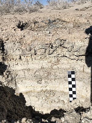
Tiny living things called Cyanobacteria (also known as blue-green algae) grow on and just below the surface when the playa is wet. If you look closely at the sediments (layers of dirt and minerals), you might see alternating light and dark bands. The light bands are rich in gypsum, while the dark bands have more dolomite.
Gypsum Dunes
When the playa is dry, especially during the summer, strong winds blow the gypsum around. This gypsum forms into large sand dunes. These dunes are a unique sight in the area.
The Salt War
The salt deposits in this area were very important a long time ago. There was even a conflict called the San Elizario Salt War. This was a disagreement over who owned these valuable salt deposits and who had the right to collect the salt.
See also
 In Spanish: Salt Flat (Texas) para niños
 | Shirley Ann Jackson |
 | Garett Morgan |
 | J. Ernest Wilkins Jr. |
 | Elijah McCoy |


