Samalayuca Dune Fields facts for kids
Quick facts for kids Samalayuca Dune Field |
|
|---|---|
| Médanos de Samalayuca | |
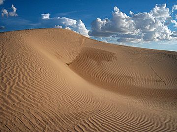
View of the Médanos de Samalayuca near Samalayuca, Chihuahua.
|
|
| Highest point | |
| Elevation | 3,872 ft (1,180 m) |
| Geography | |
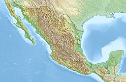
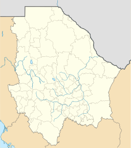
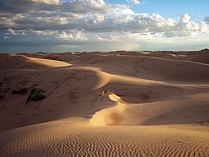
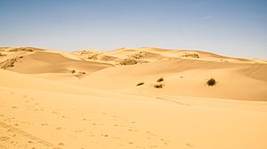
The Samalayuca Dune Fields, also known as Los Médanos (the dunes), are a huge area of sand dunes in northern Chihuahua, Mexico. These dunes are spread out across a large part of the Chihuahuan Desert, south and southeast of Ciudad Juárez. This whole area is called the Samalayuca Desert and covers about 2,000 square kilometers.
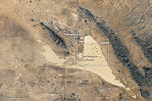
The most famous part of the Samalayuca Dune Fields is near the village of Samalayuca. These dunes are easy to spot because they are right along the main road and railway between Chihuahua City and Ciudad Juárez. They are also very tall and shaped by the wind, especially behind the Cerro de Samalayuca mountain.
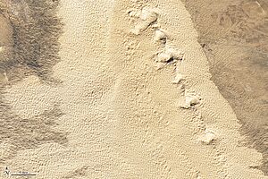
The dunes are made of almost pure quartz sand, which is a type of mineral. They look white or tan and are very fine. The wind constantly moves and reshapes them. Over time, the wind has carried sand and dropped it in natural dips in the land, forming these amazing dunes.
For hundreds of years, these sand dunes were a big challenge for travelers. They blocked the main route between Chihuahua City and "The Pass of the North" (now Ciudad Juárez and El Paso). Crossing about 30 kilometers of loose sand was very hard and dangerous before modern roads and trains. Travelers sometimes chose a longer, safer path around the dunes.
Today, the Samalayuca dunes are popular for tourism and fun activities. They are also home to many unique plants and animals that live only in this special desert environment. The sand's high purity has also caught the eye of industries.
Contents
What Are the Samalayuca Dunes?
The Samalayuca Dune Fields get their name from the nearby town of Samalayuca. This town has historical springs, which is why people settled there. The tallest dunes are close to the town, about 52 kilometers south of Ciudad Juárez. These high dunes are formed by strong winds from the northwest, which drop sand behind the Samalayuca Mountain.
Where to Find the Dunes
The most impressive parts of the Samalayuca dunes are found east and west of Mexican Federal Highway 45. This highway and a railway run through the dune area, about 30 to 60 miles south of Ciudad Juárez. You can see low dunes for many kilometers on both sides of the highway.
The very tall dunes near Samalayuca village can be seen from a distance as you drive on Highway 45. These dunes are created as the wind blows sand particles and drops them behind the Samalayuca Mountains.
Besides the famous high dunes near the village, there are other dune areas in the Samalayuca desert. Some stretch west from Samalayuca, covering a larger area than the high dunes. These extend north into the municipality of Ascension. Smaller dune fields also reach east into the municipality of Guadalupe.
Traveling the Chihuahua Trail
The Samalayuca Dune Fields lay right across the main path of the Chihuahua Trail. This trail was part of a much longer route called El Camino Real de Tierra Adentro, or "the royal road of the interior." The Chihuahua Trail went north from Chihuahua City all the way to Santa Fe, in New Mexico. From the time Santa Fe was founded in 1598, many goods and people traveled this route.
The only major river on the trail was the Rio Grande. Travelers crossed it at a shallow spot near a famous pass between the Juarez and Franklin mountains. This crossing became known as "the Pass" or "The Pass of the North" (El Paso del Norte). A town was built there, which is now Ciudad Juárez. Later, another town called El Paso del Norte was founded on the north side of the river in the United States.
About 45 miles south of "the Pass," the Chihuahua Trail ran into a 15-mile stretch of the Samalayuca dunes. The wind constantly shifted and piled up the deep, fine sand. Walking through these soft, moving sands was very tiring for both animals and people. Horses, oxen, mules, and people struggled to cross. Old two-wheeled carts often got stuck deep in the sand.
Early Explorers and Detours
In 1598, a rich nobleman named Juan de Oñate traveled north to start a new colony. He was one of the first to use the Chihuahua Trail. When he reached Los Médanos (the dunes), he tried to cross but found it too difficult. So, he took a detour to the east to go around the sand dunes. This detour set a pattern for future travelers.
After Oñate, an alternative trail was used to go around the dunes near Samalayuca. South of the dunes, the Chihuahua Trail split at Laguna de Patos (Duck Lake). The detour branch went northeast for about 60 miles, skirting the edge of the dunes, until it reached the Rio Grande. Then, it followed the river upstream for another 60 miles to El Paso del Norte, where it rejoined the main trail.
The main branch of the Chihuahua Trail went straight north from Laguna de Patos, crossing the dune fields directly. This direct route was about 65 miles long. It involved crossing 12 to 15 miles of sandy dunes before reaching about 30 miles of desert brush lands, and then finally El Paso del Norte.
Taking the detour around the dunes added about 50 or 60 miles to the trip. For someone on horseback, this could mean an extra three days of travel. For a merchant caravan moving slowly, it could add five or more days to their journey between Chihuahua City and El Paso del Norte.
Water Challenges on the Trail
Water was extremely important when traveling through the Samalayuca sand dunes. The only reliable water sources were many miles north and south of the dunes. Water near the dunes was very hard to find. Getting stuck in the dunes during a dry year without enough water could be very dangerous.
There were springs near the current town of Samalayuca, at the northern edge of the sand. However, these springs were not always dependable. Sometimes, the water was too salty to drink. Even today, two of the three springs in the area have water that is too salty. People in Samalayuca get their water from shallow wells.
Travelers in the 1840s said that the Samalayuca Springs only flowed during certain seasons. In dry years, these springs would dry up completely. This meant there was no water source between El Paso del Norte in the north and the village of Carrizal in the south.
Travelers' Stories from the 1800s
Many travelers chose to go straight across the dunes to save time, even though it was difficult. From the 1600s to the 1800s, merchants, explorers, soldiers, and tourists found crossing the Samalayuca dunes tough and risky. During this time, Apache Native Americans sometimes attacked travelers in the area. They watched the trail and water holes to find groups that were struggling.
Even in 1882, travelers were warned to avoid "Los Médanos" because of the danger from Apache attacks. They were advised to take the longer, alternative route around the dunes.
While people and animals found it hard to walk in the loose sand, the biggest problem was pulling heavy wagons or carts. Vehicles could sink up to their axles. Some merchants would hire mule teams to help. When they reached the dunes, they would unload their carts onto the mules. Once the carts were empty, they could be pulled across the dunes more easily. On the other side, the goods would be reloaded.
In 1842, a man named George W. Kendall wrote in his diary about traveling through the dunes. He was a prisoner being marched down the Chihuahua Trail. He saw tall "mountains" of loose sand. Horses sank deep into the sand, and walking was exhausting for everyone. Carts got stuck, and it took extra animals to pull them through. Kendall also noticed a large stone, weighing about 200 pounds, right in the path. For many years, mule drivers had a tradition of lifting the stone and moving it a few feet closer to Mexico City each time they passed. Over decades, this stone was reportedly moved about 14 miles!
In 1846, an English soldier reported seeing skeletons of oxen, mules, and horses scattered along the trail through the dunes. He said the sand was knee-deep and constantly shifting. The dunes caused many deaths. He even saw the upper half of a human skeleton sticking out of the sand on one ridge.
Traveling at night helped avoid the hot desert sun in summer. In 1846, a German scientist named Friedrich Adolph Wislizenus described a night journey through the dunes. Flashes of lightning lit up ghostly images of slow-moving wagons, riders wrapped in blankets, and travelers walking or sleeping by the trail. It was quiet except for the calls of mule drivers and the sound of thunder. The winding path of the group through the dunes was marked by many small lights from "cigarritos."
During the Mexican War, Colonel Alexander William Doniphan led about 1,000 American soldiers south from El Paso. They were guarding a group of 315 heavy wagons going to Chihuahua City. They decided to go through the Samalayuca Sands instead of taking the detour. Once in the dunes, the mules pulling the heavy wagons sank to their knees, and the wagon wheels buried themselves up to the hubs. With the wagons stuck, people and animals began to suffer badly from lack of water. The group had to leave behind thousands of pounds of supplies to free the wagons. Men and animals had to work together to push and pull the wagons out of the dune area. After getting past the dunes, Colonel Doniphan continued south. He and the wagon train later defeated a Mexican force and captured Chihuahua City.
The Dunes Today
Today, the original Chihuahua Trail (except for the detour) is now under or next to Mexico's Federal Highway 45. A railroad runs alongside the highway, used only for freight trains. Travelers on Highway 45 can now pass over the sandy areas easily without any problems.
How the Dunes Were Formed
The white to tan sands of the Samalayuca dunes are almost pure silica. On average, the sand is 90-95% quartz and 5-10% other rock grains.
The sand particles are round or lumpy. They were formed when wind wore down rocks into tiny pieces. These tiny pieces were then carried by the wind and dropped into natural dips in the land. Big changes in desert temperature also helped break up surface rocks into sand grains, which contributed to the formation of the dunes.
Unique Plants and Animals
In large dune systems, many plants and animals develop and adapt to the tough environment. This means they become unique and can only be found there, which is called being endemic. The Samalayuca dunes are a great example of this. They are home to 248 plant species and 154 animal species, and most of them are endemic. This makes the area very special for biology around the world, and it's getting more attention as a protected natural area. Most of the known endemic species in the Samalayuca Dunes are plants and different kinds of native bees.
Dunes for Fun and Movies
The amazing look of the dunes near Samalayuca, which you can see from Highway 45, has made them popular for tourism. This includes adventure tourism! Tourists enjoy hiking in the dunes, riding over them in special vehicles, and sliding down the dunes on sandboards.
The Samalayuca Dunes were also used as a filming location for several movies. Many outdoor scenes in the 1984 movie Dune were filmed here. The dunes were also a setting for another 1984 film, Conan The Destroyer.
Protecting the Dunes
On June 5, 2009, the Mexican government officially made a large part of the Samalayuca dune fields a protected area. This area covers about 63,182 hectares (which is about 631.82 square kilometers or 156,126 acres). This helps keep this special place safe for its unique plants, animals, and natural beauty.
See also
 In Spanish: Médanos de Samalayuca para niños
- Juárez Municipality, Chihuahua
- Chihuahua (state)
- Chihuahuan Desert
- Médanos (geology)
- Trans-Pecos
- Dune (1984 film)
 | Madam C. J. Walker |
 | Janet Emerson Bashen |
 | Annie Turnbo Malone |
 | Maggie L. Walker |


