
San Martín del Rey Aurelio facts for kids
Quick facts for kids
San Martín del Rey Aurelio
Samartín del Rei Aurelio (Asturian)
|
||
|---|---|---|
|
||
 |
||

San Martín del Rey Aurelio
Location in Spain
|
||
| Country | ||
| Autonomous community | ||
| Province | Asturias | |
| Comarca | Nalón | |
| Capital | Sotrondio | |
| Area | ||
| • Total | 56.13 km2 (21.67 sq mi) | |
| Highest elevation | 1,096 m (3,596 ft) | |
| Population
(2018)
|
||
| • Total | 16,283 | |
| • Density | 290.09/km2 (751.34/sq mi) | |
| Time zone | UTC+1 (CET) | |
| • Summer (DST) | UTC+2 (CEST) | |
| Postal code |
33950
|
|

San Martín del Rey Aurelio (which is Samartín del Rei Aurelio in the Asturian language) is a special type of town area called a municipality. It is found in the northern part of Spain, within the region known as the Principality of Asturias.
This municipality has three main towns: Sotrondio, El Entrego, and Blimea. There are also many smaller villages, like Santa Bárbara and La Hueria.
Contents
Welcome to San Martín del Rey Aurelio
San Martín del Rey Aurelio is located in the middle of Asturias. It sits just below the Sierra de San Mamés mountains, which are part of the larger Cantabrian Mountains. The Nalón River, the longest river in Asturias, flows right through this area. Close by, you can also find the beautiful Redes Natural Park.
A Look at Its History and Today
Long ago, this area was famous for its mining. People worked in mines to dig up valuable resources. Today, things are changing. The area is working to bring in new types of businesses, especially those that use computers and technology. Many young people have moved away, but new factories are trying to set up here.
Important Local Areas
San Martín del Rey Aurelio is divided into five smaller areas called parroquias. These are like local districts or parishes. Each one has its own unique features.
- Blimea
- Cocañín
- Linares
- Rey Aurelio
- Santa Bárbara
Images for kids
-
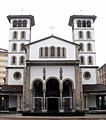
Iglesia de San Andrés in El Entrego, Linares
_-_Iglesia_de_San_Andres_00.jpg)
See also
 You can find more information in Spanish here: San Martín del Rey Aurelio para niños
